

Minthe, Zacharo, Elis,West Greece
Araklovo Castle
or Voutsaras Castle or Alvaina’s castle or Chryssouli
1
2 / 32

NE wall (Lemonakis, 2020)
3 / 32

NE wall (Lemonakis, 2020)
4 / 32

NE wall (Lemonakis, 2020)
5 / 32

NE wall (Lemonakis, 2020)
6 / 32

East wall (Lemonakis, 2020)
7 / 32

East wall (Lemonakis, 2020)
8 / 32

NE corner plateau, cistern in the middle, wall right
9 / 32

Central tower at the SW side(Lemonakis, 2020)
10 / 32

Central tower at the SW side(Lemonakis, 2020)
11 / 32

SW wall, under the tower (Lemonakis, 2020)
12 / 32

Main cistern of the acropolis (Lemonakis, 2020)
13 / 32

Main cistern of the acropolis (Lemonakis, 2020)
14 / 32

Wall fragment of the acropolis (Lemonakis, 2020)
15 / 32

External western tower (Lemonakis, 2020)
16 / 32

House ruins east of the acropolis (Lemonakis, 2020)
17 / 32

House ruins east of the acropolis (Lemonakis, 2020)
18 / 32

House ruins east of the acropolis (Lemonakis, 2020)
19 / 32

External fortification of the settlement (Lemonakis, 2020)
20 / 32

External fortification of the settlement (Lemonakis, 2020)
21 / 32

External cistern of the settlement (Lemonakis, 2020)
22 / 32

External cistern of the settlement (Lemonakis, 2020)
23 / 32

NW outer bastion (Lemonakis, 2020)
24 / 32

NW outer bastion (Lemonakis, 2020)
25 / 32

NW outer bastion from above (Lemonakis, 2020)
26 / 32

Interior of NW outer bastion (Lemonakis, 2020)
27 / 32

Detail of wall of NW bastion (Lemonakis, 2020)
28 / 32

House remain outside the walls (Lemonakis, 2020)
29 / 32

Panagia church at the foot of the hill (Lemonakis, 2020)
30 / 32

Panagia church at the foot of the hill (Lemonakis, 2020)
31 / 32

Fortification ruins in Strosidaki hill (Lemonakis, 2020)
32 / 32

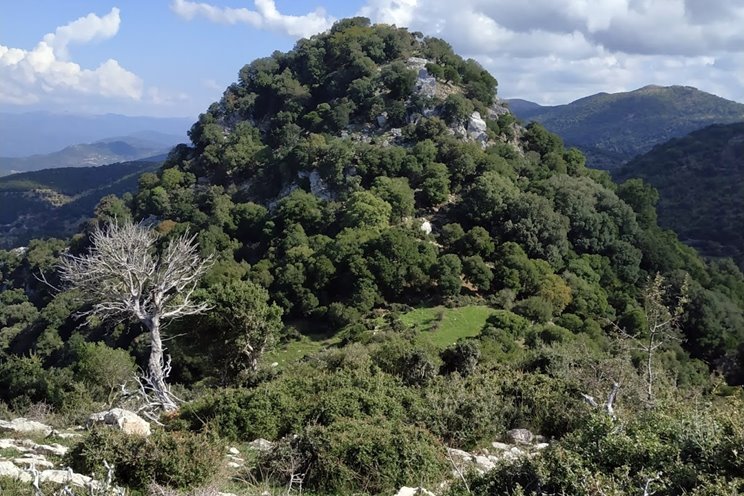
The hill of the castle from the west (Lemonakis, 2020)

THE END
| Location: |
| Summit Chrysouli, east of Minthe village, West Peloponnese |
| Region > Prefecture: |  |
| West Greece Elis | |
| Municipality > Town: | |
| City of Zacharo • Minthe | |
| Altitude: | |
|
Elevation ≈ 1000 m (Relative Height≈700 m) |
| Time of Construction | Origin | |
| 12th century (?) | BYZANTINE |
|
| Castle Type | Condition | |
| Castle |
In Ruins
|
A small and ruined castle on a summit of mount Minthe east of the village Minthe and of the Vounouka peak. Despite its small size and bad condition, once upon a time, it was one of the most strong and celebrated castles of Peloponnese.
Location & Strategic Scope
The peak Vounouka of mountain Minthe overlooks from the south the village Minthe (old name Alvaina). Vounouka sometimes is mistaken as the location of Araklovo but there is no medieval castle there. The mountain ridge extends to the east with three distinct peaks. The east peak is named “Kastro” or “Chryssouli”. It is the most forbidding of the three and it contains the fortress which has been identified with Araklovo since 1989.
The name Chryssouli derives from the village of the same name –now deserted– at the NE foot of the peak.
The site is accessible only from the west side and with some difficulty. It is completely inaccessible from the other sides. Due to the difficulty of ascent, it is one of the least visited fortresses in Peloponnese.
The castle is in a mountainous region extending in western Arcadia and eastern Elis which was called in Middle Ages Skorta or Escorta. Skorta was considered of strategic importance for the defense and communication in western Peloponnese and was protected by several fortifications. One of them was Araklovo which surveyed the passage between the mountains Minthe and Lykaion.
The field of view from the castle:
To the south: mountains of Messinia.
To the east: Lykaion mountain and the western peaks of Mainalon and the medieval settlement of Zakouka.
To the north: Alfeios valley up to the peaks of mount Erymanthos.
To the west: Vounouka peak of Minthi mountain.

The Name of the Castle
Before the identification of this castle with Araklovo, it was known as the castle of Chrysssouli or the castle of Alvaina (Alvaina being the old name of the mountain Minthe and also of the village Minthe).
Araklovo is mentioned by the sources with various names, such as Ereoklovo, Oreoklovo, Arvanokastro. It is also called the castle of Doxapatris Voutsaras, who was the last Greek defender of the castle (1205-1210).
It is believed that Araklovo was the same castle that the Franks called Bucelet or Buceleto (in IItalian).
However, since we cannot be absolutely certain that the castle of this page was indeed Araklovo, let’s not forget just yet the name “Castle of Chryssouli”.
History
Araklovo was a Byzantine fortress. It was one of the ten castles of Moria that the Byzantines did not abandon when the Franks invaded Peloponnese led by Guillaume de Champlitte and Geoffrey I Villehardouin in 1205.
It was defended by the legendary Byzantine general Doxapatris Voutsaras. The Franks took it after 5 years, around 1210.
The castle belonged to the barony of Karytaina. It was granted with 22 fiefs to the companion of Champlitte Hugo de Bruyeres who thus became the first baron of Karytaina long before the castle of Karytaina was built.
In 1289, it was in the possession of Isabella, ruler of the Principality of Achaea. It is recorded in the lists of fiefs of 1377 and 1391.
Around 1430 it must have been occupied by the Greeks of the Despotate of Mystras and in 1460 by the Turks.
After the 15th century Araklovo disappears from the sources. Obviously, it was abandoned and not in use during the Ottoman period.
Structure, Fortification & Buildings
The castle is not in good condition and not easily spotted from afar. Moreover, it is in a remote location in high altitude and its access is difficult. For this reason, despite its historic significance, it remained unvisited and unknown. There have been papers about it, but the last researcher who actually visited was Ekstein,assistant of Ernst Meyer who co-authored Peloponnesische Wαnderungen , published in 1939! That is until October 2020 when Sakis Lemonakis visited the hill and provided valuable photographs and updated info.
The castle consists of 3 parts:
1) the keep (or goulas),
2) the fortified settlement (or burgo) outside the keep
3) the settlement outside the external wall.
The main castle (the keep) is on a small plateau at the top of the hill. It is a triangular plateau measuring 50μ✖30m with 110m perimeter surrounded by walls. The wall is especially strong –and better preserved– at the NE corner, at a length of 15m, maximum height 7m and 2m thick (pict.2–5).
At the eastern wall must have been the gate of the keep (pict.6, 7).
At the SW side of the keep, on th peak, lies the central tower which is preserved at a max height 1.5m, measuring 5✖4m (pict.9, 10).
At the NE side of the plateau we find the remains of a large vaulted cistern 8✖3,5m with internal height 2m. (pict.12,13,8). The outline of the cistern is even visible in Google Earth!
Next to the cistern is preserved a wall, a remain of an undefined building (pict.14, 8).
At the western side of the keep, next to the central tower, there are the ruins of a large edifice of unknown use which leans on the curtain wall but on its exterior side. It had a vaulted roof and the basement was apparently another cistern. It was most probably a tower. (pict.15)
East of the keep, on the slope, there are the ruins of the houses and buildings of the settlement (pict.16,17,18). The settlement was protected by an external curtain wall that starts at the NE end of the keep and continues south and west ending at the steep northern slope of the hill.
The length of this wall is about 300m. It is in bad condition but visible in its entire perimeter (pict.19,20).
At the western end of the settlement, SW of the keep, there is another cistern 3✖3m, 3m high, which is adjacent to the inner side of the external wall (pict.21, 22).
The external wall spreads to the west and north of the keep. At the NW edge there is a protruding big structure, like a bastion. Perhaps it was a tower. It is 6m high and 8m wide. The space in its interior has a semicircular layout. Maybe this enhanced part was protecting an external gate (pict.23–27).
Finally, there are many ruins even outside the external wall, some of them standing at a considerable height (compared to the rubble inside the walls). (pict.28)
The general picture is that this has been a rather significant and well-built fortification, a fact that is not easily understood from a distance.
The general layout of the castle:

▬:the keep , ▬:cistern, ▬:external gate, ▬:houses, ▬:outer cistern, ▬:external wall
At the foot of the hill there are the remains of a church named “Panagia tou Kastrou” (Virgin Mary of the Castle), (pict.29,30).
The approach to the castle:

▬:asphalt road , ▬:dirt road , ▬:trekking path
| First entry in Kastrologos: | November 2012 | Last update of info and text: | March 2020 | Last addition of photo/video: | March 2020 |
Sources
- Research, photographs and info by Amfitridis and his blog ΑΜΦΙΤΡΕΙΔΗΣ
- Antoine Bon, 1969, La Morée franque. Recherches historiques, topographiques et archéologiques sur la principauté d'Achaïe (1205-1430), Editions de Boccard, Paris, 1969, pag.370,648
- Konstantinos Kourelis, 2003, “MONUMENTS OF RURAL ARCHAEOLOGY MEDIEVAL SETTLEMENTS ΙΝ ΤΗΕ NORTHWESTERN PELOPONNESE”, Presented to the Faculties of the University of Pennsylvania in Partial Fulfillment of the Requirements for the Degree of Doctor of Philosophy, σελ.259-261
- Ουΐλλιαμ Μίλλερ, 1909, Ιστορία της Φραγκοκρατίας εν Ελλάδι (1204-1566), (William Miller, The Latins In The Levant: A History Of Frankish Greece, 1204-1566) μετάφρ. Σπυρ. Π. Λάμπρου, μετά προσθηκών και βελτιώσεων, Εν Αθήναις Ελληνική Εκδοτική Εταιρεία, 1909-1910, σελ.239-241
- Chronicle of Morea, 114, 557-575
- Μιχαήλ Σ. ΚΟΡΔΩΣΗΣ, ΤΑΥΤΙΣΗ ΤΟΥ ΒΥΖΑΝΤΙΝΟΥ ΚΑΣΤΡΟΥ ΑΡΑΚΛΟΒΟΝ (ΑΛΒΑΙΝΑ ΗΛΕΙΑΣ), ΑΝΑΤΥΠΟ ΑΠΟ ΤΗΝ ΔΩΔΩΝΗ, ΤΟΜΟΣ ΙΗ΄, ΤΕΥΧΟΣ 1(1989)
- Ioannis Sarris, Τα κάστρα των Σκορτών Αράκλοβον και Άγιος Γεώργιος, Αρχαιολογική Εφημερίς, Αθήναι 1936, σελ. 57–84
- Located for Kastrologos by Mr. Alexandros Kontoulis
- Αγαθοκλής Παναγούλιας ιστοσελίδα ΜΙΝΘΗ - Το κάστρο Αράκλοβο
- Δημήτριος Αθανασούλης, ΑΡΧΑΙΟΛΟΓΙΚΟΝ ΔΕΛΤΙΟΝ. τεύχος 56-59/Β4. 2001-2004, σελ. 594
|
|
| Access |
|---|
| Approach to the monument: |
| From village Minthi take the road to Vrasto. After 700m turn right to dirt road. After 400m turn left in the crossroads, After 2km turn left to another dirt road. After 1km we are at the foot of the hill. Reach the top after 15m hiking. |
| Entrance: |
| Free but difficult access |


