

Tourkolias, Megalopoli, Arcadia,Peloponnese
Castle of Gardiki


| Location: |
| 4km west of the village Tourkolekas of Arcadia, on the mountain passage to Messinia |
| Region > Prefecture: |  |
| Peloponnese Arcadia | |
| Municipality > Town: | |
| City of Megalopoli • Tourkolias | |
| Altitude: | |
|
Elevation ≈ 530 m (Relative Height≈150 m) |
| Time of Construction | Origin | |
| 1264 to 1292 | FRANKISH |
|
| Castle Type | Condition | |
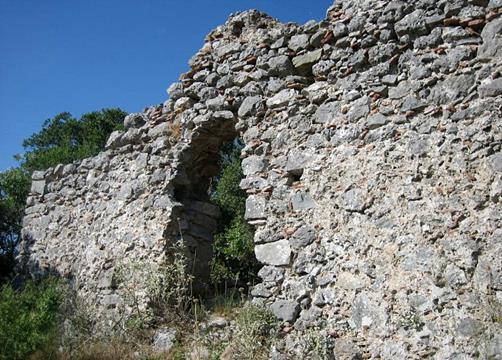
| Castle |
In Ruins
|
The castle was built by the Franks of the Principality of Achaea over the ruins of the ancient Amfeia, sometime between 1264 and 1292. Shortly afterwards, early in the 14th century, it was occupied by the Byzantines of the Despotate of Mystras.
History
In 1460 the castle was captured, like most forts in Peloponnese, by the Ottoman forces led by Mohamed II the Conqueror. The defenders, along with many refuges from other areas, were forced to surrender due to lack of water. The Turks violating the agreement slaughtered 6000 of them.
The castle was known as "Kokala" (bones) from the dead bodies that were thrown from the cliff by the Ottomans and remained unburied. It was also known as the "Castle of Oria" (of the fair lady) from the legend of an unknown beauty who preferred to throw herself from the rock than to be taken by the Turks.
| First entry in Kastrologos: | November 2012 |
Sources
- Website Medieval Greece
- Website Meropitopik - Το κάστρο της Ωριάς (Γαρδικίου) (Greek only)
- Website kalimera-arcadia.gr - Το κακοτράχαλο κάστρο του Γαρδικίου …και η ανύπαρκτη πρόσβαση σε αυτό!
|
|
| Access |
|---|
| Approach to the monument: |
| From the village Tourkolia there is a road tha leads right under the castle (3km). From there you have to walk to the top of the rock. The path is difficult, dangerous and unmarked. |
| Entrance: |
| Like most remote, ruined and neglected fortifications, entrance is not an issue. The difficult part is to approach the castle and walk around inside. |


