

Kardamyli, Dytiki Mani, Messenia,Peloponnese
Fortification of Meropi


| Location: |
| On the islet Meropi at Kardamyli, Messinia, South Peloponnese |
| Region > Prefecture: |  |
| Peloponnese Messenia | |
| Municipality > Town: | |
| City of Dytiki Mani • Kardamyli | |
| Altitude: | |
| Elevation ≈ 4 m |
| Time of Construction | Origin | |
| 1779 | MODERN GREEK |
|
| Castle Type | Condition | |
| Coastal Fortress |
Rather Poor
|
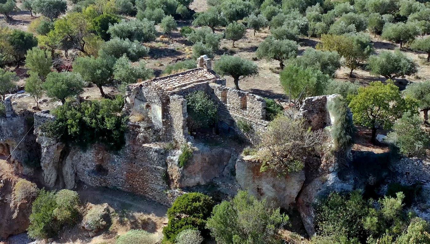
Meropi is a small uninhabited island 400m from the port of Kardamyli in Messinia and 100m from the rocky coast. Its area is 35,000 sq.m.
On the island there is the church of Agios Nikolaos and next to it the ruins of a big, two-storey building. The church and the building are part of a fortification that protected the island.
Inside the church there is an inscription of a date: 1779. This dates the church at the end of the 18th century. The fortification was most probably built at the same period to protect the port, the population and the church against pirates. The claim that the walls are Venetian is apparently inaccurate.
| First entry in Kastrologos: | November 2015 | Last addition of photo/video: | August 2023 |
Sources
- Photos 1, 2, 7 by Fred Kok (October 2019)
|
|
| Access |
|---|
| Approach to the monument: |
| The island is accessible with boats from the port of Kardamyli. |
| Entrance: |
| Free access |