

Skala of Abdera, Abdera, Xanthi,East Macedonia & Thrace
Polystylon
or Castle on the shore of Abdera


| Location: |
| Skala, 5 km south of Avdira, next to the archaeological site, Thrace, North Greece |
| Region > Prefecture: |  |
| East Macedonia & Thrace Xanthi | |
| Municipality > Town: | |
| City of Abdera • Skala of Abdera | |
| Altitude: | |
| Elevation ≈ 10 m |
| Time of Construction | Origin | |
| before 9th century | BYZANTINE |
|
| Castle Type | Condition | |
| Byzantine City |
Rather Poor
|
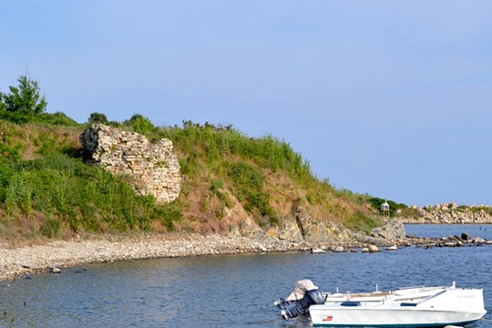
Right next to the archaeological site of Avdira -but not inside- there are remains of a Byzantine fortified town.
The place is the continuation of the important ancient city of Avdira (or Abdera, where Democritus was born) which during the Byzantine period was named Polystylon
History
The medieval town Polystylon was at the location of the acropolis of the ancient city of Avdera. The fortification of Polystylon was built around the 7th or 8th century AD. The byzantine walls were based on the walls of the ancient acropolis.
The byzantine historian Nikiforos Grigoras reports that in 1342 Ioannis Kantakouzenos reinforced the fortifications of Polystylon. Actually he repaired the upper part of the fortification, the so called “Byzantine acropolis”.
Before the 13th century, Polystylon was a rather important city being a bishopal seat. In the next centuries, the turmoil of that era (Latin conquest, civil wars) caused its decline. The place was abandoned around 1380, while the Ottomans had already prevailed in the area and had founded another settlement nearby, Genisea.
Structure, Fortification & Buildings
The Byzantine township of Polystylon occupies the acropolis of the ancient city of Abdera. Its defences, approximately 800 metres long, follow more or less the contours of the hill. Built on bedrock and, at places, over the Classical defences, their width varies from 2.40 to 3.50 metres, depending on whether the wall is single (north and south sides) or double (northwest side). Several rectangular towers and an outer wall along the more vulnerable, northwest side complete the Byzantine system, while two gates on the north wall and a small one on the west allowed access into the town.
Within the defences, an internal wall divides the town into two roughly equal parts, while a second one forms, together with the eastern defence wall, the Byzantine acropolis with its two towers dating to the years of John Kantakouzenos. Recent excavation revealed a series of religious and public buildings of the Byzantine period. One of the latter, located in the west part of the acropolis, is a rectangular bath building, with three rooms, of which the middle one was heated. Near the main north gate is a single-aisled church, its dome supported by four shallow arches. The church stands in the middle of a cemetery with simple cist graves containing wooden coffins. The church was built in the twelfth century and destroyed in the fourteenth.
The middle section of the settlement, at the peak of the acropolis hill, contained the episcopal church. This Middle-Byzantine basilica consisted of a portico, a narthex, a naos divided into three aisles by two rows of massive pillars, and a sanctuary. Under the floor of large marble slabs of various sizes were contemporary and later graves. A square room at the northwest corner of the church is interpreted as the bishop's quarters. The episcopal church was built in the ninth century and destroyed in the mid-fourteenth century. It was founded over the remnants of an earlier three-aisled basilica, of which parts are still visible in the central and south aisle. The baptistery at the northeast corner of the church, with its cruciform baptismal font, belongs to the earlier building. Between the baptistery and the bishop's quarters is a portico used for burials. Two built graves erected against the north wall of the church are thought to belong to important people. It is here that a painted rosette within a cross of the eleventh-early twelfth century was found; it is now in the Abdera Archaeological Museum. Around the church are partially excavated houses and various other buildings that have not been investigated yet.
| First entry in Kastrologos: | May 2013 | Last update of info and text: | March 2017 | Last addition of photo/video: | March 2017 |
Sources
- Article in the Website of the Greek Ministry of Culture "ΟΔΥΣΣΕΥΣ", author Stavroula Dadaki - Polystylon
- AGELARAKIS, & AGELARAKIS (2015). Abdera/Polystylon: A Byzantine Town in Western Thrace in the context of historicalDevelopments during the 6th-14th centuries as depicted by its Archaeo-Anthropological Record. Βυζαντινά Σύμμεικτα, 25,11-56. available online
- ΑΡΧΑΙΟΛΟΓΙΚΟΝ ΔΕΛΤΙΟΝ, Τόμος 52 (1997), τεύχος Β3, σελ. 894
- ΑΡΧΑΙΟΛΟΓΙΚΟΝ ΔΕΛΤΙΟΝ, τόμος 52 (1997), τεύχος Β3, σελ.894
|
|
| Access |
|---|
| Approach to the monument: |
| From Xanthi, follow the direction to Avdhira and from there to the aAvdhira archaeological site, 18km to the south, by the sea. Polystylon is next to it. |
| Entrance: |
| Free entrance. The fortification is outside of the archaeological site where the entrance is not free. |
| Other castles around |
|---|
| Wall of Anastasioupolis |
| Fortress of Avgo |
| Castle of Peritheorio |
| Castle of Poroi |
| Topeiros |
| Xanthi Castle |


