

Sophiko, Corinth, Corinthia,Peloponnese
Castle of Tsalika


| Location: |
| On the Mt Tsalika 1 km NE of the village Sophiko, south of Corinth, in Peloponnese |
| Region > Prefecture: |  |
| Peloponnese Corinthia | |
| Municipality > Town: | |
| City of Corinth • Sophiko | |
| Altitude: | |
|
Elevation ≈ 785 m (Relative Height≈320 m) |
| Time of Construction | Origin | |
| 15th century | Late-BYZANTINE |
|
| Castle Type | Condition | |
| Dry-Stone Fortification |
In Ruins
|
A dry-stone fortification of a medieval settlement with ancient Greek origin on the top of Mt Tsalika over the town Sophiko south of Corinth.
History
Here was the location of the ancient town Solygeia founded around 1400 BC. In 145 BC, it was destroyed by the Romans.
Around 1385, an Albanian population settled in the area and a village developed in the place of ancient Solygeia on top of Mt Tsalika. The settlement was fortified with the materials from the ancient walls that have been demolished by the Romans.
Sophiko was never a major castle. It is not included in Frankish or Turkish documents. It has been just a medieval settlement with a decent fortification. It must have been abandoned soon after the Ottoman conquest.
Structure, Fortification & Buildings
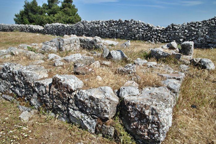
The wall is dry-stone, i.e. without mortar. The contours of the fortification is rectangular with a length of about 80 meters and a width of 40, in which the curvilinear perimeter of a settlement is attached.
The wall has a height of approximately 2 meters and a width of 1.40. We can not be sure of its original height, as many stones are scattered on both sides of the wall. The fortification on the west side is completely damaged, with traces of masonry scattered on the ground.
At about the center of the fortification are the foundations of a square tower with outside dimensions 6,10m✖6,10m. Probably it was a guard house or an observation tower offering a great views across the northern and central region of the Saronic Gulf, part of the Corinthian Gulf and the ancient land route from Attica to Corinth.
| First entry in Kastrologos: | March 2016 |
Sources
- Website ΣΟΛΥΓΕΙΑ - ΙΣΤΟΡΙΚΑ- ΣΟΛΥΓΕΙΑΣ
- pictures from Panoramio, user stevenvanValen+hannekeRolloos
- Gregory,T. E. (1996) “The Medieval Site on Mt. Tsalika near Sophiko” in The Archeology of Medieval Greece, eds. P. Lock and G. Sanders, Oxford, pp. 61-76, 1997
- Sharon E. J. Gerstel, Rural Lives and Landscapes in Late Byzantium: Art, Archaeology, and Ethnography, Cambridge University Press, 2015, pp.20
|
|
| Access |
|---|
| Entrance: |
| Free acces |


