

Valtaki, Anatoliki Mani, Laconia,Peloponnese
Valtaki Fortress


| Location: |
| On a seaside hill between Selinitsa and Valtaki, NE of Gytheio in south Peloponnese |
| Region > Prefecture: |  |
| Peloponnese Laconia | |
| Municipality > Town: | |
| City of Anatoliki Mani • Valtaki | |
| Altitude: | |
|
Elevation ≈ 65 m (Relative Height≈8 m) |
| Time of Construction | Origin | |
| 18th century | OTTOMAN |
|
| Castle Type | Condition | |
| Fortress |
Rather Poor
|
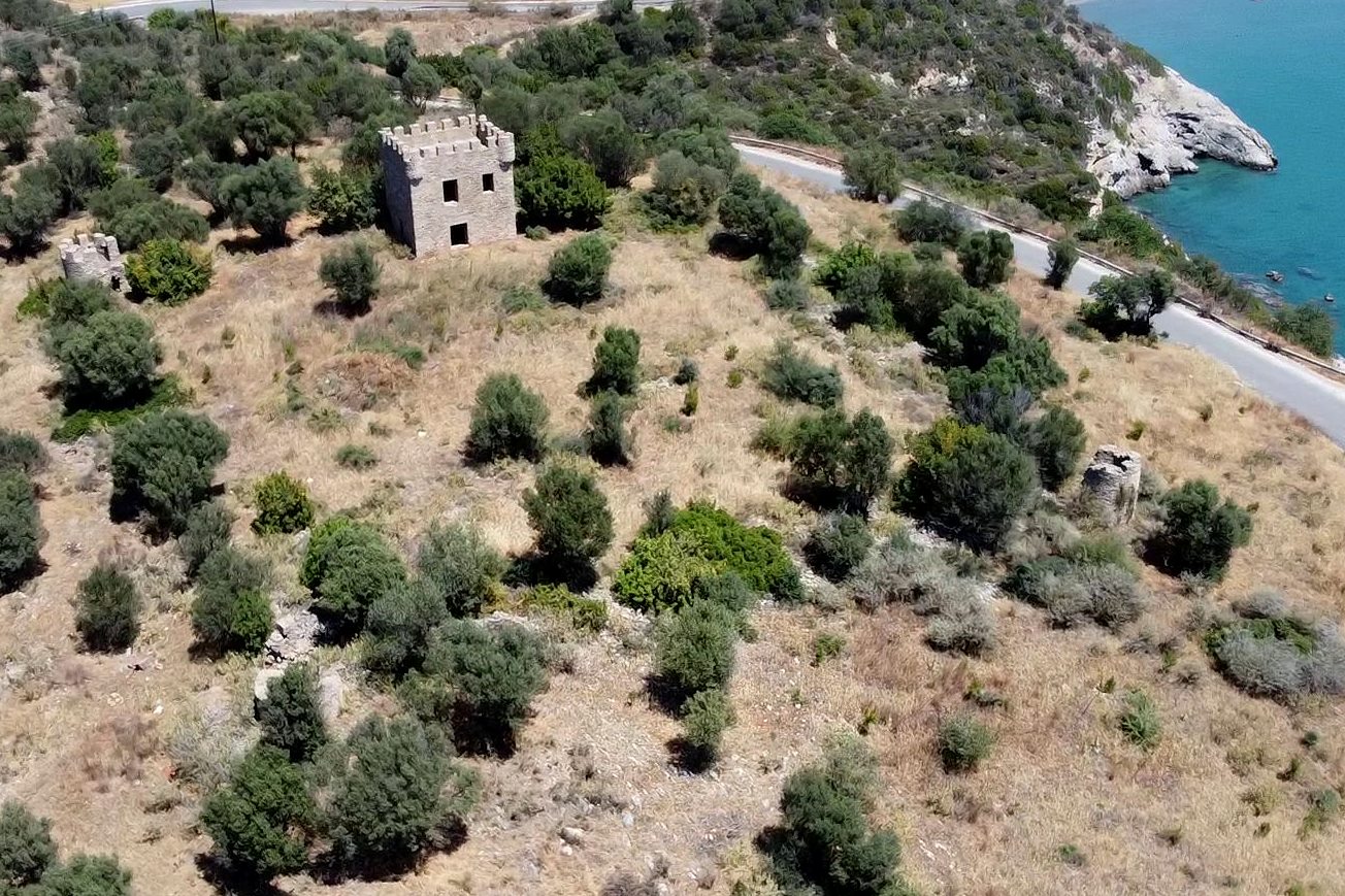
A fortified complex on a seaside hill, next to the road, 4km northeast of Gytheio, between the village of Selinitsa and the beach of Valtaki.
Almost unnoticed in a territory with many towers and fortified mansions, but it is different: It did not belong to a Maniote family; it was an Ottoman military fort.
It was built by the Turks in the 18th century and perhaps after the Orlov events, i.e. after 1780. Its purpose was to survey the bay from Trinisa to Gytheio and also to guard the border with the independent region of Mani.
The fort had an almost square layout with an area of 2500 sq.m. and a perimeter of 200m. Two cylindrical towers are still standing at diametrically opposite corners and one rectangular central tower 5✖6.5 m in the middle of the northern side.
| First entry in Kastrologos: | September 2016 | Last addition of photo/video: | October 2021 |
Sources
- ΑΡΧΑΙΟΛΟΓΙΚΟΝ ΔΕΛΤΙΟΝ, τόμος 53 (1998), τεύχος Β1, σελ.205
- Video by the user G Traveller Φρούριο στο Βαλτάκι | Valtaki Fortress where the photos 1, 5, 6, 7 ,9 were taken from
|
|
| Access |
|---|
| Entrance: |
| Free access |