Koroni, Pylos - Nestor, Messenia,Peloponnese
Castle of Koroni
| Location: |
| Koroni, Messinia, SW Peloponnese |
| Region > Prefecture: | 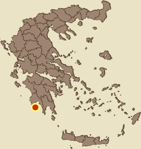 |
| Peloponnese Messenia | |
| Municipality > Town: | |
| City of Pylos - Nestor • Koroni | |
| Altitude: | |
| Elevation ≈ 25 m |
| Time of Construction | Origin | |
| end of 13th century | VENETIAN |
|
| Castle Type | Condition | |
| Fortress-state |
Relatively Good
|
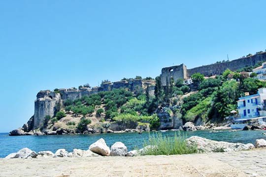
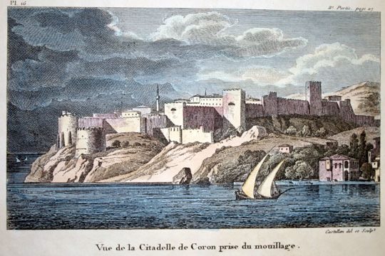
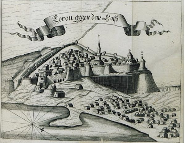
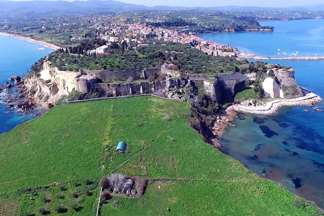
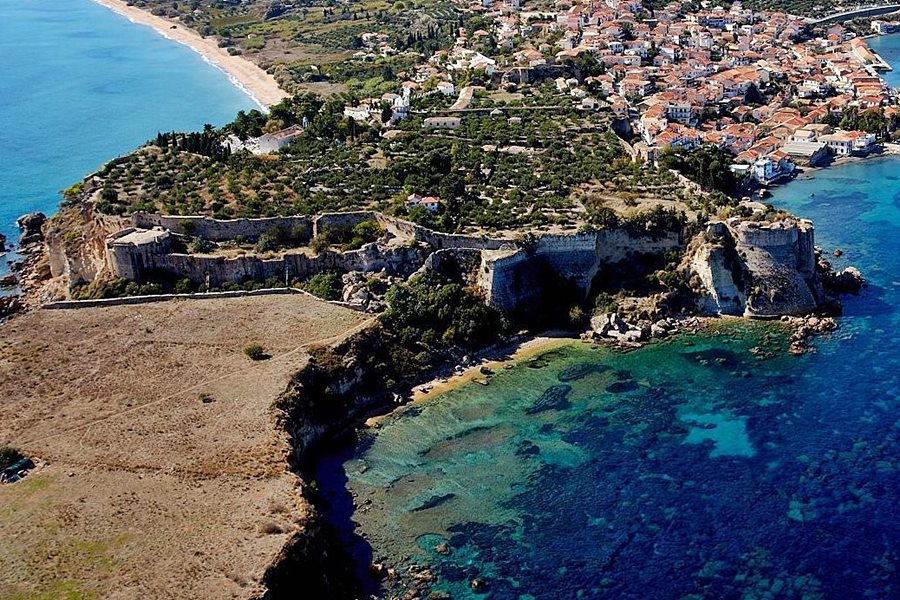
A castle with impressive fortifications at the southwestern end of Peloponnese which existed since the 7th century AD and was completed and reconstructed by the Venetians in the 13th century. The city flourished in the following centuries, but it was constantly in the middle of the long conflict between Venetians and Turks.
History
An ancient acropolis existed at the location of the castle since before the Trojan war. Its name was Aisini and it was one of the 7 cities offered by Agamemnon to Achilles to ease his anger according to Homer.
In the 6th or 7th century AD, the Byzantines built a fortress there.
As many castles in Peloponnese, the city became important and flourished after the 13th century and the Frankish occupation.
Following the fall of Constantinople to the Fourth Crusade in 1204, a Venetian fleet under Premarini and the son of the doge Dandolo occupied it in 1206, and converted the port into a provisioning station “where all passing ships could receive a month's rations”, a custom maintained after the place became a regular Venetian colony.
Since 1205 Koroni belonged to the Frankish Principality of Achaea. In 1209, the ruler of Achaea Geoffroi de Villehardouin I had no choice than to cede officially the castle-city to the Venetians.
The Venetians made a major reconstruction and expansion of the castle which finished around the end of that century.
The fortress and town were captured by the Ottoman troops of Sultan Bayezid II, who led personally the operation, in 1500.
In 1532, the Habsburg emperor Charles V ordered the Genoese admiral Andrea Doria to attack Koroni as a diversion to the Turkish campaigns in Hungary. Doria managed to capture the city, and to lay waste to the surrounding coast.
In spring 1533, the Ottoman Emperor Suleiman the Magnificent sent 60 galleys to retake the city. They blockaded the harbour, but they were defeated by Doria, highlighting the weakness of the Ottoman Navy at that time. An Ottoman land army however was successful in laying a siege around the city, forcing its surrender on 1 April 1534. The weakened Spanish garrison was allowed to leave the city unharmed
In 1685 the Venetians under general Morozini returned and stayed until 1715. But the golden age of the city was not revived.
After that, Koroni remained under Turkish occupation. The fortress suffered serious damages after a heavy bombardment during the Orlof events in 1770. In the Greek revolution, the Greek fighters were unable to capture the city.
Koroni was liberated in 1828 by the French General Nicolas Joseph Maison, after the battle of Navarino.
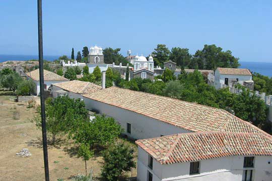
A couple of families still live in the castle today. There is also a nunnery.
Structure, Fortification & Buildings
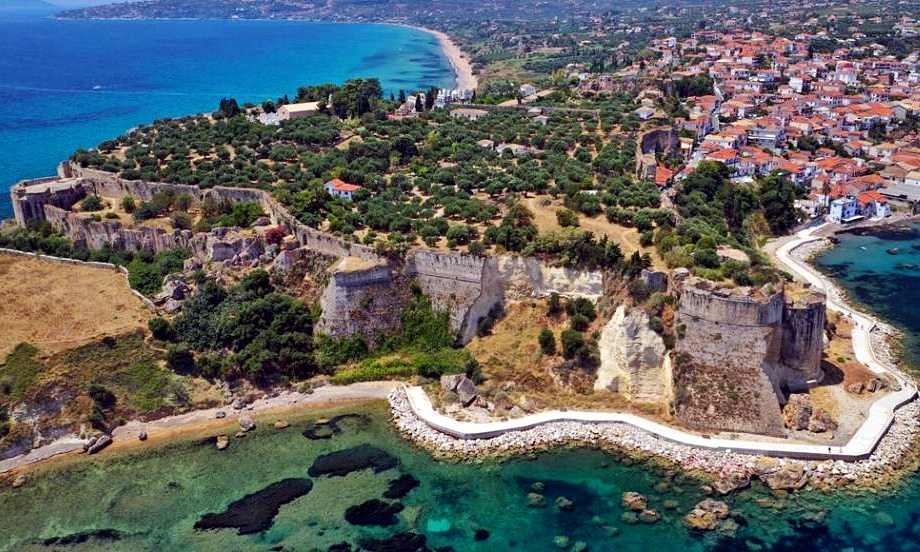
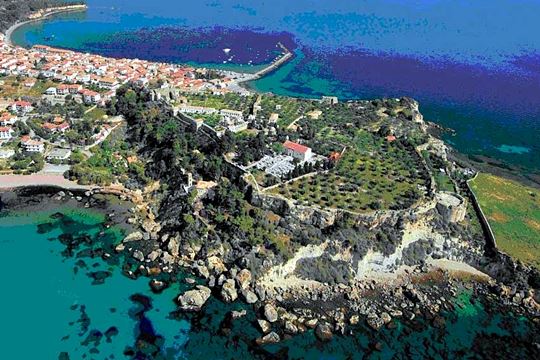
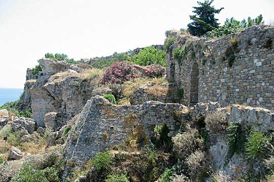
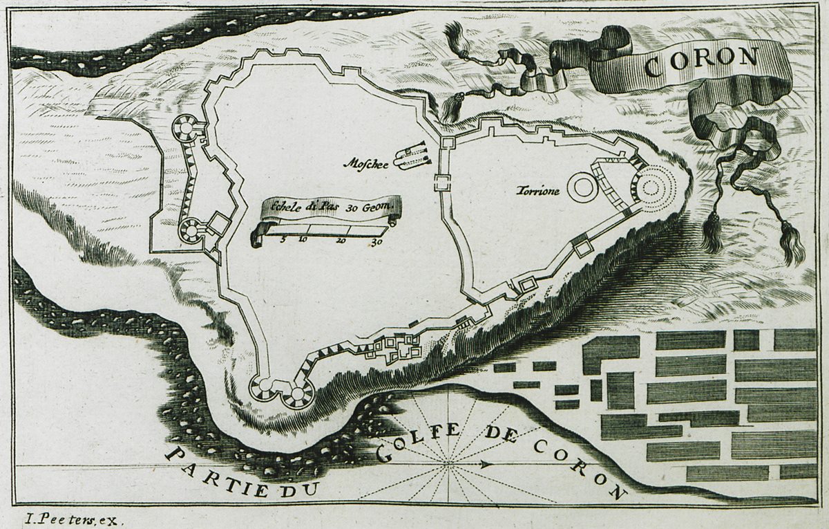
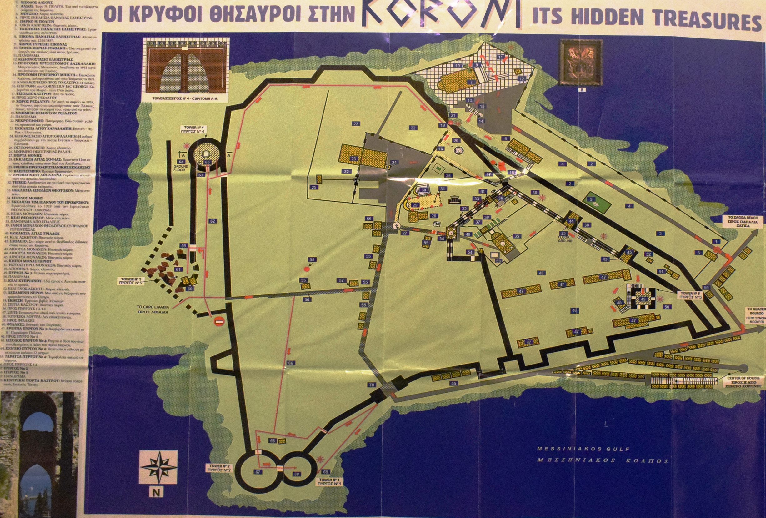
The castle of Koroni occupies an area of about 62,000 sq.m. The perimeter of the fortification was 1200 meters. The walls are preserved for much of this perimeter.
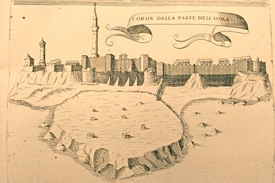
The shape of the fortification is triangular with the “base” of the triangle being the wall to the east and the “top” being the northwest corner of the fortification. The “height” of the triangle is 325 meters. East of the castle at a lower elevation there is a large flat area named “Livadia” with an area almost equal to that of the castle. This surface must have been one of the weak sides of the castle, although the landing of enemy forces on it was not very easy due to the rocky coast.
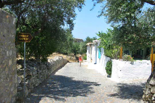
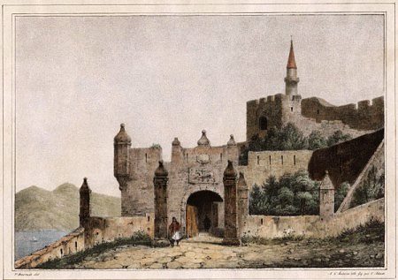
The main entrance is shaped like a large square structure. At the upper point, where the gate guard room was, a curved arch is formed. There are two more gates –smaller– in the castle. One at the eastern side, leading to the Livadia section and the other at the SW side, near the church of Panagia Eleistra.
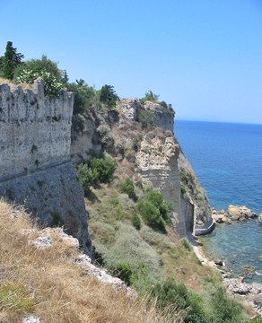
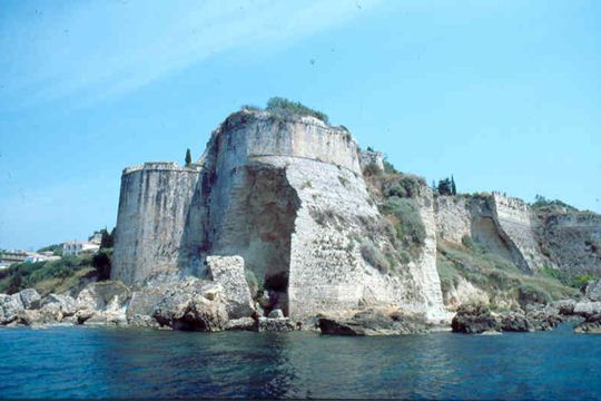
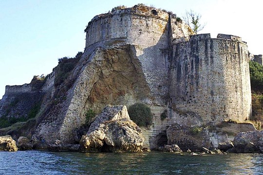
Along the northern side towards the port and the Messinian gulf, the wall rises vertically and only at the northeastern end it bends and forms two imposing round towers on the steep shore (photos 17,18). This section according to Kevin Andrews (1953) is the best example of the plasticity of Venetian fortress architecture in Greece.
On the east side, the Turks added in the 16th century a rampart to protect the main wall from cannon shells. This additional wall was blown up by Morosini in 1685 and thus the delivery of the castle was achieved. There were two large round towers at both ends of the rampart, the northernmost of which was blown up in 1944 by the Germans, who used it as an ammunition depot. The southernmost tower of the wall is preserved intact (photos 19,20).
Along the east side of the curtain wall, the Turks added in the 16th century an outer wall to protect the main fortification from cannon shells. This rampart was blown up by Morosini in 1685 and thus the capture of the castle was achieved. There were two large round towers at both ends of the rampart, the northernmost of which was blown up in 1944 by the Germans, who used it as an ammunition depot. The southernmost tower of the wall is preserved intact (photos 19,20).
At the west point inside the wall is the monastery of Timios Prodromos, at the same location of the old Byzantine fortress and the inner bailey.
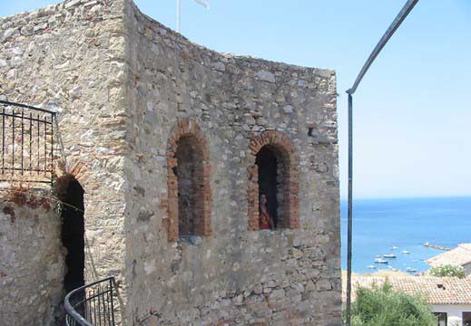
Inside the courtyard of the monastery is preserved an octagonal tower (photos 9,10,11) built during the Tourkokratia, which is the highest point of the castle. This was probably the residence of the Turkish bey of Koroni.
| First entry in Kastrologos: | August 2012 | Last update of info and text: | December 2021 | Last addition of photo/video: | January 2024 |
Sources
- Yorgos Costopoulos, info and photos 4,5,8,10-14,20,21 (2018)
- Ιωάννης Θ. Σφηκόπουλος, «Τα Μεσαιωνικά κάστρα του Μορηά», Αθήνα,1968, σελ.350-352
- Andrews, Kevin, Castles of the Morea, Princeton, New Jersey,1953
- Video by the user G Traveller Κάστρο Κορώνης | Castle of Koroni (January 2024)
|
|
| Access |
|---|
| Approach to the monument: |
| Easy access from the town of Koroni. |
| Entrance: |
| The entrance is free but it is not possible to visit some areas all the time. |
| Timeline |
|---|
|


