

Koxare, Agios Vasileios, Rhithymna,Crete
Koules of Koxare


| Location: |
| South of the Village Koxare, south of Rethymno, in Crete |
| Region > Prefecture: |  |
| Crete Rhithymna | |
| Municipality > Town: | |
| City of Agios Vasileios • Koxare | |
| Altitude: | |
|
Elevation ≈ 352 m (Relative Height≈150 m) |
| Time of Construction | Origin | |
| 1867 or shortly after | OTTOMAN |
|
| Castle Type | Condition | |
| Small Fort |
Rather Poor
|
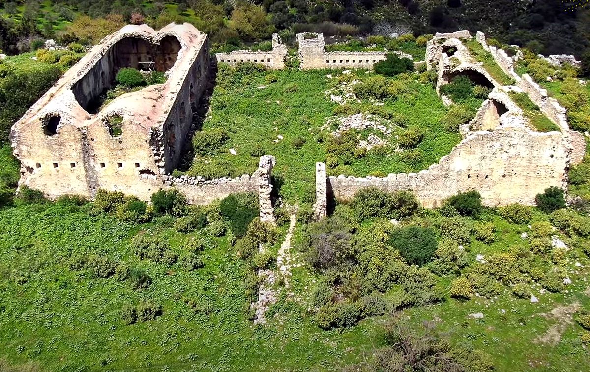
One of the many small forts -the so called “koules”- built by the Turks after 1886 following the outbreak of the Cretan revolution that year.
It was one of the forts guarding the important passage from Mesara plain to Sfakia area. It was built near the entrance of the gorge Kourtaliotis, near the village Koxare.
It was partially destroyed by the Greek rebels in 1896.
Structure, Fortification & Buildings
The fort consists of a large inner yard, enclosed all along the western side by two adjoining spaces linked with arches. Those spaces are covered by dome-shaped roofs.
At the eastern part, there is an edifice, which is also roofed with a dome that lies lower than the other two. It is accessible through a ramp on the southern side.
The fortress was built of local whitish stone and hard connecting mortar. Both inside and outside it is coated. The thickness of the masonry is 1.20 m. The western and eastern edifices have collapsed. There is a cistern for the collection of rainwater, which is partially preserved preserved.
| First entry in Kastrologos: | April 2015 | Last addition of photo/video: | July 2023 |
Sources
- Website CretanBeaches - Koxare Fort
- Video by the user VISIT GREECE-Φοίβος Κοξαρέ : Τούρκικο Οχυρό { Kule } - Ρέθυμνο, soutce of the photos 1, 2, 5 (May 2023)
|
|
| Access |
|---|
| Entrance: |
| Free access |
| Similar |
|---|
| Fortress of Agia Roumeli |
| Fodele Fortress |
| Koules of Loutros |
| Koules of Meronas |
| Koules of Ano Moulia |
| Koules of Potamoi |
| Koules of Vathiako |
| Voukelasi Fort |