

Apóllona, Rhodes, Dodecanese,South Aegean
Erimokastro of Apollona


| Location: |
| On a rocky hill north of the road Apollona -Platania in Rhodes |
| Region > Prefecture: |  |
| South Aegean Dodecanese | |
| Municipality > Town: | |
| City of Rhodes • Apóllona | |
| Altitude: | |
|
Elevation ≈ 550 m (Relative Height≈230 m) |
| Time of Construction | Origin | |
| Middle Btzantine period | BYZANTINE |
|
| Castle Type | Condition | |
| Castle Ruins |
In Ruins
|
Ruins of a Byzantine fortification of the Dark Centuries of Byzantium (probably).
On Rhodes there are at least three fortifications called Erimokastro. In addition to the one presented here, these are the Byzantine Erimokastro near Arnitha in the south of the island and the Erimokastro near Kalithíes on the east coast, an ancient fortification.
Castle Description
Text: Dr. Michael Losse – Singen (Hohentwiel), Germany (04.07.2021)General Description
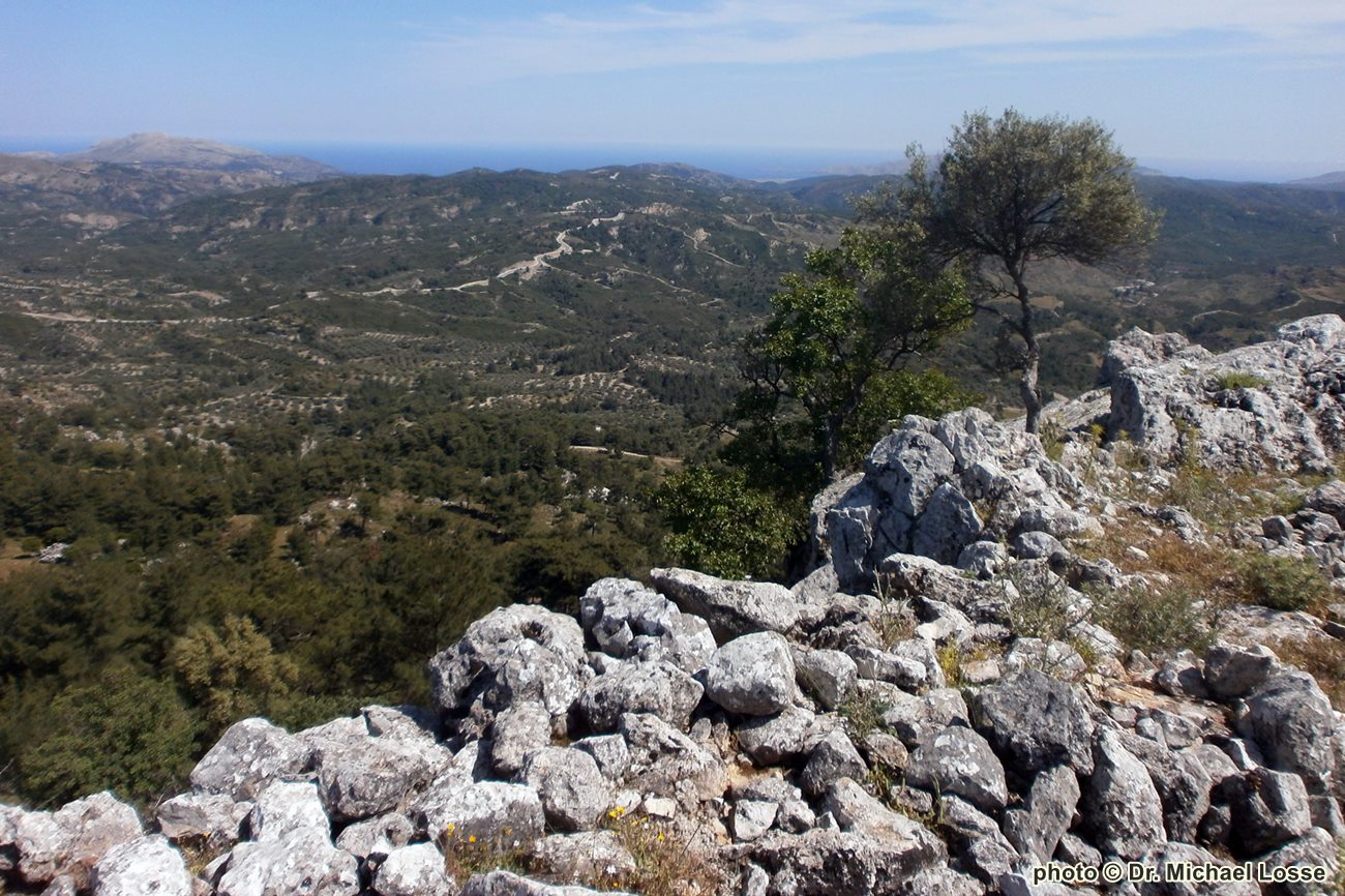
On a spur of the Kepoules between Apollona and Platania lie on a mountain tongue above the church of Agia Paraskevi the ruins of a medieval fortification, called Erimokastro by local people. Its enceinte encloses an inclined surface with integrated rock steps, which was reshaped after the abandonment of the castle by the creation of arable terraces by farmers. In the enceinte’s small-scale Byzantine masonry, a rock wall was included in the upper part.
Access today is possible via dilapidated masonry at the striking rocky peak, which was probably integrated into the enceinte.
Inside the castle there are only a few, probably post-medieval remains of buildings. Stones were taken from the Erimokastro for the construction of the retaining walls of the road below, which was developed in the Italian period (1912-1943).
There are view connections to different fortifications and Vígles: Vígla of Archipoli; Profilia; Vígla (or Villa) of Agios Isidoros; the Byzantine Kastro above Moni Inko monastery; the Byzantine Kastrelia; Byzantine fortification on Mt. Vouni next to Mesanagros; Erimokastro next to Arnítha. Also the islands Chalki and Symi can be seen from here.
Access
Accessible via the heavily washed-out dirt road, which branches off from the road Apollona-Platania at the sign “Pigi”.
History of the castle
Maybe built during the “Dark Centuries”. A use by the Knights hospitallers (perhaps as a refuge for the rural population) cannot be proven, but the comprehensive view, which the mountain offers at least suggests a use as a Vigla at different times (cf. Erimokastro at Arnitha).
In the 630s, the Arab-Islamic expansion in the Mediterranean began, which brought great territorial losses for the Byzantine Empire, which was subjected to Arab attacks for about 200 years and was only able to reconquer single places in the 9th century. In the Aegean Sea, the empire still asserted itself with many bases on islands and coasts.
“In 649 Cyprus had fallen to the Arabs, five years later Rhodes, in the 9th century Crete and Sicily followed, even the Balearic Islands had been part of their sphere of influence since the 8th century” (German: „649 war Zypern an die Araber gefallen, fünf Jahre später Rhodos, im 9. Jahrhundert folgten Kreta und Sizilien, selbst die Balearen zählten seit dem 8. Jahrhundert zu ihrem Machtbereich“, Bernd Fuhrmann: Hinter festen Mauern. Europas Städte im Mittelalter. Darmstadt [Germany] 2014, p. 13).
In this existentially threatening period of the 7th to 10th centuries, which some historians referred to as the "Dark Ages", many coastal settlements in the Aegean Sea were apparently abandoned because of the Arab raids. New fortified settlements were built on mountains off the coasts, on the Dodecanese, among others, the Palaiokastro on the island of Tilos (cf. Kastrologos), Galatiani on Kalymnos (aka Vryokastro, cf. Kastrologos), Dikaios on Kos, Erimokastro near Arnitha on Rhodes (cf. Kastrologos) and probably also the Erimokastro described here. They were probably only used sporadically in the later Middle Ages, some perhaps maintained as refuges for the civilian population during the later Byzantine and the Knights Hospitallers‘ periods, as well-preserved cisterns inside some Kastra suggest.
Some of those partly extensively preserved Kastra, which were hardly exposed to stone robbery because of exposed locations, far away from younger settlements, are no longer known to the islanders today, as they can only be reached via goat paths or over long-lost routes.
Other Info
SourcesLosse, Michael: Burg und Expansion in der Südost-Ägäis: Von den byzantinischen Befestigungen der „Dunklen Jahrhunderte“ (7.-10. Jahrhundert) bis zu den Invasionen der „Franken“ (13./14. Jahrhundert) und Osmanen (15./16. Jahrhundert). In: Joachim Zeune/Christof Krauskopf (eds.): Burg und Expansion. Kolloquium des Wissenschaftlichen Beirats des Deutschen Burgenvereinigung Brandenburg 2019 (Veröffentlichungen der Deutschen Burgenvereinigung e. V. Hrsg. vom Europäischen Burgeninstitut – Einrichtung der Deutschen Burgenvereinigung. Reihe B: Schriften, Bd. 18; zugleich Arbeitsberichte zur Bodendenkmalpflege in Brandenburg, Bd. 36, hrsg. von Franz Schopper). Braubach 2021, pp. 107-124.
| First entry in Kastrologos: | November 2021 |
Sources
- Photos (May 2014) and article by Dr. Michael Losse
|
|
| Access |
|---|
| Approach to the monument: |
| Accessible via the heavily washed-out dirt road, which branches off from the road Apollona-Platania at the sign “Pigi”. |
| Entrance: |
| Free access |