

Kefalas, Sparti, Laconia,Peloponnese
Tower of Kefalas


| Location: |
| On the road Sparti-Geraki, 10km from Sparti, south of the chapel of Agios Efstratios |
| Region > Prefecture: |  |
| Peloponnese Laconia | |
| Municipality > Town: | |
| City of Sparti • Kefalas | |
| Altitude: | |
| Elevation ≈ 275 m |
| Time of Construction | Origin | |
| perhaps 14th or 15th c. | Late-BYZANTINE |
|
| Castle Type | Condition | |
| Tower |
Rather Poor
|
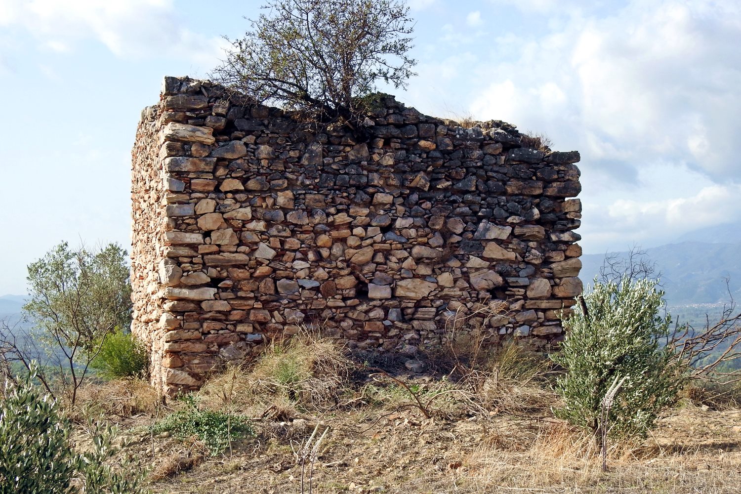
Ruins of a rectangular tower south of the village of Kefalas, Laconia, on a plateau next to the road that connects Sparta with Geraki.
The point is not elevated in relation to the surrounding area and therefore did not have good physical protection. However, it is on a mountain slope and has an excellent view to the Laconian plain and Sparta.
History
The history of the tower is completely unknown. There is no mention of it (as far as we know) in historical sources, medieval or more recent. We assume that it is late Byzantine structure (14th or 15th century).
However, if we take into account the construction technology and the fact that the place is not naturally fortified, we should not rule out the possibility that it belongs to the second Ottoman period (18th century).
Structure, Fortification & Buildings
The dimensions of the tower are 6.50✖4.60 meters and the surviving height is about 4 meters.
On the perimeter of the plateau where the tower is located, there are scattered remnants of walls that are preserved at a height of less than 1 meter. It is obvious that the tower was surrounded by an outer fortification enclosure. The boundaries are not clear but the length of the perimeter was over 300 meters and encircled an area of about 6000 sq.m. In other words, it was a relatively large complex that could have been a small castle or a fortified farmhouse or even a settlement.
| First entry in Kastrologos: | February 2021 |
|
|
| Access |
|---|
| Entrance: |
| Free access |


