

Agios Ioannis, Corinth, Corinthia,Peloponnese
Castle of Alataria
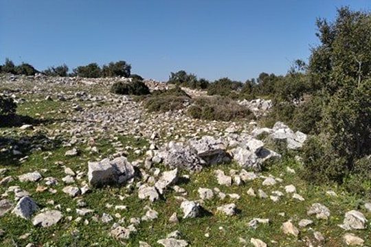
1
2 / 18

the location of the castle as seen from the north
3 / 18

the location of the castle as seen from the west
4 / 18

photo: Aris Tax, 2021
5 / 18

photo: Aris Tax, 2021
6 / 18

photo: Aris Tax, 2021
7 / 18

photo: Aris Tax, 2021
8 / 18

photo: Aris Tax, 2021
9 / 18

photo: Aris Tax, 2021
10 / 18

photo: Aris Tax, 2021
11 / 18

photo: Aris Tax, 2021
12 / 18

photo: Aris Tax, 2021
13 / 18

photo: Aris Tax, 2021
14 / 18

photo: Aris Tax, 2021
15 / 18

photo: Aris Tax, 2021
16 / 18

photo: Aris Tax, 2021
17 / 18

remains of the other fort at the NE of Alatara
18 / 18

ruins of the old Faneromenis monastery 2.5km to the west

THE END
| Location: |
| On a plateau of the mount Metochi, 4 km west of the village Agios Ioannis in Corinth region |
| Region > Prefecture: |  |
| Peloponnese Corinthia | |
| Municipality > Town: | |
| City of Corinth • Agios Ioannis | |
| Altitude: | |
| Elevation ≈ 680 m |
| Time of Construction | Origin | |
| early 13th cent, (?) | FRANKISH |
|
| Castle Type | Condition | |
| Dry-Stone Fortification |
In Ruins
|
Ruins and stone piles, which barely resemble a castle, west of the village Agios Ioannis in the mountains south of Corinth in northern Peloponnese.
Location & Strategic Scope
The ruins are located on a plateau below the peak Metochi, near the church of Agios Ioannis and about 4 km west of the village of Agios Ioannis. To the west, it is 2.5 km from the old, abandoned monastery of Faneromeni. A little further, 500 meters from the monastery, are the remains of the castle of Ampiditsa (aka “Ellinopyrgos”). Farther to the southwest, there is the castle of Agionori which together with that of Ampiditsa guard the entrances of the ancient passage to Argolis, the Kontoporeia.
The place where the castle is located is a small plateau at an altitude of 680 meters surrounded by low mountains. The spot does not have good visibility. Of course, it has visual contact with Ellinopyrgos and the monastery of Faneromeni, but otherwise the field of vision is limited. At first glance, a castle in this place is not justified.
However, we must take into account that in front of the castle passed a secondary route from Akrocorinth, to Piada, Argolis, the so-called Faneromeni passage, which bypassed the passage of Kontoporeia. This route was mountainous, but on flat terrain and was in use. It is therefore very possible that the castle of Alataria guarded this alternative passage, while preventing access to the castle of Ampiditsa behind it, which from this side is vulnerable.
It should be noted that at a peak northeast of Alataria, at a distance of less than 500 meters, there are traces of another stone fortification of undetermined date, from which also few (but more than in Alataria) survive. The proximity of the two castles raises questions. They may belong to different eras. At present, this second fort will not be included in Kastrologos.
History
The history of the castle is not known. From various facts it can be concluded that it is Medieval, probably Frankish from the beginning of the 13th century. It has not been identified with any known fortress and no historical references have been found about it.
In the mountainous area between Corinth and Argolis there are many castles that have a similar rough construction and are in a similar condition to that of Alataria (although Alataria is in worse condition than all). Especially the castle of Gyklos, Foukas and the castle above Athikia (which in Kastrologos has been identified with Mon Escouve) have a construction style very similar to that of Alataria.
The castles of this group usually date back to the beginning of the Frangokratia (until 1225), when the Duke of Athens Otto De LaRoche wanted to secure the borders of his territory, which reached the borders of the present prefectures of Argolis and Corinth. This dating is not entirely certain, but it is the most likely. (Some scholars attribute these Argolid-Corinthian fortifications to the period when Sgouros was ruler of the area, towards the end of the 12th century).
Like most castles of this group, Alataria does not seem to have been used in the following centuries of Frankish rule and certainly not during the Turkish occupation.
During the autopsy carried out by Aris Tax at the beginning of 2021, the information came from a local shepherd, that some years ago a contractor took the stones of Alataria to use them as building material !
Structure, Fortification & Buildings
The fortress was built of dry stone without mortar binder. It covered an area of 13500 sq.m. (today the stone piles do not cover even one third of this area). The fort consists of:
a) A section with Polygonal fortification on the south side – perhaps the main castle. Inside there was an elongated, tiled building 6✖14m.
b) Very close to the east, a fortified trapezoidal walled area.
c) Outer fortification enclosure, from which traces of the west side are preserved. It may have surrounded a small settlement (from which no traces have been found).
The thickness of the walls is 2.2-2.3 m. Except for the trapezoidal section where it is 2.80 m.
The walls, except for the trapezoidal section, are structured as follows: two facades, inside-out, made of larger stones and an intermediate filling with smaller stones that were partly spolia from ancient constructions (there were ancient tombs in the surrounding area). The neighboring castles of Gyklos , Fouka , Eskouve etc. have a similar construction.

| First entry in Kastrologos: | March 2021 |
Sources
- Ι.Ε. Πέππας, Μεσαιωνικές σελίδες της Αργολίδας, Αρκαδίας, Κορινθίας, Αττικής, Αθήνα 1990
- Aris Tax, photos and info, 2021
|
|
| Access |
|---|
| Approach to the monument: |
| From the village Agios Ioannis which is easily accessed from Corinth, a dirt road to the west leads after 4km to the castle. |
| Entrance: |
| Free access |
| Similar |
|---|
| Castle of Mount Escouve |
| Gyclos Fort |
| Larisi castle |
| Fort of Perama |
| Fort of Zarakas |


