

Vourvoura, Tripoli, Arcadia,Peloponnese
Tower of Analipsis


| Location: |
| On a low hill where there is a church of Analipsis, 3km west of the village Vourvoura in Arcadia |
| Region > Prefecture: |  |
| Peloponnese Arcadia | |
| Municipality > Town: | |
| City of Tripoli • Vourvoura | |
| Altitude: | |
|
Elevation ≈ 920 m (Relative Height≈20 m) |
| Time of Construction | Origin | |
| perhaps late 13th c. | Late-BYZANTINE |
|
| Castle Type | Condition | |
| Ruined Tower |
In Ruins
|
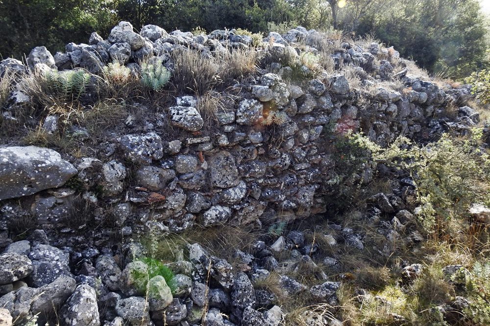
Few remains from a large Byzantine tower on a low hill 3 km west of the village Vourvoura in Arcadia, near the church of Analipsis (Ascension). The hill is at the south bank of river Sarantaporos, on the road to Vourvoura, overseeing a small plain to the southwest and the access to the southeastern Arcadia.
It is believed that the hill was the location of the ancient city Karyai.
This was a large tower or a small fortress measuring 21.65m✖21.65m✖20m in a trapezoid layout, with partitions in the interior. Today is in ruins, the maximum height reaching 1.80m at the southern side. The wall thickness is 2.80m at the east and west sides and 1.65 at the other walls. The type of structure, with mortar and tile fragments, indicates that this was not an ancient tower neither a construction of the Ottoman period.
We do not know the history or the time of construction of the tower but since it was at the frontiers between the Frankish and Byzantine territories towards the end of the 13th century, a period of conflict and constant hostilities, it is possible that it was built around that period. But we cannot be sure.
| First entry in Kastrologos: | October 2020 |
Sources
- Ιωάννης Θ. Σφηκόπουλος, «Τα Μεσαιωνικά κάστρα του Μορηά», σελ. 360-361 – Αθήνα,1968
- Κ. Α. Ρωμαίος, «Τοπογραφικά της Φραγκοκρατίας», σελ. 10, Πελοποννησιακά – Τόμος Β’ (1957)
|
|
| Access |
|---|
| Entrance: |
| Free access |