

Avia, Dytiki Mani, Messenia,Peloponnese
Castle of Mantineia
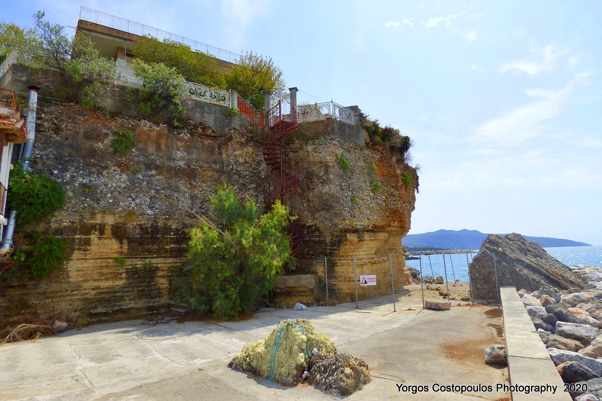
1
2 / 22

south side, by the sea - photo: Y.Costopoulos, 2020
3 / 22

south side, by the sea, detail - photo: Y.Costopoulos, 2020
4 / 22

south side, by the sea, detail - photo: Y.Costopoulos, 2020
5 / 22

south side, by the sea - photo: Y.Costopoulos, 2020
6 / 22

north side, by the sea, detail - photo: Y.Costopoulos, 2020
7 / 22

north side, by the sea - photo: Y.Costopoulos, 2020
8 / 22

remains of a gate (?) on the road to the top - photo: Y.Costopoulos, 2020
9 / 22

remains of a gate (?) on the road to the top - photo: Y.Costopoulos, 2020
10 / 22

remains of a gate (?), detail - photo: Y.Costopoulos, 2020
11 / 22

wall detail on the road to the top - photo: Y.Costopoulos, 2020
12 / 22

house with guardiolla - photo: Y.Costopoulos, 2020
13 / 22

inscription on the wall of the church (1775) - photo: Y.Costopoulos, 2020
14 / 22

wall remains (?) south of the church - photo: Y.Costopoulos, 2020
15 / 22

wall remains (?) south of the church - photo: Y.Costopoulos, 2020
16 / 22

wall remains (?) south of the church - photo: Y.Costopoulos, 2020
17 / 22

wall remains at the north side, close to the road - Costopoulos, 2020
18 / 22

wall remains at the north side, close to the road - Costopoulos, 2020
19 / 22

wall remains at the north side, close to the road - Costopoulos, 2020
20 / 22

wall remains at the north side, close to the road - Costopoulos, 2020
21 / 22

wall remains at the north side, close to the road - Costopoulos, 2020
22 / 22

the base and the start of the road to the top - photo: Y.Costopoulos, 2020

THE END
| Location: |
| Inside the coastal village Avia of Messenia |
| Region > Prefecture: |  |
| Peloponnese Messenia | |
| Municipality > Town: | |
| City of Dytiki Mani • Avia | |
| Altitude: | |
| Elevation ≈ 12 m |
| Time of Construction | Origin | |
| 14th cent. perhaps | FRANKISH |
|
| Castle Type | Condition | |
| Castle Ruins |
Few Remains
|
Scattered fortification remains inside the coastal village of Avia, south of Kalamata, in Messinia. It is believed that here is the location of the medieval castle of Mantineia.
History
The castle was built on the site of ancient Avia, which is mentioned in Homer. It was one of the seven cities that Agamemnon had ceded to Achilles. The 1st century traveler Pausanias mentions it, but then there is no mention of it again.
It is not known when the medieval castle was built. It was probably created during the Frankish period, in the 13th or 14th century. We have no indication that there was any fortification there from the Middle Byzantine period.
We know that there was a medieval castle in Mantineia from the lists of castles (Hopf tables) where the castle appears in the list of 1463 as Mantenya, 1467 as Mantegna and 1471 as Mantinea. In all 3 cases it is recorded as a Venetian castle. Apparently it was among the castles that the Venetians hurried to occupy after the conquest of the Despotate of Morea by the Ottomans.
The castle of Mantineia appears historically only in the 15th century. Several sources of that time (the Chronicle of Tocco, Halkokondylis, etc.) report an incident in 1415, where the lord Eleavourkos based in Giannitsa (Eleochori) rebelled against Byzantium. Emperor Manuel II himself, who had descended on the Peloponnese to consolidate Byzantine rule, was forced to besiege him in Mantineia and after a bloody battle to defeat him.
Mantineia reappears in historical sources in 1429, when the Principality of Achaea had been overthrown by the Byzantines, and the Despot of Mystras, Theodore II Palaiologos, was forced to share some of the new possessions with his brothers Constantine and Theo. Thus he granted to Constantine (who later became emperor) some regions including the richest part of Messinia with towns such as Androusa, Kalamata, Nisi, Ithomi and Mantineia.
Shortly afterwards, another brother of the Palaeologoi, Andronikos, came to Mantineia. He was Despot of Thessaloniki until 1430, when Thessaloniki was conquered by the Ottomans. It is probable that Andronikos died in Mantineia.
After the conquest of the Byzantine Peloponnese by the Ottomans, the Venetians took some castles in the southern Peloponnese, including Mantineia. In 1479 the Venetians left it to the Turks.
During the Turkish occupation, medieval Mantineia was abandoned and the inhabitants moved inland, founding today's “Megali Mantineia”.
Structure, Fortification & Buildings
The castle was at the shore, on a slightly elevated plateau (10 to 15 meters) above the sea, in a location that is currently occupied by the settlement of Avia.
The few remains of the castle are visible mainly on retaining walls on the north side of the village, near the road. Also some remains are visible on the foundations of houses on the cobblestone cliff, to the west, above the sea. In addition, in the alley that goes up to the top and the center of the village, at the beginning (see plan) there are ruins of walls that are shaped in a way that shows that maybe here was a gate.
The perimeter of the fortification is not visible, but should have been the same with the perimeter of the elevated part of the village, so it must have been about 480 meters. The area inside the walls was about 10,000 square meters.

location os the fortification remnants in Avia
| First entry in Kastrologos: | December 2020 |
Sources
- Photos, on-site survey and info by Yorgos Costopoulos, October 2020
|
|
| Access |
|---|
| Entrance: |
| Free access |


