Kythnos, Kythnos, Cyclades,South Aegean
Vryokastraki of Kythnos
| Location: |
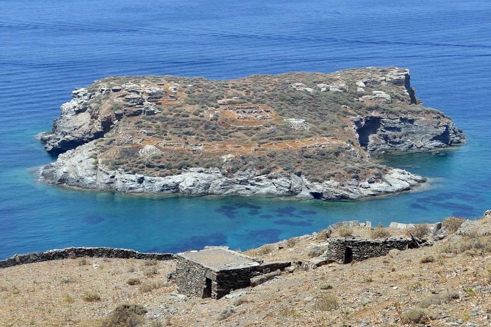
| On an islet at the western coast of Kythnos island, Cyclades |
| Region > Prefecture: |  |
| South Aegean Cyclades | |
| Municipality > Town: | |
| City of Kythnos • Kythnos | |
| Altitude: | |
| Elevation ≈ 12 m |
| Time of Construction | Origin | |
| 7th cent. | BYZANTINE  |
|
| Castle Type | Condition | |
| Ancient City |
In Ruins
|
Ruins of an ancient settlement with fortification, inhabited from the 7th century BC (perhaps even earlier) until the 7th century AD.
Location & Strategic Scope
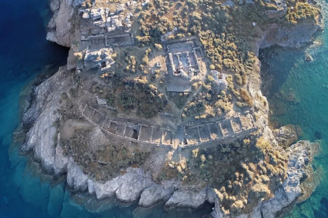
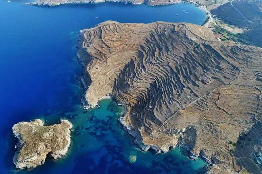
The settlement is located on a rocky islet on the west coast of Kythnos, opposite the cove of Mandraki and between the coves of Apokrousi to the north and Episkopi to the south. Directly opposite the islet, to the east, above the cove of Mandraki, there is an extensive ruin that was the central settlement of Kythnos during Antiquity and which is today called Vryokastro or Rigokastro.
According to underwater findings. in the past, Vryokastro was connected to the peninsula of Vryokastro through a narrow isthmus or a kind of breakwater.
History
As mentioned, Vryokastraki during Antiquity was united with Vryokastro, that is, ancient Kythnos, and was obviously a part of this large settlement, which, judging from the excavation findings, was a large and flourishing city and one of the most important cities of the Cyclades during the Classical Period..
Therefore, the history of Vryokastraki is directly linked to the history of Vryokastro.
Kythnos was already inhabited since the 3rd millennium BC, however the ancient city at the site of Vryokastro seems to have flourished from the Geometric and Archaic periods to the Hellenistic period — a fact confirmed by its fortification, which dates back to these periods.
The ancient city-state of Kythnos was important and well-organized, renowned for its governing system. Notably, Aristotle dedicated a special study to it in his work On the Kythnian State, which unfortunately has not survived. The city continued to be inhabited and important during the Roman and Early Byzantine periods, and is also mentioned in the Synekdemos of Hierocles — the list of Byzantine cities of the 6th century — as belonging to the province of “Hellas, or Achaia”.
It is worth noting that several foreign travelers had noticed and reported the existence of the ruins of Vryokastro, with some of them (Maihous, D'Estourmel) mentioning that the place was called Evreokastro — a name from which the name “Vryokastro” seems to have arisen in more recent times.
Especially for Vryokastraki, which was part of the ancient city, it was also inhabited from the Geometric Period and an integral part of the ancient city of Kythnos until Late Antiquity. However, it seems that gradually from the 4th century AD the main city, opposite, began to decline and shrink, while its population was concentrated in Vryokastraki.
In the fortification of the islet, at least 2 construction phases are observed with a difference of 1000 years from each other: The first phase dates back to the 7th century BC and the second to the 7th century AD.
The pottery and other finds from the excavations date back to the mid-7th century AD. It seems that around then, probably towards the end of the 7th century, Vryokastraki was abandoned and was never inhabited again. The cause was obviously the intense pirate activity of the Saracens in the Aegean, which began in the mid-7th century and continued for many centuries.
Structure, Fortification & Buildings
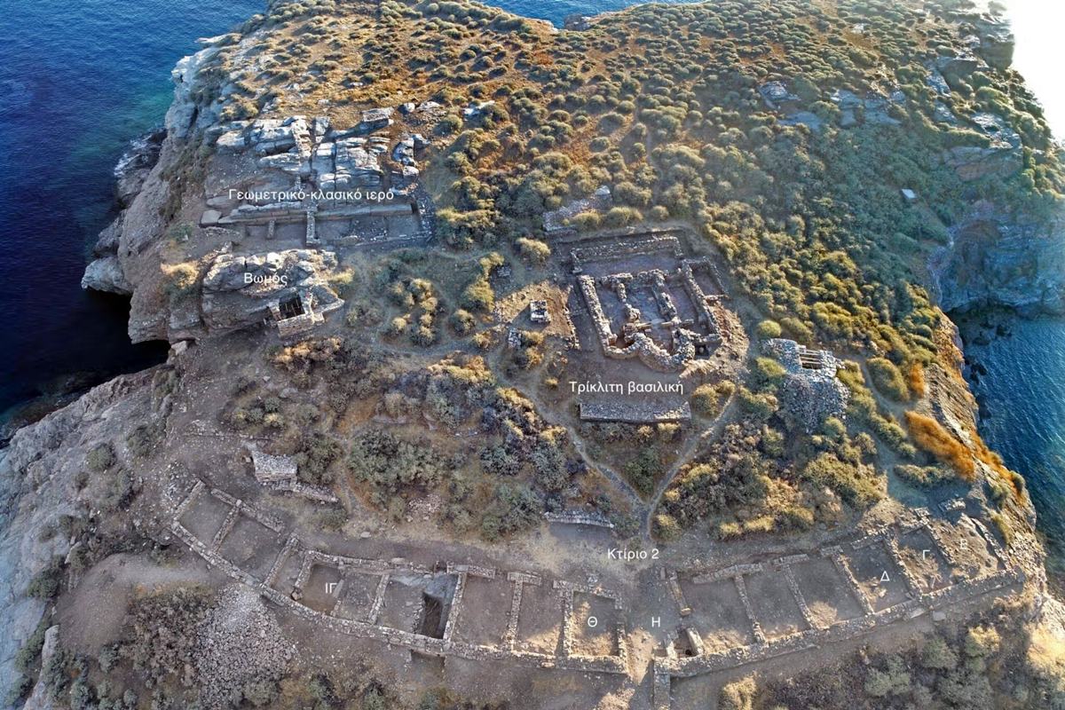
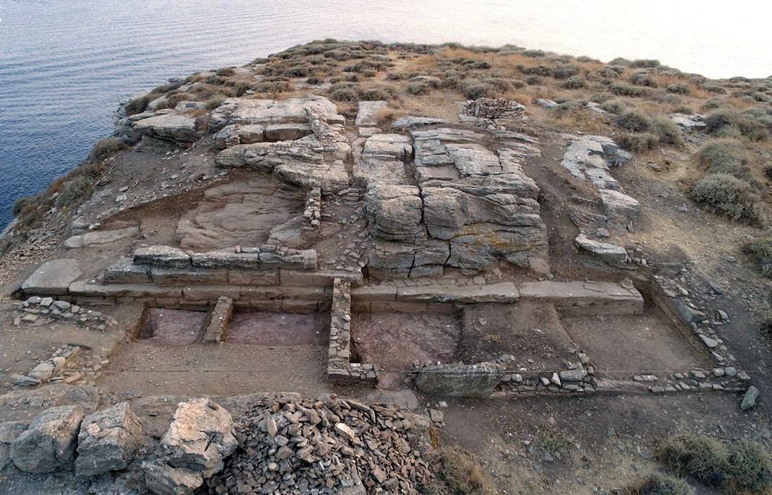
Of the strong fortification that existed in Vryokastraki, only the wall on the eastern side facing Mandraki has survived. Its form was finalized after the modifications of the 7th century AD.
In its original form, the fortification enclosure developed along the entire coastline of the small island. The perimeter of the wall was approximately 460 meters and the surface area within the walls was approximately 11,500 sq.m.
The fortification was based on the natural rock and rose vertically to a considerable height. The preserved eastern wall is 76 meters long. It is a strong structure with an average width of 1.20-1.50 meters.
Near the northern end of the eastern wall, the entrance gate has been spotted, which was protected by a tower. This tower had a rectangular layout with dimensions of 7.0✖5.5m. A similar structure has also been spotted at the southern end of the wall.
On the inner side of the eastern wall, a series of 15 small rooms has been revealed, which abut the wall. The rooms are rectangular, with similar dimensions, approximately 5✖6m and the entrance door from the west, from the inside of the islet. They are autonomous spaces, which do not communicate with each other, which may have had a military use, or even storage.
Two different masonry types have been observed in the surviving wall. The lower type resembles the masonry of the archaic wall of the city of Kythnos at Vryokastro opposite, while the upper part has relatively low-quality masonry, which consists of ancient marble elements in second use (spolia) and of large rectangular stone blocks, with the gaps between them being filled with small and medium-sized stones. These observations are supported by the ceramic findings from the excavations in the area, which in the lower layers can be dated mainly from the Protogeometric - Geometric era, and earlier, while in the upper layers they date back to the 7th century AD.
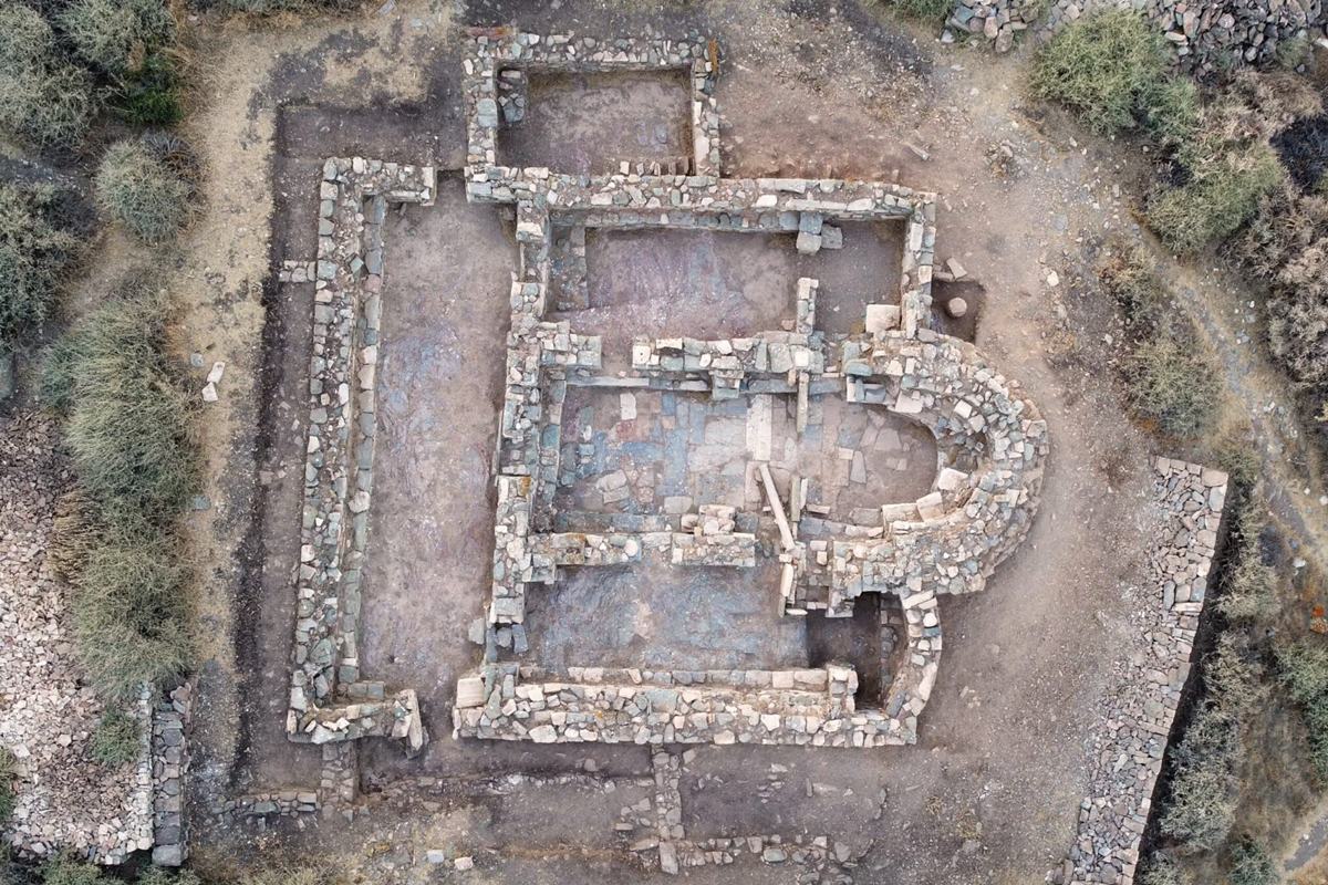
In a prominent position inside the islet, a three-aisled basilica with an episcopal throne was identified. From the excavation findings so far, we conclude that this church was in operation at least until the 7th century, without ruling out its later use.
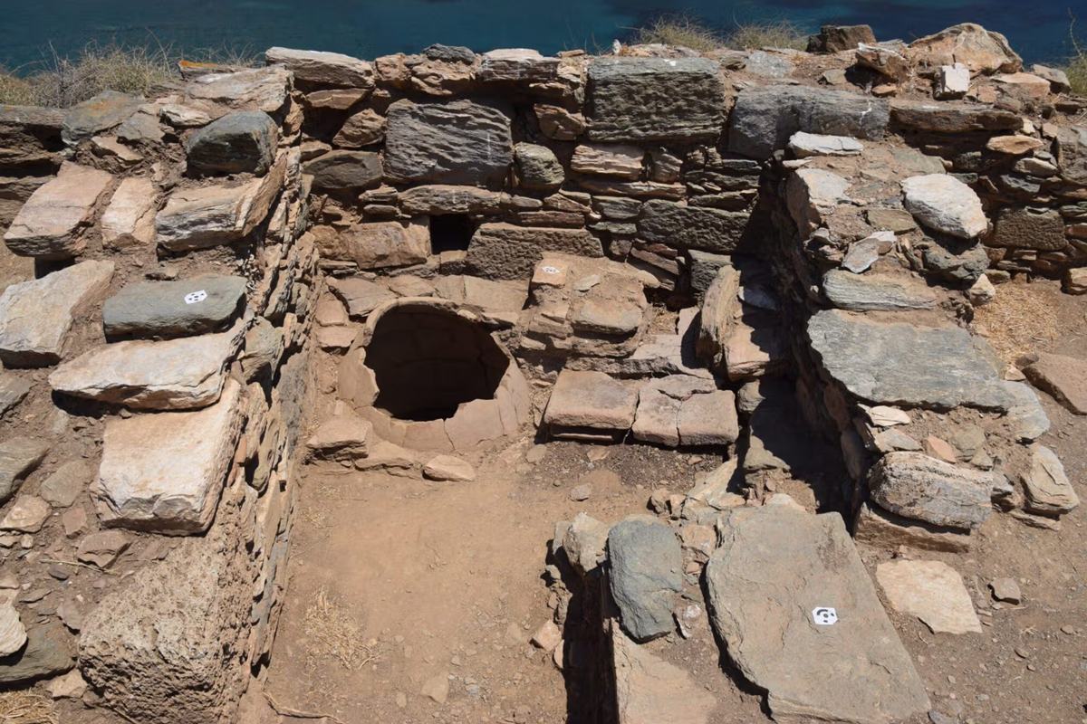
The fortified settlement's drinking water supply was ensured by cisterns for collecting rainwater.
Sources
- Ιστοσελίδα Cycladic Castles της Εφορείας Αρχαιοτήτων Κυκλάδων - Βρυοκαστράκι Κύθνου
- Website NAXOSPRESS - Κύθνος: Η βραχονησίδα «Βρυοκαστράκι» αποκαλύπτει κι αυτή τα μυστικά της (Νοέμβριος 2020)
- Website Ηuffingtonpost - Κύθνος: Εντυπωσιακά ευρήματα από την ανασκαφή στην βραχονησίδα Βρυοκαστράκι (Νοέμβριος 2020)
- Αβούρης Νικόλαος - Ζαμπέτας Κωνσταντίνος (2013), ΒΙΓΛΕΣ ΝΗΣΟΥ ΚΥΘΝΟΥ. ΙΣΤΟΡΙΟΓΡΑΦΙΑ ΔΙΚΤΥΟΥ ΕΠΙΚΟΙΝΩΝΙΑΣ ΤΩΝ ΟΙΚΙΣΜΩΝ, Πτυχιακή Εργασία, Ανώτατο Τεχνολογικό Εκπαιδευτικό Ίδρυμα Πειραιά, Τμήμα Πολιτικών Δομικών Έργων. σ.38-60
- Desktop research and info by Charalampos Papadopoulos