

Konitsa, Konitsa, Ioannina,Epirus
Castle of Konitsa
or Castle of Agia Varvara
1
2 / 15

The south wall and view to Aoos river valley
3 / 15

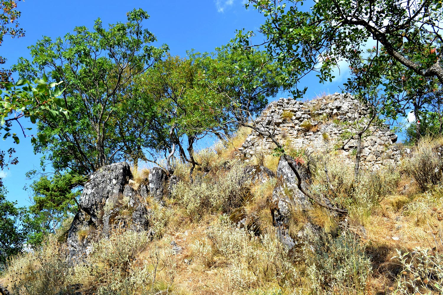
The preserved south part of the wall
4 / 15

Detail of the structure of the wall
5 / 15

The north wall or tower
6 / 15

The north wall or tower
7 / 15

Remains of the northeastern wall and view of town
8 / 15

The hill of the castle from a distance
9 / 15

The path from Agia Varvara to the castle
10 / 15

View of the castle from Agia Varvara (right on top of the cross)
11 / 15

The entrance to the plateau of the castle
12 / 15

View of Aoos river from the castle (toward SW)
13 / 15

Remains of the northeastern wall and view of town
14 / 15

Part of the wall fallen on the northwestern slope
15 / 15

View of the hill of the castle from the Natioal road (top left)

THE END
| Location: |
| On a hill SE of Konitsa close to the Agia Varvara chapel and over the end of the Aoos gorge. |
| Region > Prefecture: |  |
| Epirus Ioannina | |
| Municipality > Town: | |
| City of Konitsa • Konitsa | |
| Altitude: | |
|
Elevation ≈ 720 m (Relative Height≈280 m) |
| Time of Construction | Origin | |
| 14th century | Late-BYZANTINE |
|
| Castle Type | Condition | |
| Castle |
In Ruins
|
Location & Strategic Scope
The castle is on a hill at the western end of the Trapezitsa mountain which extends across the northern bank of Aoos river.
The castle controlled the western entrance to the gorge of Aoos.
It is near the chapel of Agia Varvara and this is the reason that is also known as the “castle of Agia Varvara”.
History
The chronology of the castle of Konitsa is rather uncertain.
The castle (and Konitsa) is mentioned for the first time in the Chronicle of Ioannina, written around 1380. The chronicle narrates that the castle was built by the Despot of Epirus Thomas Preloumbos, a Serb ruler seated in Ioannina, to strengthen his defense against Albanian raids.
In spite of this reference, it is more probable that the castle was built (or re-constructed) around 1319, during the short period (1318-1339) that the Byzantine Empire had regained control over the territories of the Despotate of Epirus.
It is also possible that the original castle was one of the fortifications that were built in the 6th century during the reign of emperor Justinian.
The Ottomans conquered the area in 1431 and initially used the castle which was abandoned (or destroyed) later. How this happened and when is not known.
Structure, Fortification & Buildings
The castle is small and ruined. Only a few parts survive.
A small part of a wall still stands at the south side with a height around 2,5m and a length of 6m. At the northern side there are the remains of what seems to be the foundations of a rectangular tower. A few meters to the west of the “tower” lie the remains of another part of the wall.
The maximum length of the fortification is ca. 40m while the maximum width is ca. 10m. But there are remains also at the slopes of the hill hidden under the vegetation. This perhaps means that the castle was initially larger but it was destroyed by earthquakes or landslides and as a result, parts of it had fallen towards the slopes.
| First entry in Kastrologos: | November 2012 | Last update of info and text: | August 2016 | Last addition of photo/video: | August 2016 |
|
|
| Access |
|---|
| Approach to the monument: |
| Along the main street of Konitsa there are many roadsigns directing to the "Agia Varvara' chapel which is halfway. Following one of them, on foot, we reach the church. From there, the path continues up to the castle (and beyond). Total time ca. 45 min. |
| Entrance: |
| Free entrance |
| Other castles around |
|---|
| Tower of Hamko |
| Lachanokastro |
| Kastraki of Agios Minas |
| Kastri of Vella |


