Corfu, Kentriki Kerkyra, Kerkyra,Ionian islands
Western fortification of Corfu
1
2 / 19
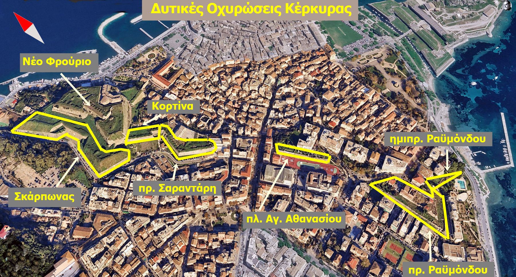
the preserved elements of the western fortifications
3 / 19
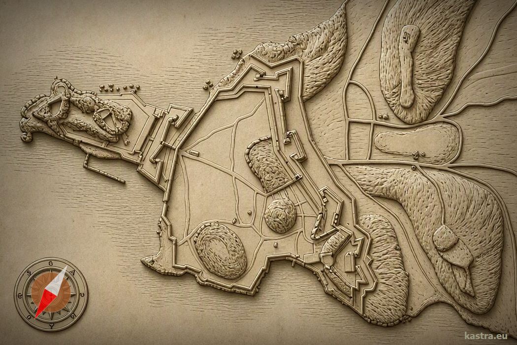
relief map of the fortifications based on a 18th cent. Map
4 / 19
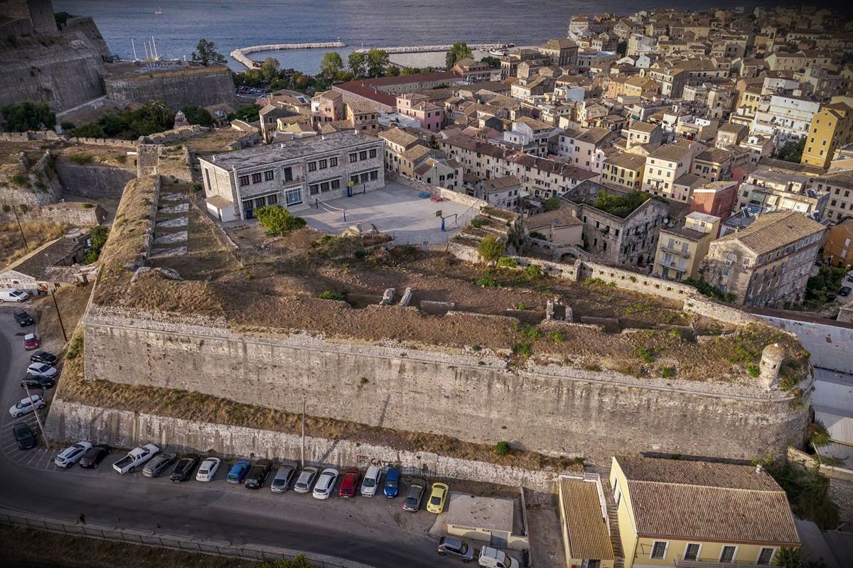
Sarantaris bastion
5 / 19
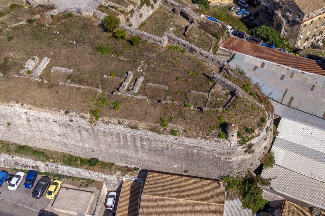
the orecchione of the south tip of Sarantaris bastion
6 / 19
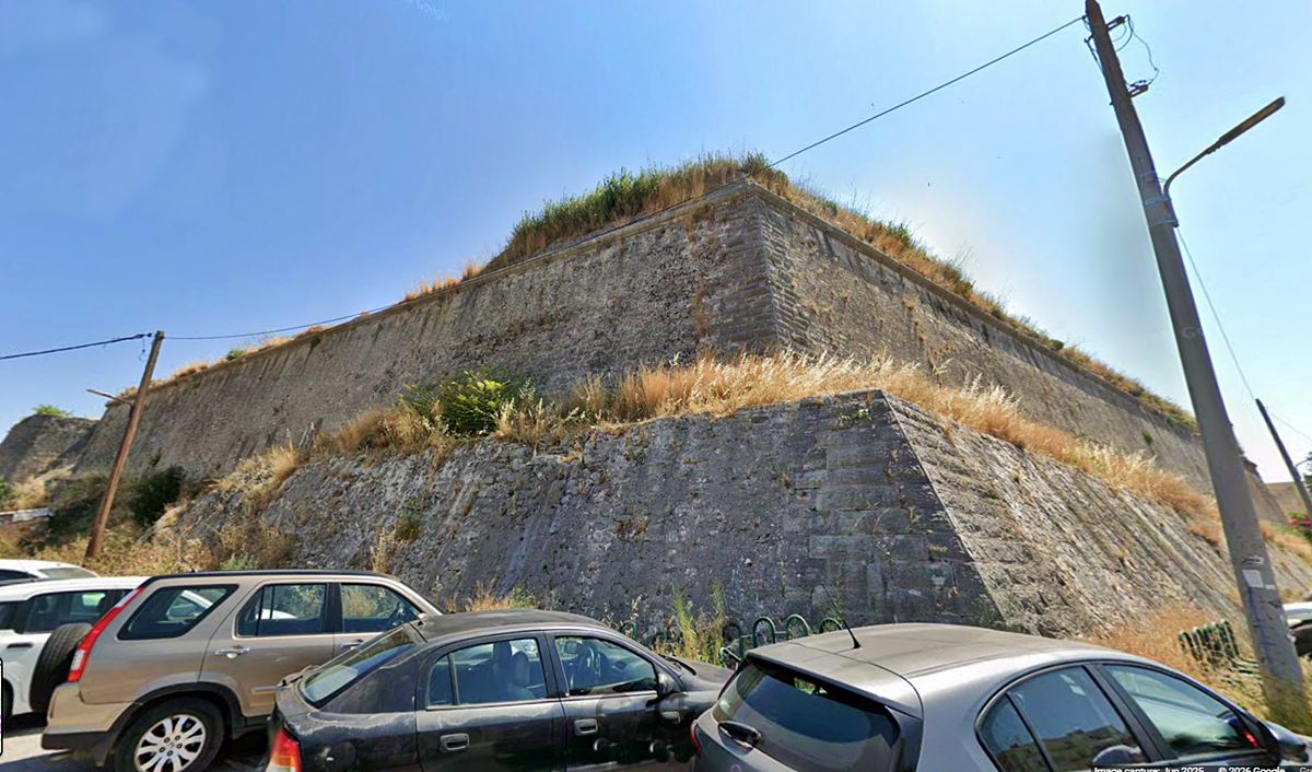
the NW corner of Sarantaris bastion
7 / 19
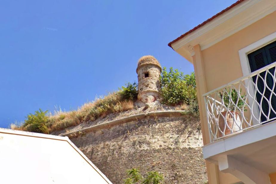
guardpost at the south end of Sarantaris bastion
8 / 19
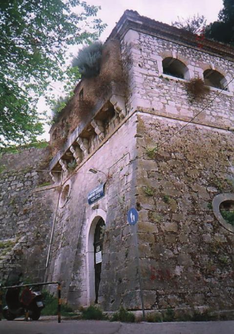
the gate to Sarantaris bastion
9 / 19
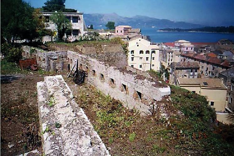
Sarantaris bastion – east side
10 / 19
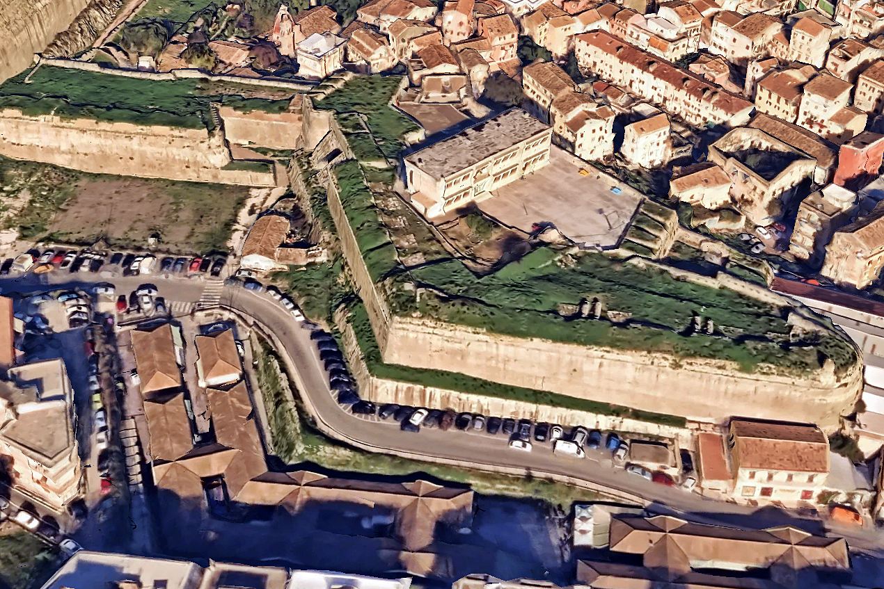
Sarantaris bastion
11 / 19
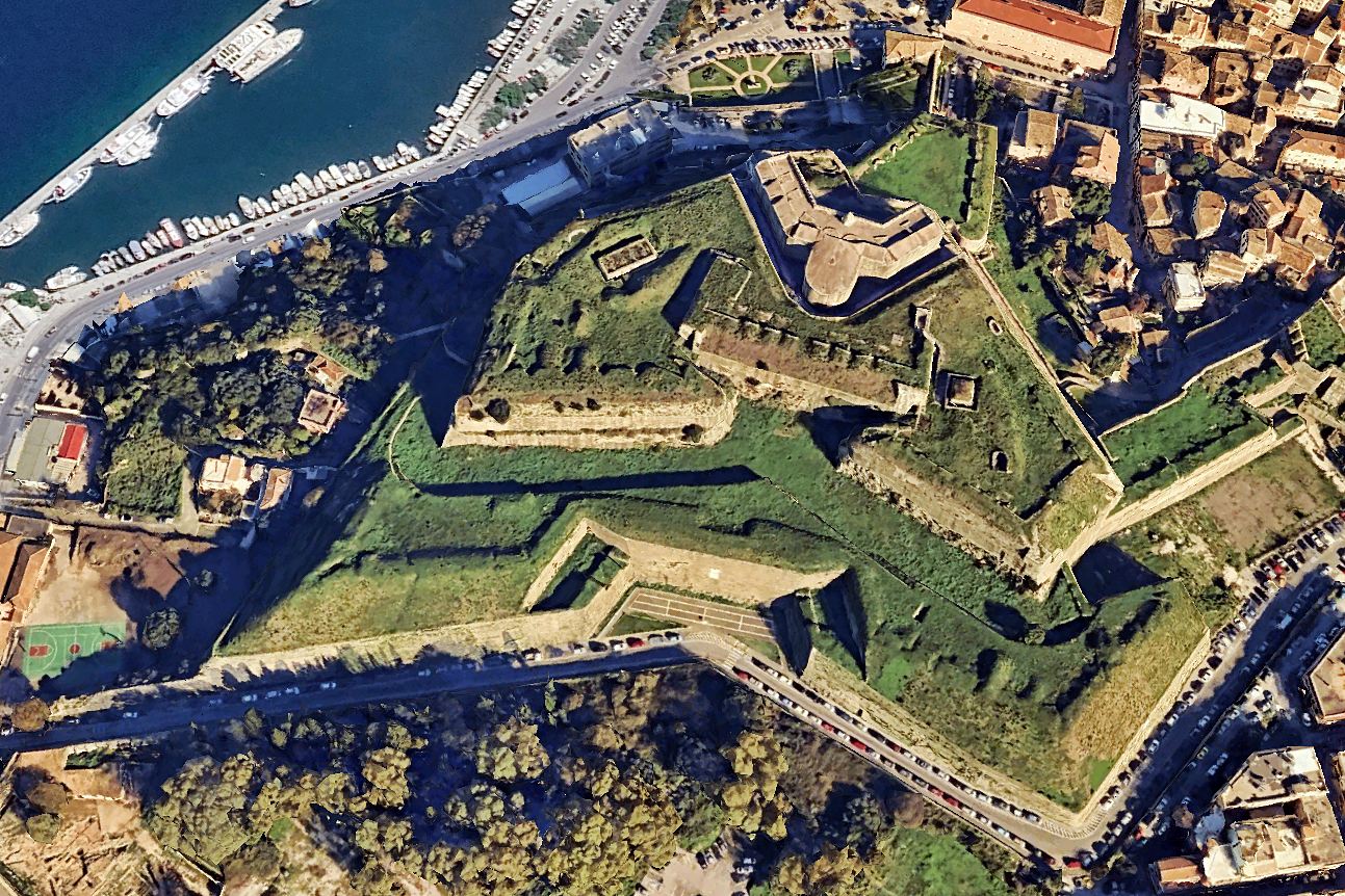
fort Scarponas (at the west side of the New Fortress)
12 / 19
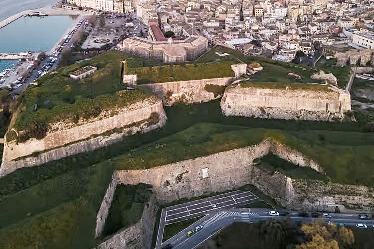
fort Scarponas (at the west side of the New Fortress)
13 / 19
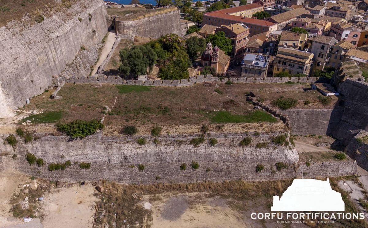
curtain wall between the Sarantaris bastion and the New Fortress
14 / 19
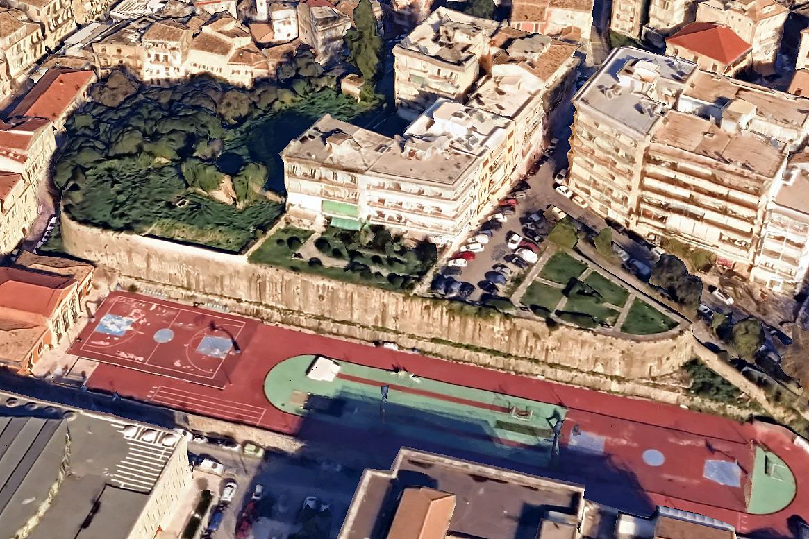
the platform of Agios Athanassios
15 / 19
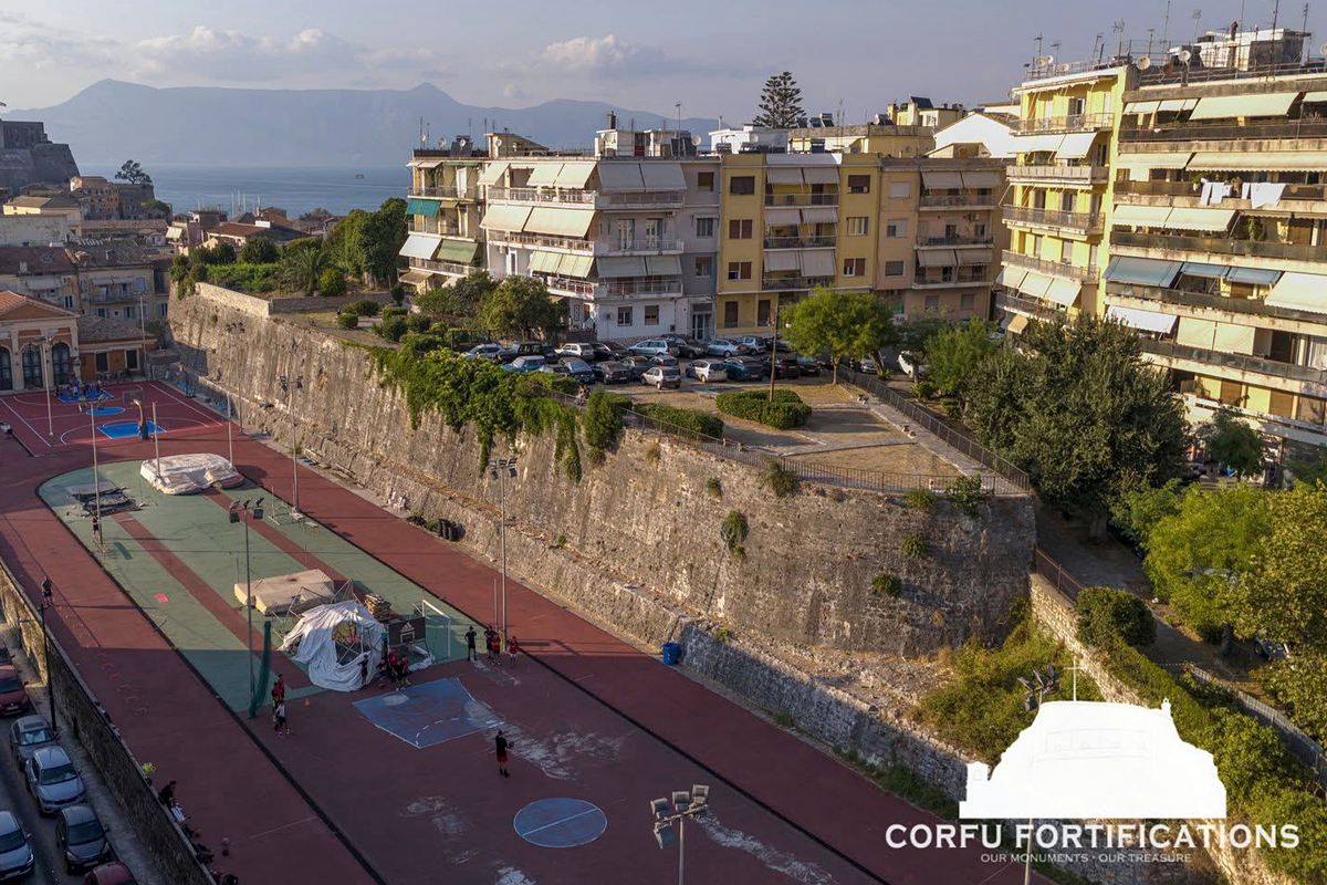
the platform of Agios Athanassios
16 / 19
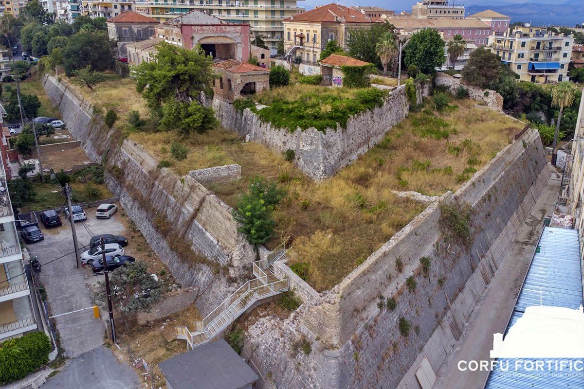
the Raymond bastion at the south end
17 / 19
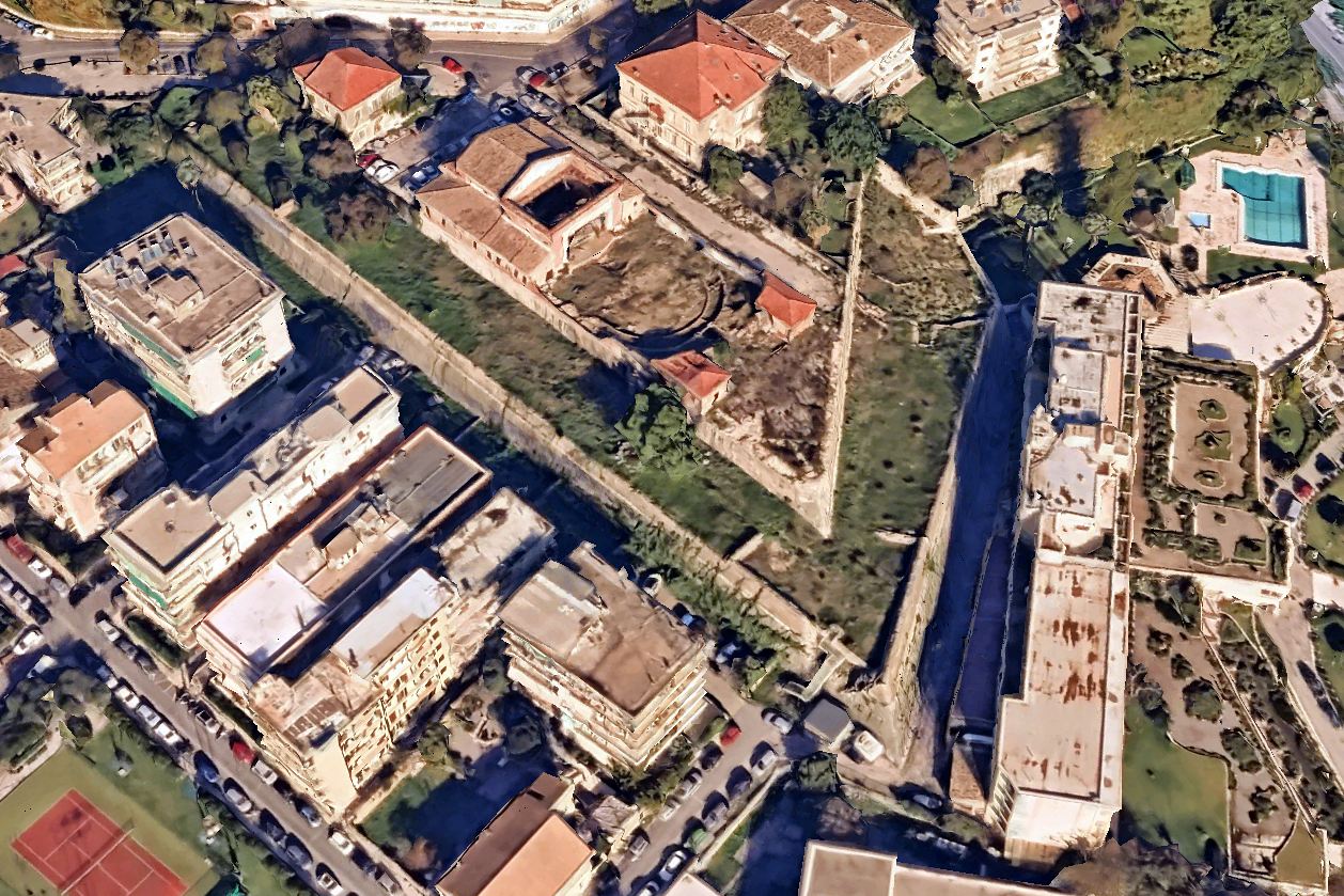
the Raymond bastion at the south end
18 / 19
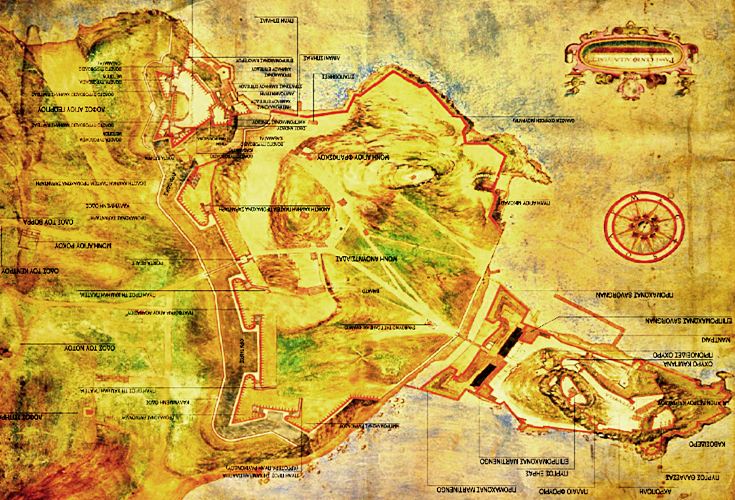
drawing of the fortifications at the end of 16th century
19 / 19
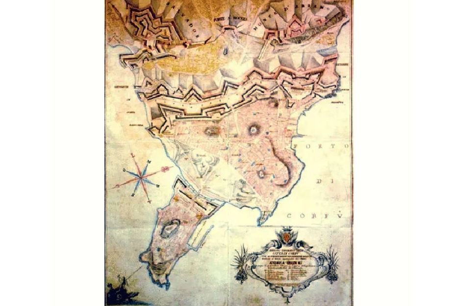
drawing of the fortifications at the end of 18th century
THE END
| Location: |
| At the west side of the city of Corfu |
| Region > Prefecture: | 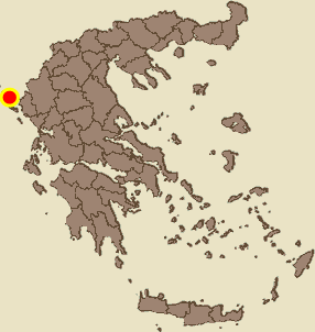 |
| Ionian islands Kerkyra | |
| Municipality > Town: | |
| City of Kentriki Kerkyra • Corfu | |
| Altitude: | |
| Elevation ≈ 10 m |
| Time of Construction | Origin | |
| 16th cent. | VENETIAN  |
|
| Castle Type | Condition | |
| Fortress |
Not Good
|
Corfu, as is well known, has two of the most important castles in Greece: the Old Fortress and the New Fortress.
In addition to these two landmarks, however, other fortifications survive in the city, much less prominent and probably largely unknown.
These are the fortifications on the western side of the city, which were intended to defend it against attacks from the landward side and were originally built by the Venetians in the 16th century.
The Surviving Western Fortifications
A large part of the western fortifications has been destroyed, but substantial sections survive. Starting from the north, at the New Fortress, and proceeding south/southeast, these are:
— the Skarponas Fort (photo 11,12)
— the Tenedos Cortina or Tenedos Curtain Wall i.e. the connecting wall between the New Fortress and Sarantari (photo 13)
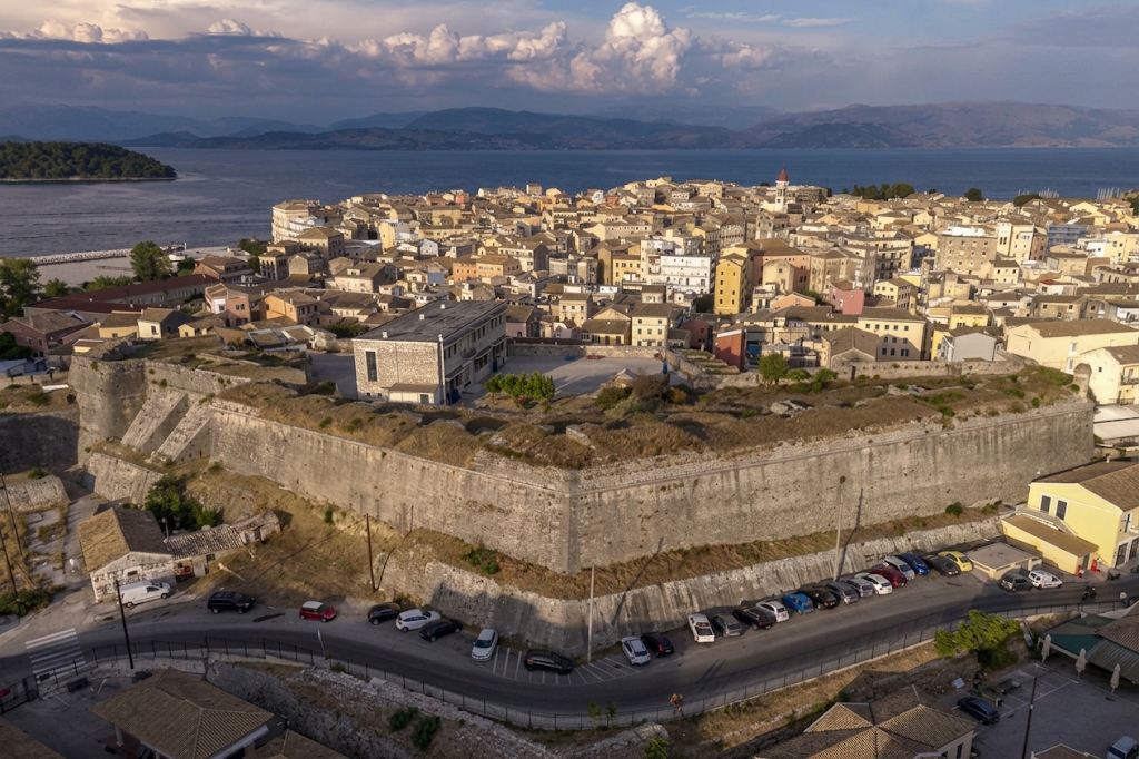
— the Sarantaris Bastion (photo 1, 4-10)
— the Agios Athanasios Platform (photo 14,15)
— the Raymond Bastion (photo 16, 17)
— the Raymond Demi-Bastion at the southeastern end of the western fortifications.
Skarponas and the Cortina are sometimes regarded as parts of the New Fortress, and perhaps the Sarantaris Bastion as well. On Kastrologos, however, we present them on this page as separate fortified positions, and we believe this to be the correct approach. Skarponas is a hornwork located outside and in front of the New Fortress (to the west, beyond the moat), while the Cortina is the wall that connected the New Fortress with the next bastion, the Sarantaris Bastion, which was an independent fortification.
All the surviving parts of the western fortifications are separated from one another, with the exception of the Sarantaris Bastion, which is attached to the Cortina.
All these forts formed a compact and continuous defensive line and were connected to one another by curtain walls. These intervening walls have been demolished, and only the Tenedos Cortina has survived. But it is not only these walls that have been destroyed. The entire outer enceinte of the western fortifications, together with its bastions and dry moat, has also disappeared.
In addition, the western defensive front included three forts located farther to the west:
— the Fort of Agios Sotiras (Fortezza di San Salvador, originally known as Corner)
— the Avramis Fort
— the Fort of Agios Rokos (San Rocco)
The first two stood on two hills on the western side of Corfu, while the third was built in the gap between them. None of these three forts survives today.
Castle Terminology
At this point, let us recall some terms related to castle architecture –specifically the Italian fortification terminology of the 16th century– that are widely used when describing the Corfu Western fortifications:
— The bastion (bastione) was a projection from the wall featuring independent defenses; it had a polygonal shape terminating in at least two acute angles and typically comprised two levels or “piazze”.
— The platform (piattaforma) was also a projection from the wall but featured a simpler construction and a rectangular shape, lacking acute angles.
— The demi-bastion (mezzo bastione) was an incomplete or small bastion. In this instance, the Raymond demi-bastion is simply an elongated, pointed angle situated a short distance from the main Raymond bastion.
— The Cortina (curtain wall) was the straight section of wall connecting two towers or two bastions.
History
The Venetian rule in Corfu began in 1386, when the inhabitants, after a period of lawlessness and uncertainty, chose to declare themselves subjects of the Serenissima Republic of Venice.
Corfu never experienced the Turkish yoke, although the Ottomans tried several times: in 1431, in 1537 (under the fearsome Hayreddin Barbarossa), in 1571, in 1573, in 1716. Each time the Ottomans plundered the island, but vould not capture the castles.
Decisive for the construction of new fortifications in Corfu was the second siege by the Ottomans in 1571, when the still unfortified borgo was almost completely destroyed, making the need for defensive protection of that part of the city imperative.
In 1558 construction began, but it did not proceed quickly. Work began at a regular pace only in 1576 under the supervision of the architect Ferrante Vitelli.
Then the New Fortress was built on the hill of Saint Mark. In addition, the western side of the city was enclosed by a strong wall that isolated it from the countryside. The wall started from the southern side and ended at the New Fortress on the northern/northwestern side and consisted of the bastions we mentioned.
In front of the front, a moat and a covered road were constructed, while in front of the New Fortress a hornwork was built, the Scarponas fort.
Access to the fortified perimeter of the city was through four main gates: of Spilia, of Saint Nicholas, of Raymond, and the Porta Reale. There were also 3 gates in the New Fortress.
This western fortification, the Vitelli line, remained more or less the same for over 100 years. In 1669 the scene changed, as with the fall of Candia, the conquest of Crete by the Ottomans was completed and Corfu found itself to be the last stronghold of Venice against the Turks. Therefore it was decided urgently to reinforce the fortifications.
The fortifications were reinforced based on the plans drawn up by the engineer Filippo Verneda. On the southern side of the western fortification, a second hornwork was then built, that of Saint Anthony, supported by two turrets. The front then advanced northward reinforced by two small forts, Corner (Rivellino Corner – between Raymond and St. Athanasios) and Grimani (Rivellino Grimani – in front of the Porta Reale north of the Sarantaris bastion). Next to it, another fort was built, in the shape of a crescent, the Mezzaluna Grimani. These new forts were connected by curtain walls up to the Scarponas.
The new fortification works were completed by 1682. The new Verneda line was decisive for the defense during the Turkish siege of 1716. In this siege Corfu came under fierce attacks and found itself in great danger, but was ultimately saved thanks to its fortifications, the heroism of its defenders and the abilities of the military commander of the island, the German field marshal (in the service of Venice) Johann Matthias von der Schulenburg.
The last defensive works carried out by the Venetians were constructed in the period 1716-1735, when, based on the lessons of the great siege of 1716 and on the recommendations of Schulenburg, the hills of Sotira (Saint Savior) and Avramis were fortified and a small fort was built in the suburb of Saint Rocco. These 3 new fortresses were independent and were not incorporated into the fortified enclosure of the city.
Later, between 1763 and 1765, a –not particularly strong– outer wall (falsa braga) was built that followed a parallel alignment with the main walls, at a distance of about 10 meters.
At the southeastern corner of the main defense line, in front of the southern front of the Raymond half-bastion, the Valier bastion was built in 1765, a pentagonal bastion that protected the southern end of the main moat, and supported the outwork.
The Venetian rule in Corfu lasted over 400 years, until 1797, when the Republic of Venice was overthrown by Napoleon. Then Corfu passed briefly into the hands of the French with the Treaty of Campo Formio.
In 1799, after a four-month siege (when once again the western fortification came under the greatest pressure), the Russians, who had allied with the Turks, became the new rulers and created a new semi-independent state.
In 1807, with the Treaty of Tilsit, the Russian Empire ceded control of the islands again to France. In 1814, the French left and the British came.
The British did not build new fortifications in the city of Corfu. Their interest focused mainly on the creation of new fortification works on the islet Vido. In the western fortifications they limited themselves to repairs and modifications, mainly by adding gun-loops and reinforcing the artillery positions.
The decline and demolition of the fortifications
Meanwhile, international conditions had now changed. Britain had developed into a great global power, while the Ottoman Empire was in decline. Thus, the fortifications of Corfu had lost much of the critical geostrategic importance they had during the Venetian period. At the same time, the perception began to take shape that they were excessively extensive, costly to maintain and, ultimately, unnecessary.
In 1838 the British drew up a new urban plan, which provided for the erection of public buildings and residences within the military zone, as well as the demolition of a large part of the western fortifications, so that the expansion of the city could become possible. The implementation of the plan did not proceed quickly, but over the next two decades it was carried out gradually. On a map of 1847 it is shown that a large part of the Verneda line had already been demolished. The Valier bastion and the fort of Saint Anthony had also been destroyed, while the outer wall and the moat are now absent from the map. During the same period, the curtain walls and the gates between the bastions of the Vitelli line must also have been demolished.
The demolition of the fortress of the Savior had also begun. In its place, a few years later, the notorious prisons of Corfu were built.
The fort of Saint Rocco still remained standing, but its transformation into a psychiatric institution had already begun. After 1850 it operated as the “Asylum for the Insane” and became the first Public Psychiatric Hospital of Greece. Over time it gradually lost its original fortress character.
The final blow for the western fortifications came in 1864, with the union of the Ionian Islands with Greece. The Treaty of London of 1863 provided for the abolition of the fortified character of Corfu, so that the city would be handed over as an “unfortified city.”
The British decided to implement this by destroying the fortifications and, before their departure, began preparations for blowing up the fortresses and the fortifications .
In the end, however, after strong reactions from the inhabitants and diplomatic actions by Charilaos Trikoupis, the complete destruction was avoided. Only the fortifications on Vido, the fort of Avramis and certain other secondary structures in the western fortifications were blown up.
The demolition of the fortifications, however, did not stop with the departure of the British. Over the following decades, other sections of the walls were also demolished for the needs of the city’s expansion. The most characteristic case was the monumental Porta Reale (which now stood alone between the Sarantaris bastion and the New Fortress), which was demolished in 1893 for the opening of the road to the new suburbs.
| First entry in Kastrologos: | October 2026 |
Sources
- Στανέλλος, Λεωνίδας (2015), «Η Βρετανική στρατιωτική αρχιτεκτονική στην Κέρκυρα: οι επεμβάσεις των Βρετανών στα φρούρια, τις οχυρώσεις, τα κτίρια και τις στρατιωτικές εγκαταστάσεις: 1814 – 1864», Διδακτορική διατριβή – Εθνικό Μετσόβιο Πολυτεχνείο (ΕΜΠ). Σχολή Αρχιτεκτόνων Μηχανικών. Τομέας Ι : Αρχιτεκτονικού Σχεδιασμού. 37-49, 230-281.
- Σελίδα Facebook Corfu Fortifications - Προστασία & Aνάδειξη των Kερκυραϊκών Oχυρώσεων , , από όπου οι φωτογραφίες 1,4,5,13,15,16
| Access |
|---|
| Entrance: |
| Free access to the exterior. |
| Other castles around |
|---|
| Gardiki Castle |
| Tower of Garoufa |
| Fort of Gouvia |
| Fortress of Kassiopi |
| New Fortress of Corfu |
| Old Fortress of Corfu |
| Vido fortifications |