Kastritsa, Ioannina, Epirus
Acropolis of Kastritsa
1
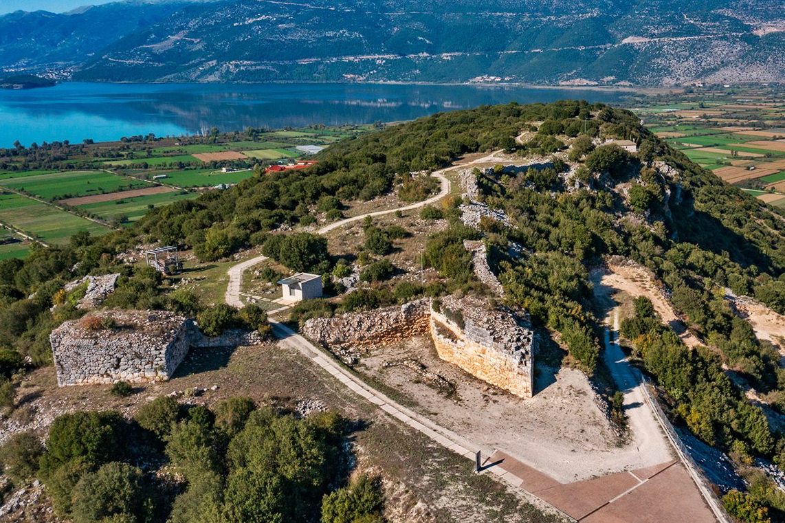
2 / 12
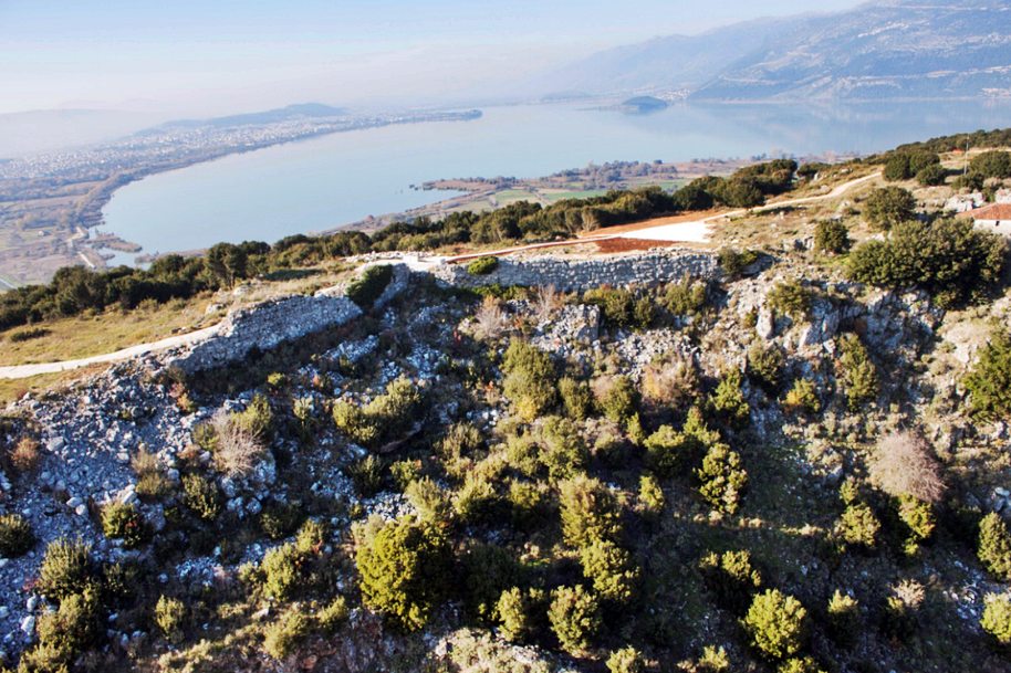
eastern side of thw fortification
3 / 12
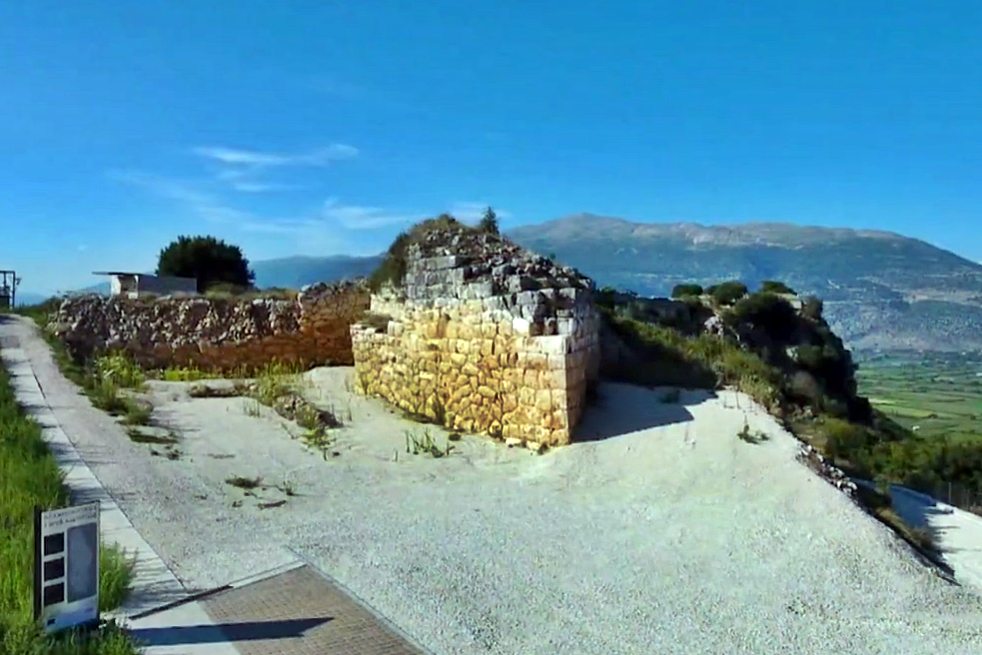
southeastern tip of the fortification with the spear-shaped tower
4 / 12
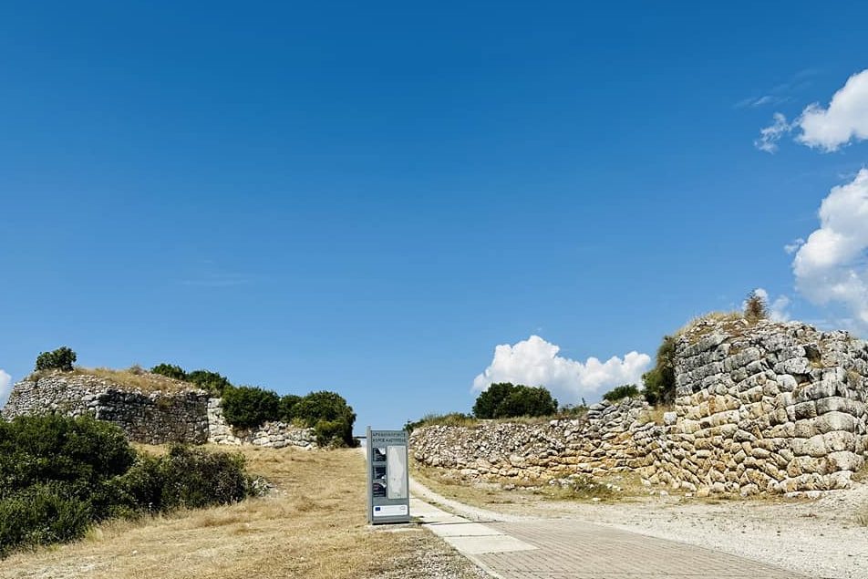
southeastern tip of the fortification with the spear-shaped tower
5 / 12
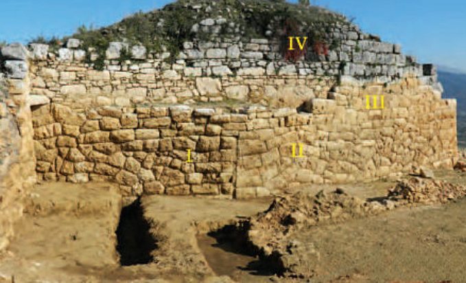
the SE tower with 3 phases of construction
6 / 12
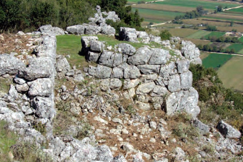
gate III
7 / 12
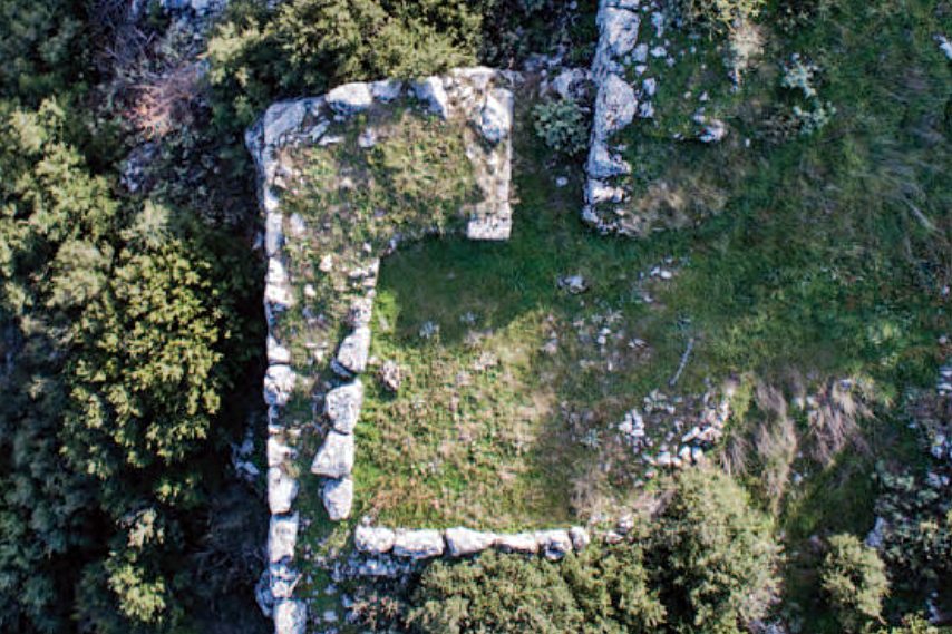
gate III - aerial view
8 / 12
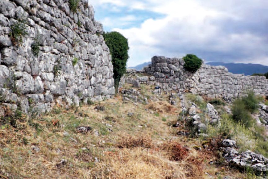
access to gate I
9 / 12
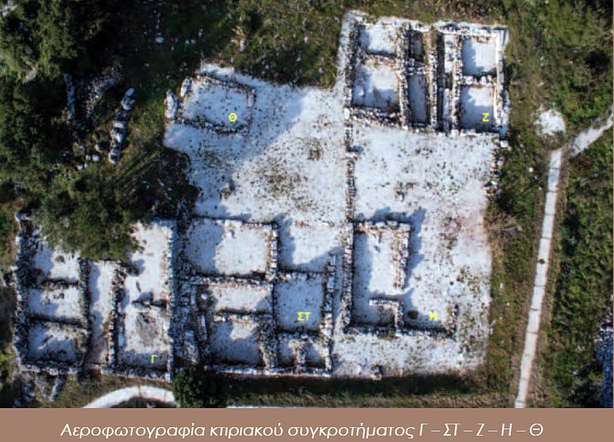
10 / 12
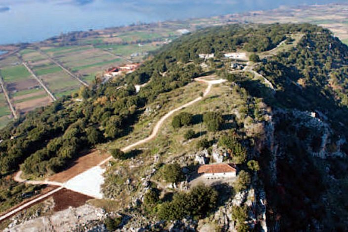
the top of the hill with Α. Athanassios chapel and Agios Prodromos further back.
11 / 12
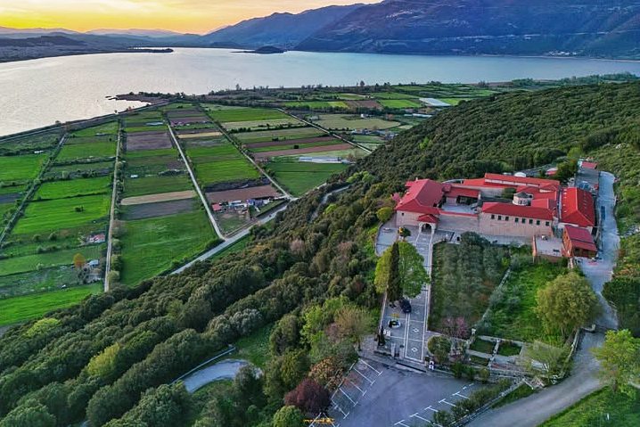
the monastery of Agios Ioannis Prodromos
12 / 12
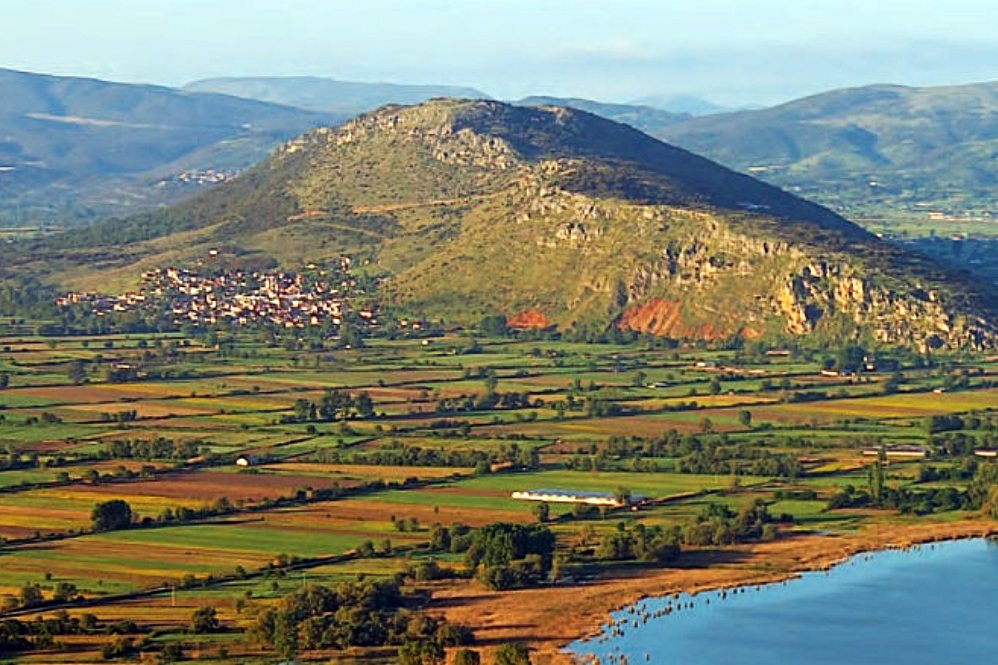
the hill of Kastritsa from Northeast
THE END
| Location: |
| On a hill above the village of Kastritsa, just outside to the SE of Ioannina in Epirus. |
| Region > Prefecture: | 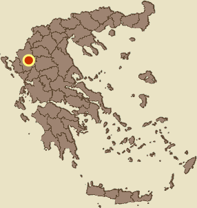 |
| Epirus Ioannina | |
| Municipality > Town: | |
| City of Ioannina • Kastritsa | |
| Altitude: | |
|
Elevation ≈ 650 m (Relative Height≈250 m) |
| Time of Construction | Origin | |
| Various periods | ANCIENT  |
|
| Castle Type | Condition | |
| Ancient City |
Rather Poor
|
The elongated hill of Kastritsa (on the north-south axis and with an altitude of 757m) dominates the northwestern part of the Ioannina basin, very close to the southern shore of Lake Pamvotida and at a road distance of only 12 km from the center of Ioannina.
The hill has hosted human activities from the Paleolithic Age to the present day.
The construction of the acropolis fortification dates back to the Hellenistic period, while it was used and modified later, up to the Early Byzantine period.
Location & Strategic Scope
The hill is in a strategic position, controlling the ancient passages to Dodoni, Thesprotia, Ambracia and, conversely, to Macedonia and Thessaly.
The fortification and the ancient settlement are not located at the top of the hill, but lower, in the northern and northwestern part of the hill, at an altitude of up to 650m. (250m from the surface of the lake). At the northeastern foot of the hill, far outside the castle, is the present-day village of Kastritsa (old name: Brakmadi).
A few hundred meters north and northwest of the hill extends Lake Pamvotida, which in Antiquity had a larger area and reached the foot of the hill. It is very likely that the hill of Kastritsa was an island at that time!
History
The acropolis of Kastritsa was founded by the ancient Greek tribe of the Molossians during the Hellenistic period, and more specifically in the 3rd century BC. The heyday of the acropolis coincides with the period of the League of Epirus (233 BC – 168 BC).
The results of the research so far on the acropolis show that, during its heyday, the settlement was densely populated, with building blocks adapted to a rectangular urban plan and the natural rocky sloping terrain. The large size of the buildings and the quality of the constructions, as well as the fact that even after the 1st century BC, new buildings were built on the acropolis in this area, such as a balaneion, indicate the high standard of living of the inhabitants of the area.
The hill was inhabited long before the creation of the Hellenistic acropolis. On the NW side of the hill (outside the fortification) is the Kastritsa Cave, one of the most important Paleolithic sites in the Balkans, which was inhabited from 22000 to 9000 BC (the cave is currently inaccessible due to landslides). Finds from another site at the northern foot of the hill date from the Neolithic period (5500-3200 BC) to the end of the 4th/beginning of the 3rd century BC.
The human presence higher up, on the top of the hill, is late:, from the end of the Late Bronze Age/Early Iron Age. But the organization of the fortified city happened, as mentioned, only in the 3rd century BC. It was a time when the Molossians, who until then lived in small settlements and villages, made an attempt to adapt to the city-state model that applied to the rest of the Greeks.
It is not exactly known which ancient city was located on the hill of Kastritsa. The archaeologist Sotiris Dakaris argued that it is the ancient city of Tekmon mentioned by the Roman historian Titus Livius in the account of the conquest of Epirus. N. Hammond identified the location with the city of Eurymenae, based on topographical observations combined with descriptions by Diodorus Siculus.
In 167 BC the city was captured by the Romans who destroyed it. We can assume this with certainty, because it is known that the Romans, after their victorious outcome of the Third Macedonian War and the dissolution of the Macedonian Kingdom (168 BC), invaded Epirus the following year where they systematically destroyed 70 cities (to avenge what they suffered by King Pyrrhus). Thus, although we are not sure about the identity of the city and its ancient history, we can be sure that it did not escape the vengeful wrath of the Romans, and was destroyed.
Despite that destruction, the city continued to exist and develop in the following centuries. In the archaeological site, additions to buildings and fortifications belonging to the Late Roman period and the Early Byzantine period are observed. However, it should be noted that there are no references to the city from historical sources for these relatively more recent periods.
The city was abandoned towards the end of the 6th century AD, probably due to an invasion from the north by Avars and Slavs. The walled settlement was never inhabited again.
Much later, in the 11th or 12th century, the monastery of Agios Ioannis Prodromos was founded on the northwestern outskirts of the ancient city. Building material from the fortification was used to build the monastery.
The monastery functioned for centuries. In the 18th century it was invaded and plundered by the Turks, who later, in 1854, used the monastery as a military camp. During the Balkan Wars, the Turks built forts on the hill, the remains of which can still be seen today. After 1913, the monastery became a Greek military camp and then, after 1916, an orphanage. Today it is a women's monastery.
At a distance of 100m. north of Gate I, there is a small Christian church dedicated to Saint Athanasios, which is located on the ancient wall. The church was built during the Ottoman period, but was demolished in the context of organizing the Turkish defense line of the city of Ioannina, during the Balkan Wars. After the liberation, the residents of Kastritsa rebuilt the chapel in the same location.
Between 2011 and 2015, works were carried out to protect and enhance the archaeological site, and to partially restore the antiquities on the hill of Kastritsa. The works were carried out in two phases and the budget was €1,200,000.
Structure, Fortification & Buildings
The fortification does not cover the entire hill, but only a part on its northern side. In fact, it is not located at the highest point of the hill, but at a lower point, where a large plateau is formed with more difficult access compared to the rest of the hill.
The maximum length of the fortified settlement is 1580m and the maximum width is 350m. The total area is 345,000 sq.m. The enclosure is preserved on the north, east, south and part of the western side. Its length is 3,250 meters.
On the south and southwest sides, which were the most vulnerable sides of the castle, the wall is reinforced with rectangular towers and in the southeast corner with a strong spear–shaped tower. There are no towers on the other sides of the acropolis.
The fortification enclosure is built in its largest area according to the polygonal system. The isodomic system is observed mainly in towers, near the gates, and in the preserved parts of the western side. The average thickness of the wall is 3.50m. (3.60-3.90m on the south and southeast, 2.10-2.60m on the west and north sides) and the surviving height internally 2.60-2.80m and externally 2.50-5m.
The fortification of Kastritsa had 5 gates (3 on the east side, 1 on the north and 1 on the southwest) and 1 small secondary gate, also on the SW side, which seems to have been sealed at some later stage. The gates are in the form of a corridor, between two overlapping sections of the wall, and are framed by towers or wall breaks.
The walled area is structured on many different levels, in which buildings are found organized in groups, which compose a single urban fabric. The excavation research has focused on parts of the southern and southwestern area of the acropolis, where the building remains of four building complexes were identified, which have been named by archaeologists: A–B, Γ–Δ–Z–H–Θ, E and K. The buildings date from the 3rd century BC. and it seems that they were inhabited, with minor modifications, in the following centuries.
The buildings have an almost square plan and their internal layout is characterized by a symmetrical arrangement of rooms, on both sides of a central corridor. Their area ranges from 120 – 255 sq.m., while the complexes, A–B and E cover an area of 515sq.m. and 1120sq.m., respectively. The external walls are made of large limestone blocks with polygonal masonry. They are founded directly on the rock, which in places has been carved for this purpose. As can be concluded from the meticulous limestone thresholds that are preserved in their place, the buildings had wooden, double-leaf, external doors with an opening of 2.00–2.25 m.
The most characteristic element of the Kastritsa acropolis is the unusual tower on the south side:
This “spear – shaped” tower is 24 m long, 9 m wide. It is preserved at a height of over 5 m and shows 4 building phases. 3 phases are ancient and 1 is Byzantine. The triangular end-extension – which extended the initially square tower by 16 m – is related to the extensive use of siege engines during the Hellenistic period and the need to deal with them. This hypothesis is supported by the discovery of iron points of catapult arrows and stone catapult projectiles around the tower.
On the southern (and highest) peak of the Kastritsa hill, surprisingly, no remains of fortifications or buildings have been found. The only indication was found near the southwestern edge of the hill, where two limestone blocks can be seen at the foundation level, forming a corner of a building, among bushes. Perhaps there was a a watch-tower for the area south of the acropolis here.
Access to the acropolis is via a new paved road from Kastritsa, which ends at the southern end of the fortification. From there, a network of paths has been organized within the archaeological site with information signs.
Sources
- Παρασκευή Γιούνη, Υπατία Φάκλαρη, Χάρις Κάππα (2015) ΑΚΡΟΠΟΛΗ ΚΑΣΤΡΙΤΣΑΣ, ΚΑΣΤΡΙΤΣΑ ΙΩΑΝΝΙΝΩΝ - Συνοπτικός οδηγός του αρχαιολογικού χώρου, Ιωάννινα.Παρασκευή Γιούνη, Υπατία Φάκλαρη, Χάρις Κάππα (2015) ΑΚΡΟΠΟΛΗ ΚΑΣΤΡΙΤΣΑΣ, ΚΑΣΤΡΙΤΣΑ ΙΩΑΝΝΙΝΩΝ - Συνοπτικός οδηγός του αρχαιολογικού χώρου, Ιωάννινα.
- Παρασκευή Γιούνη, Υπατία Φάκλαρη, Χάρις Κάππα (2011) ΑΚΡΟΠΟΛΗ ΚΑΣΤΡΙΤΣΑΣ, Συγχρηματοδοτούμενα Έργα. Προστασία- ανάδειξη αρχαιολογικού χώρου Καστρίτσας, ΑΔ 69 (2014), Β1γ’ Χρονικά 2011.
- Ιστοσελίδα Εφορείας Αρχαιοτήτων Ιωαννίνων (απ’ όπου και η φωτο 1) Ακρόπολη Καστρίτσας
- Ιστοσελίδα archaiologia.gr - Ακρόπολη Καστρίτσας
- Νίκος Χοϊνάς (2021), ΟΧΥΡΕΣ ΘΕΣΕΙΣ ΚΑΙ ΑΚΡΟΠΟΛΕΙΣ ΤΗΣ ΜΟΛΟΣΣΙΑΣ, Μεταπτυχιακή εργασία, Πανεπιστήμιο Ιωαννίνων, Φιλοσοφική Σχολή, Ιωάννινα. σελ.86- 91
- N. G. L. Hammond (1967), Epirus: the geography, the ancient remains, the history and topography of Epirus and adjacent areas, Clarendon P., Oxford.
- Αγγέλικα Ντούζουγλη, Αρχαιολογικόν Δελτίον, τεύχος 49/Β1-1994, σελ. 363-367
- Αγγέλικα Ντούζουγλη, Αρχαιολογικόν Δελτίον, τεύχος 50/Β2-1995, σελ. 407-409 (βασικά για ανασκαφή κτιρίου Γ)
- Βιβλιογραφική έρευνα: Χαράλαμπος Παπαδόπουλος
| Access |
|---|
| Approach to the monument: |
| A paved road uphill from the foot of the hill reaches the south entrance to the castle. Alternatively, from the road leading to the monastery. |
| Entrance: |
| Guarded area with limited opening hours. Free admission. |
| Other castles around |
|---|
| Castle of Ioannina |
| Monastery of Kipina |
| Litharitsia Bastion |