Kimmeria, Xanthi, East Macedonia & Thrace
Kales of Kimmeria
| Location: |
| On a hill 3 km north of the village Kimmeria, north of Xanthi |
| Region > Prefecture: |  |
| East Macedonia & Thrace Xanthi | |
| Municipality > Town: | |
| City of Xanthi • Kimmeria | |
| Altitude: | |
|
Elevation ≈ 542 m (Relative Height≈250 m) |
| Time of Construction | Origin | |
| Various periods | ANCIENT  |
|
| Castle Type | Condition | |
| Castle Ruins |
In Ruins
|
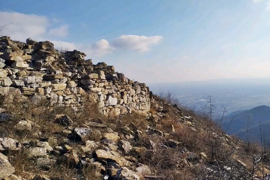
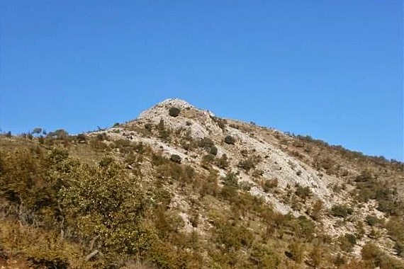
Ruins of an ancient fortification, which was used until the Byzantine period, on a difficult-to-reach hill called “Kales”, 3 km north of the village of Kimmeria in Xanthi region.
The hill is elongated on the North-South axis and is located between two streams: Xerias and Kydoneas.
The fort is built on the southern elevated edge of the hill.
History
The fort is considered a typical Thracian Acropolis. This type of fortifications, which are scattered in the mountains of Eastern Macedonia and Thrace, have some common characteristics (raw drystone construction, encircling hilltops, little in the interior) and their initial construction is attributed to Thracian tribes of the early Iron Age and especially the 9th-8th centuries BC.
The largest of these fortifications were used later, during the Hellenistic and Roman Periods, while some continued to be used during the Early Byzantine Period.
Kales of Kimmeria is one of these cases. The usage until the Early Byzantine Period is presumed from the use of binding mortar in most of the fortification and from Byzantine surface finds.
We have no evidence for the fortress from historical sources, but based on the site format and findings, we can guess that its history is summarized as follows: it was created by Thracians around the 8th century BC and continued to be inhabited throughout antiquity as part of the Macedonian and later Roman territory. Its use continued during the first centuries of Byzantium. It was probably abandoned in the 6th or early 7th century, like most mountain settlements in Macedonia and Thrace after the arrival of the Slavs and other barbarians.
Structure, Fortification & Buildings
The layout of the fortification resembles a triangle, but in reality its shape is hexagonal with one side – the south – very short. The apex of the triangle faces south, from where access is very difficult. Access is relatively easier from the north side, where a ridge connects it to the neighboring hills.
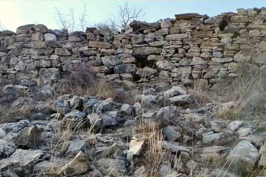
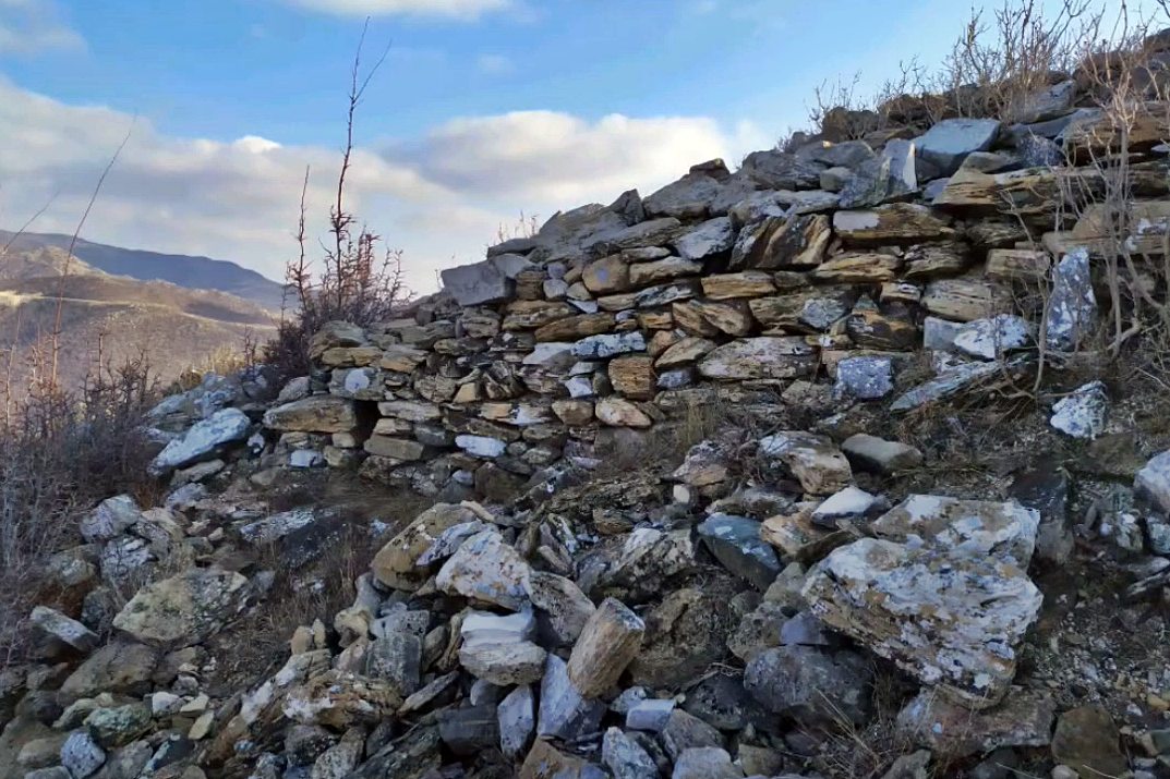
The perimeter of the fortification is 282 meters. It protected an area of over 5,000 sq.m. The trace of the fortification is visible along the entire perimeter, but in many places it is preserved only in piles of stones. Especially on the north side, the walls are seriously damaged.
On the north side, an opening can be seen that was probably the main gate. A paved road from the north ended at this (it survives in several places). A gate existed also on the –small– south side. Its opening was 1.2m.
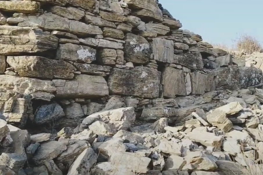
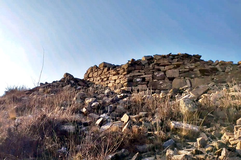
The walls are made of semi-finished slate stones of various sizes that come from the mountain rock.
In the southern part of the fort, a section of the walls 103m long is built without mortar. The thickness of the wall in this section is 2m.
The remaining fortification (believed to be Byzantine) is 1.90m wide and consists of a double wall. The outer side of the wall is 1.10m thick and has lime mortar, while the inner side of the wall is 0.80m thick without binding material. The best preserved section of the double wall is on the northeastern side where the maximum preserved height is 3m.
On the south side, in addition to the south gate, a protruding four-sided structure is formed inside with dimensions of 2✖5m. This building, which was probably a tower, had a staircase with stone steps on its eastern side.
Traces of buildings can be found in various places inside the fortress, as well as many fragments of ancient pottery. Near the highest point of the fort, where there is an altitude column of the Army Geographical Service, the foundations of a small circular building can be seen, which may have belonged to the central building of the castle.
Sources
- Διαμαντής Τριαντάφυλλος, Αρχαιολογικόν Δελτίον τευχ.29/Β3-1973/74, σ.808-809
- Νικόλαος Θ. Κόκκας, ιστοσελίδα Κάστρα και Οχυρά της Ελευθερίας - ΤΟ ΑΡΧΑΙΟ ΦΡΟΥΡΙΟ ΤΩΝ ΚΙΜΜΕΡΙΩΝ (2015)
- Π.Α. Πάντος, «Ιστορική Τοπογραφία του Νομού Ξάνθης», Θρακικά Χρονικά, τευχ. 32/1975-1976, σ.15
- Video by the user Thracologion Θρακολόγιον Το αρχαίο φρούριο των Θρακών στα Κιμμέρια της Ξάνθης (2024)
- Info and Research: Charalampos Papadopoulos
| Access |
|---|
| Approach to the monument: |
| A rough dirt road north of Kimmeria leads to a sheepfold below the castle, at an altitude of 350m. From there, it's a difficult climb of about 20 minutes. |
| Entrance: |
| Free access. |
| Other castles around |
|---|
| Wall of Anastasioupolis |
| Fortress of Avgo |
| Fortress of Komnina |
| Mesegouni Fortress |
| Castle of Peritheorio |
| Castle of Poroi |
| Topeiros |
| Xanthi Castle |