Kitros, Pydna-Kolindros, Pieria,Central Macedonia
Episcopal complex of Louloudies
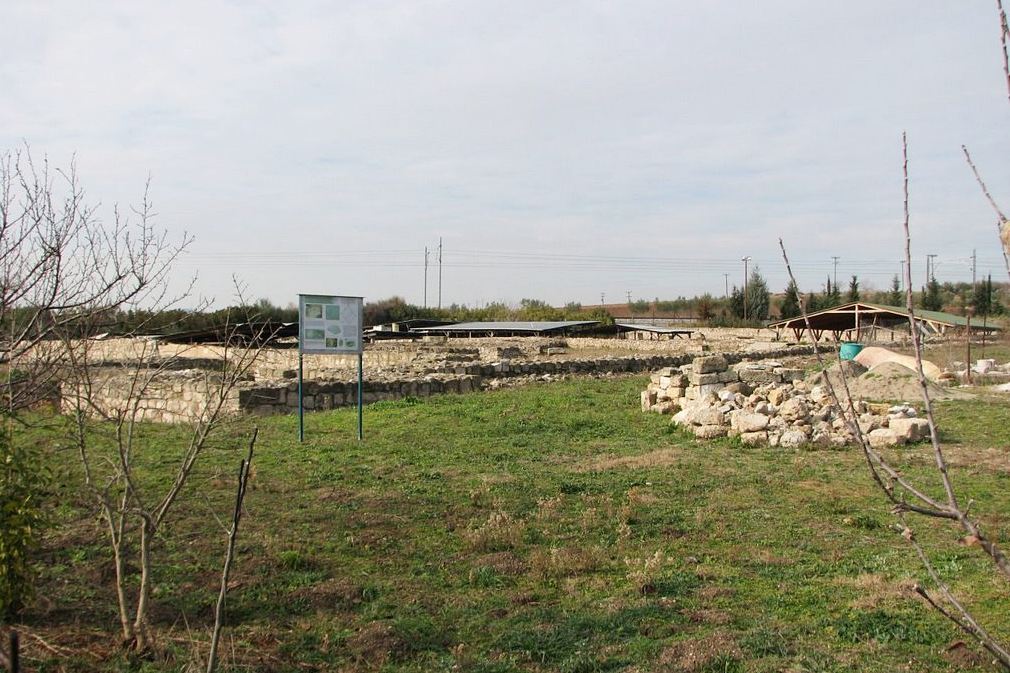
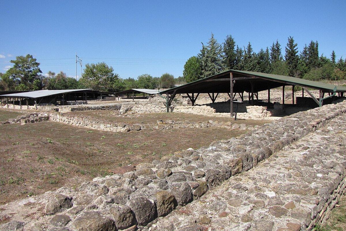
| Location: |
| In the rural location of “Louloudies” between Korinos and Kitros in Pieria prefecture |
| Region > Prefecture: |  |
| Central Macedonia Pieria | |
| Municipality > Town: | |
| City of Pydna-Kolindros • Kitros | |
| Altitude: | |
|
Elevation ≈ 8 m (Relative Height≈0 m) |
| Time of Construction | Origin | |
| little after 476 AD | Early ΒΥΖΑΝΤΙΝΕ  |
|
| Castle Type | Condition | |
| Castle Ruins |
In Ruins
|
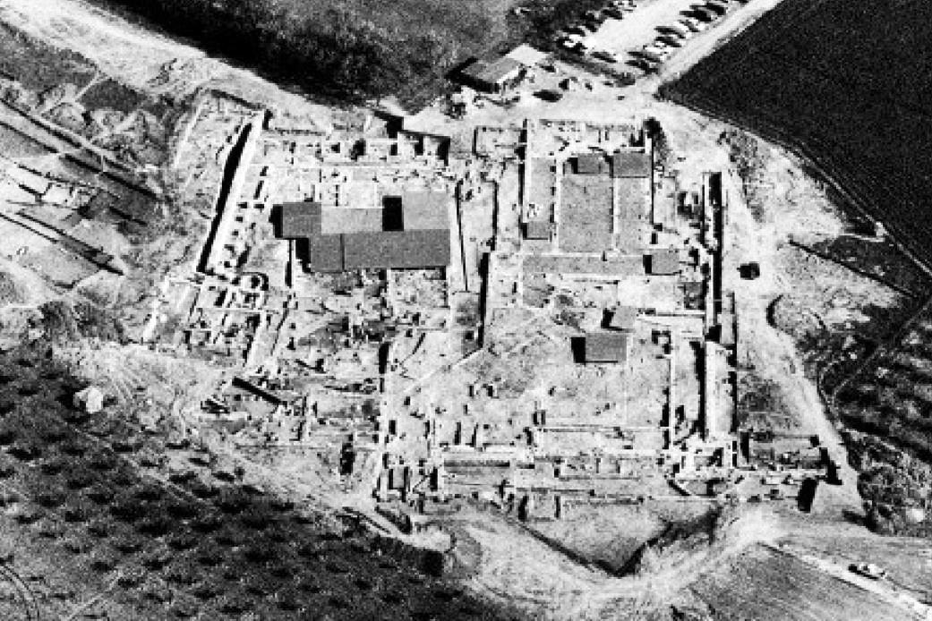
A large residential complex with a fortified enclosure and corner towers. It is believed that its original purpose was to serve as an episcopal residence and ecclesiastical center of the region.
It is located in a remote flat area, among fields, approximately halfway between Kitros and Korinos, in Pieria, next to the railway line, not far from the sea (which is 3 km east).
Due to its form – rectangular plan with towers at the 4 corners – and the era in which it was created – Late Antiquity/Early Byzantine Period –, the complex is considered to be a representative Roman tetrapyrgion (quadriburgium).
History
According to archaeological findings, the construction of the tetrapyrgioν dates back to the Early Byzantine period, and more specifically, towards the end of the 5th AD century.
The foundation of the complex is related to the siege of Thessaloniki by the Goths in 479 AD. In order to end that siege, the ruler of Thessaloniki ceded 5 cities of Macedonia to the Goths. Among these cities was Pydna (later renamed “Kitros”). Since Pydna was an important city and seat of a bishop, the (temporary as it turned out) settlement of the Goths forced the inhabitants to look for another settlement and a new episcopal seat, and they apparently chose Louloudies, where the station Anamon already existed.
It should be noted that there are no references from historical sources to this fortress, nor any document that would certify that there was actually an episcopal seat in Louloudies. However, we come to this conclusion due to certain indications:
1) The existence of imposing and unusually magnificent buildings inside (the basilica and the secular palace) that occupy a large part of the complex.
2) The form and layout of the complex, which is similar to other fortified episcopal sees of that time in the Balkans and Asia Minor.
It seems, therefore, that the complex was founded shortly after the year 479 and within a few years the fortification, the three-aisled basilica, the episcopal palace and the buildings of the rest of the settlement were constructed.
This form was preserved for a few decades, but during the time of Justinian, at the beginning of the 6th century, other buildings were added, such as warehouses, an olive press and a winery.
The complex suffered major damage from an earthquake and fire in the mid-6th century. (Around 560. It was the same earthquake that also caused major damage to neighboring Dion.)
After that disaster, the episcopal palace was abandoned and what remained of the great basilica was used as a cemetery. The vaulted Christian tombs that were discovered date from that time.
In the following decades after the earthquake, the site gradually declined. The fortification was neglected and fell into disuse, other warehouses and workshops were added, the cemetery was expanded, while most of the inhabitants abandoned it, since the danger from the barbarians had also disappeared.
The complex was finally abandoned no later than the mid-7th century, after the descent of the Slavs, when the location became very vulnerable.
The tetrapyrgion was discovered in the early 1990s, during the construction of a new section of the Athens-Thessaloniki railway line, between the Alykes, Kitros and Korinou railway stations. Due to this discovery, the design of the line was slightly changed and shifted a little further west.
However, the change was not made in time because in July 1992 a contractor caused damage and destroyed part of the archaeological site.
In the following years, OSE (the Greek Railways) adopted, in a way, the excavation and financed for a period of time the archaeological research and the shaping of the site for the protection of the monuments.
Structure, Fortification & Buildings
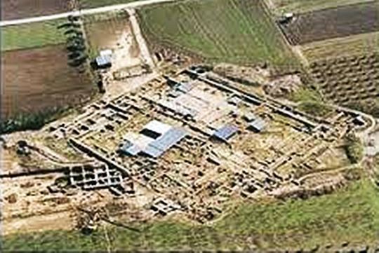
The complex occupies an area of over 6,000 sq.m. within a perimeter of approximately 340 meters. The northwestern corner of the site is cut by the railway line
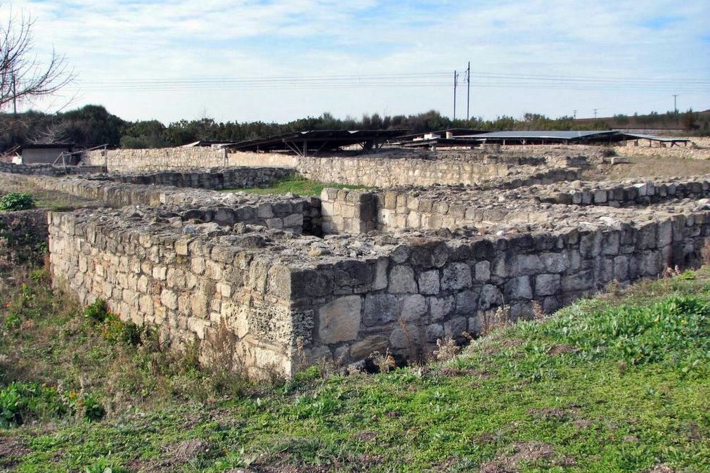
The ground plan is rectangular with dimensions of 80✖90m. It has a double gate on the south side protected by an extra tower that is preserved at foundation level. Of the 4 corner towers, 3 are visible (the northwestern one is missing). The best preserved tower is the southeastern one (photo 1) with dimensions of approximately 5✖4 m.
The wall has not been revealed in its entire length, but a large part of it is visible. Its thickness is 1.10m and is preserved at a low height – as are the towers.
Within the enclosure there are ruins of various buildings:
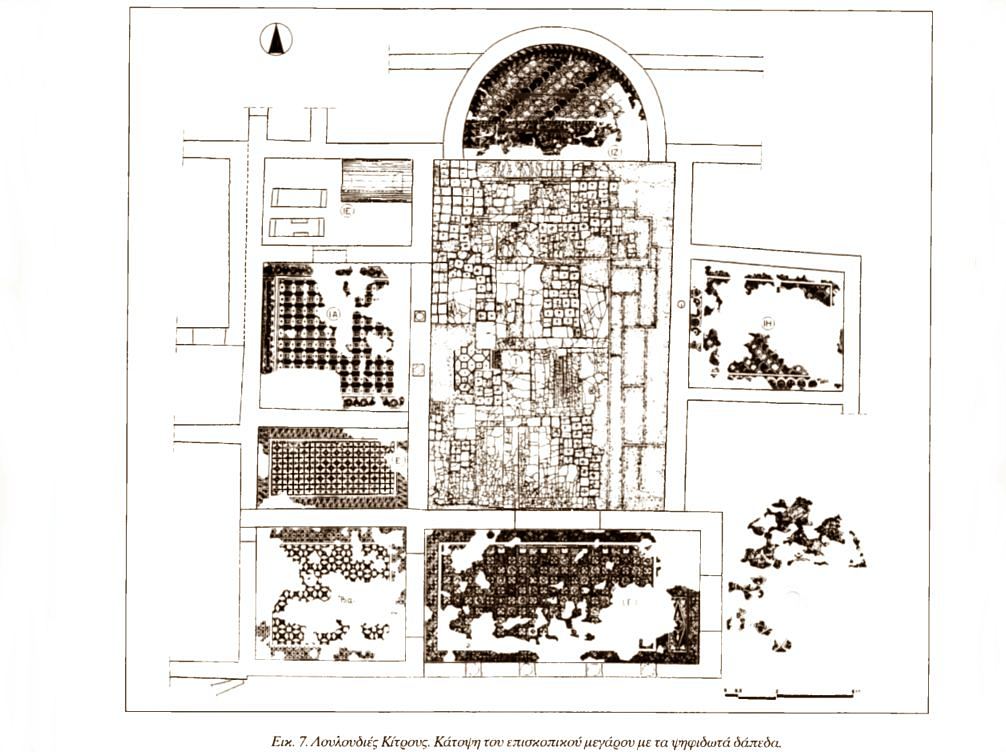
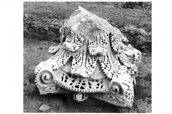
1) a large three-aisled basilica measuring 35.50✖19m with extensions on either side of the narthex, three buttresses in the arch, high pillars and capitals from the era of Theodosius the Great (i.e. the end of the 5th century).
2) A large secular building 45✖24m with outstanding mosaic floors from the 5th century (which were restored and repositioned in their original position). This building was constructed on an earlier Roman (probably a villa rustica from the Tetrarchy era).
3) Eight large vaulted tombs.
In addition to these basic elements, ruins of various other buildings survive: warehouses, a guard-house, a winery, workshops, etc.
Excavations were carried out at the site until the end of the 1990s. The place is fenced, with a guardhouse at the entrance, but in various attempts to visit – a few years ago – we found it locked. We do not know (in Kastrologos) whether the site is open to visitors today.
| First entry in Kastrologos: | September 2026 |
Sources
- Ευτέρπη Μακρή, άρθρο στο δελτίο επισκόπησης ΑΕΜΘ (Αρχαιολογικό Έργο στη Μακεδονία και Θράκη), τεύχος 7 – 1993, σελ. 223-234
- Ευτέρπη Μακρή, άρθρο στο δελτίο επισκόπησης ΑΕΜΘ (Αρχαιολογικό Έργο στη Μακεδονία και Θράκη), τεύχος 8 – 1994, σελ. 151-158
- Ευτέρπη Μακρή, άρθρο στο δελτίο επισκόπησης ΑΕΜΘ (Αρχαιολογικό Έργο στη Μακεδονία και Θράκη), τεύχος 9 – 1995, σελ. 195-202
- Αρχαιολογικόν Δελτίον, τεύχος 49/Β2 – 1994, σελ. 531
- Αρχαιολογικόν Δελτίον, τεύχος 50/Β2 – 1995, σελ. 541
- Αρχαιολογικόν Δελτίον, τεύχος 51/Β2 – 1996, σελ. 508-510
- Αρχαιολογικόν Δελτίον, τεύχος 54/Β2 – 1999, σελ. 575-577
- Website ΟΔΥΣΣΕΥΣ of the Greek Ministry of Culture - Middle Byzantine episcopal complex of Kitros
| Access |
|---|
| Approach to the monument: |
| An asphalt road leads to the point. The preferred approach is from Pydna and Aliki (there is no signage). |
| Entrance: |
| The site is fenced and locked. Normally, a visit is not possible. |
| Other castles around |
|---|
| Tower of Kolindros |
| Castle of Kitros |