

Lakkomata, Erymanthos, Achaea,West Greece
Castle of Nezera
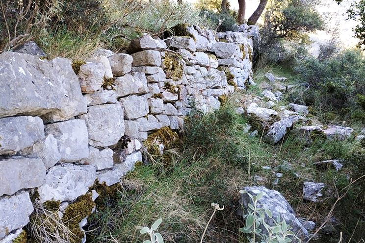
1
2 / 21

photo Amfitreidis (2019)
3 / 21

photo Amfitreidis (2019)
4 / 21

photo Amfitreidis (2019)
5 / 21

photo Amfitreidis (2019)
6 / 21

photo Amfitreidis (2019)
7 / 21

photo Amfitreidis (2019)
8 / 21

photo Amfitreidis (2019)
9 / 21

Cistern–photo Amfitreidis (2019)
10 / 21

St. Dimitrios– photo Amfitreidis (2019)
11 / 21

The hill from SW-photo Amfitreidis (2019)
12 / 21

photo Kostas Gertzos (Jan 2023)
13 / 21

photo Kostas Gertzos (Jan 2023)
14 / 21

photo Kostas Gertzos (Jan 2023)
15 / 21

photo Kostas Gertzos (Jan 2023)
16 / 21

photo Kostas Gertzos (Jan 2023)
17 / 21

photo Kostas Gertzos (Jan 2023)
18 / 21

photo Kostas Gertzos (Jan 2023)
19 / 21

photo Kostas Gertzos (Jan 2023)
20 / 21

photo Kostas Gertzos (Jan 2023)
21 / 21

photo Kostas Gertzos (Jan 2023)

THE END
| Location: |
| In a hilly area south of the village Platanos and north of the village Lakkomata in Achaea |
| Region > Prefecture: |  |
| West Greece Achaea | |
| Municipality > Town: | |
| City of Erymanthos • Lakkomata | |
| Altitude: | |
|
Elevation ≈ 590 m (Relative Height≈80 m) |
| Time of Construction | Origin | |
| around 15th cent. | Late-BYZANTINE |
|
| Castle Type | Condition | |
| Medieval Settlement |
In Ruins
|
Ruins of a settlement with fortifications in the mountainous region of Nezera in Achaea, south of Patras.
Nezera is a group of villages between the mountains Erymanthos and Panachaikon, in the upper valley of river Peiros.
The castle of Nezera is in the middle of this cluster of villages. On the opposite slope we see the well-known monastery of Panagia Chrysopodaritissa, aka Monastery of Nezera”.
The Name of the Castle
The original name of the settlement must have been “Chora”. Also, it could have been “Agios Dimitrios”, since this name existed a couple of centuries ago, but not today, while a church of St.Demetrius has been preserved there.
The name “Nezera” is of Slavic origin and is derived from ezeros, a word meaning lake or stagnant water. It is associated also with the Slavic tribe of Ezerites who supposedly had in the area there since the 10th century, but this connection is not verified.
History
We do not know the history of the place. According to Wikipedia, the settlement was created in the Frankish period and was part of a fief of the barony of Chalandritsa. However, this is not confirmed by historical sources. As a matter of fact, there are no medieval sources at all mentioning Nezera or any castle around there. Also the place is absent from any maps of that era.
The first historic record about Nezera occurs in the 17th century. A text about the life of At. Andreas written in 1623 is signed by a monk born in Ezera. A little later an Order by the Patriarchate refers to the Monastery of Chrysopodaritissa which “is opposite to the ancient town of Ezera”. This is a clear reference to what we call here Castle of Nezera.
Later, the Nezera villages are included in Venetian documents: in the Grimani census of 1700 (as di Nexero) and also in the Breve descrittione del Regno di Morea (as Nessero).
The villages of Nezera suffered in the aftermath of the Orlov events in the 1770s, when they were destroyed by the Albanian troops that had been unleashed for revenge by the Ottomans.
In conclusion, we believe that the settlement of the castle of Nezera was created after the Frankish period, around the 15th century (give or take one century) and lasted until the end of the 18th century.
Structure, Fortification & Buildings
The castle is built on the steep slope of a hill which is surrounded by two torrents which at that point converge to form river Peiros. The builds are built in 4 levels and perhaps there was a fifth level at the top which today is covered by vegetation.
The perimeter of the castle is around 600m. A fortification wall protected the weak spots, mainly those in the southeast side.
| First entry in Kastrologos: | April 2020 |
Sources
- Research, photographs and info by Sakis Amfitreidis and his blog ΑΜΦΙΤΡΕΙΔΗΣ
- Κώστας Τριανταφύλλου Ιστορία της Πόλεως και Επαρχίας των Πατρών, Πάτραι 1959 σελ. 418–420 και 700–701
- ΚΩΝΣΤΑΝΤΙΝΟΣ ΝΤΟΚΟΣ, BREVE DESCRITTIONE DEL REGNO DI MOREA. Αφηγηματική ιστορική πηγή ή επίσημο βενετικό έγγραφο της Β' Βενετοκρατίας στην Πελοπόννησο;, Ἑῶα καὶ Ἑσπέρια, 1|1993, 81-131
- Photos (12-21) and video by Kostas Gertzos (January 2023)
|
|
| Access |
|---|
| Approach to the monument: |
| Before Lakkomata, 200m to NW, take a downhill dirt road to Rikava. Pass the old Rikava and continue to the river where leave the car. Reach the hill after a 30min hike. |
| Entrance: |
| Free access |


