Nemea, Nemea, Corinthia,Peloponnese
Castle of Polyfengo
or Castle of Agios Georgios
1

2 / 32

view of the mountain from the east
3 / 32

view of the mountain from the south
4 / 32

view of the mountain from the NE
5 / 32

church of Panagia of the Rock under the castle
6 / 32

fortified cave-shelter on the rock
7 / 32

the rock (right) and Nemea from the north
8 / 32

the rock from southeast
9 / 32

the southern edge of the rock (fortification visible in two levels)
10 / 32

fortification at the southern edge (lower from the peak)
11 / 32

photo: P.Lampropoulos, Nov 2021
12 / 32

a ruined tower at the top, photo: P.Lampropoulos, Nov 2021
13 / 32
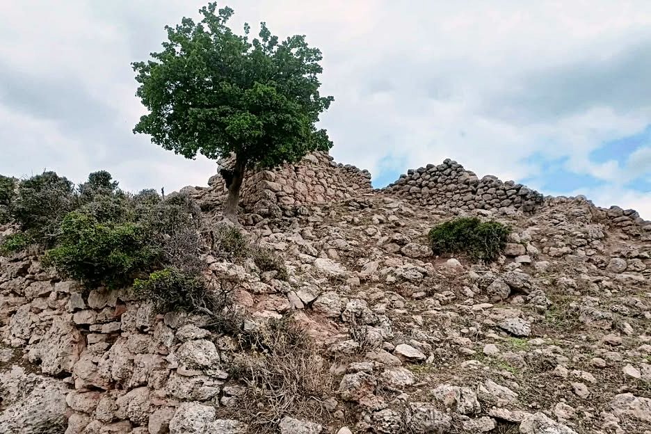
a ruined tower at the top, photo: Aris Tax, Sep 2025
14 / 32
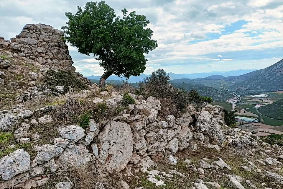
a ruined tower at the top, photo: Aris Tax, Sep 2025
15 / 32
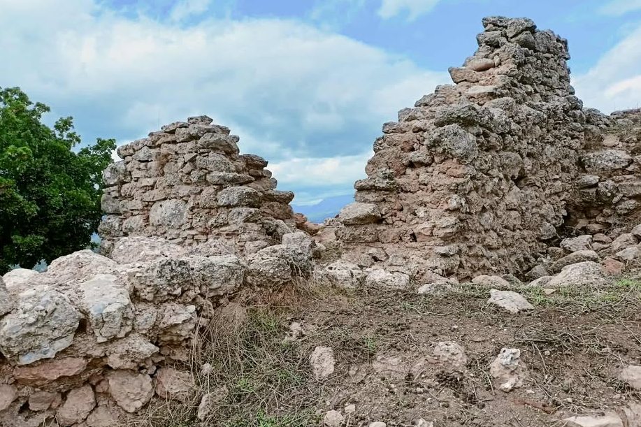
a ruined tower at the top, photo: Aris Tax, Sep 2025
16 / 32
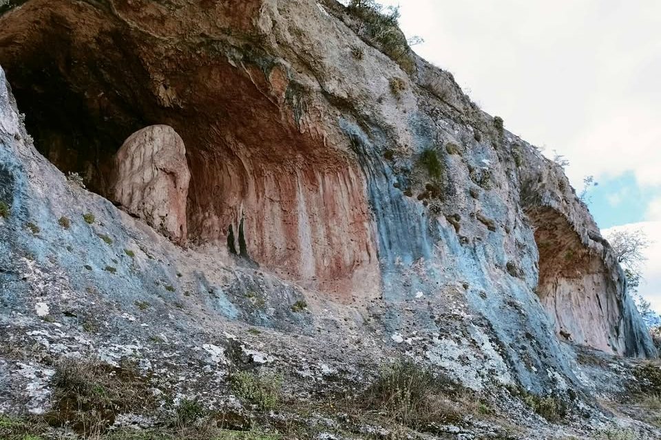
rock shelters at the SW rock
17 / 32
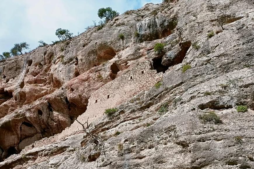
fortfied rock shelter at the SW rock
18 / 32
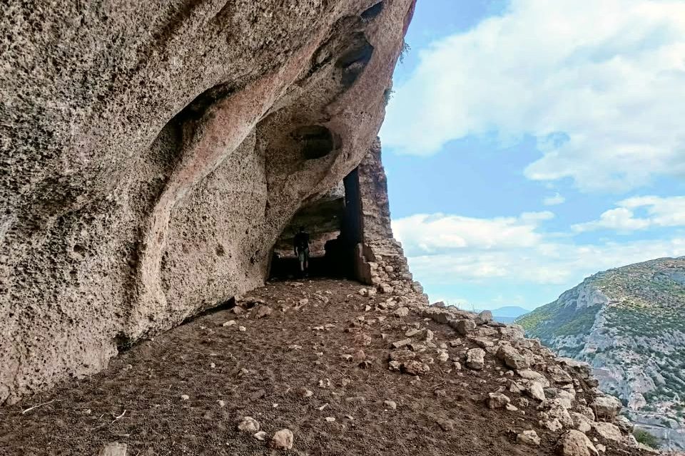
fortfied rock shelter at the SW rock
19 / 32
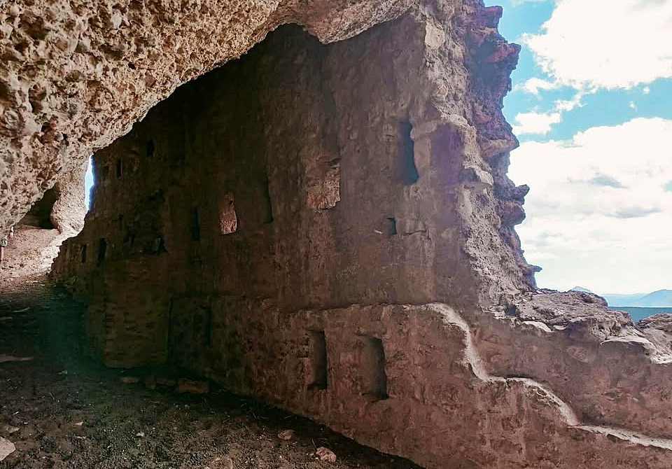
fortfied rock shelter at the SW rock
20 / 32
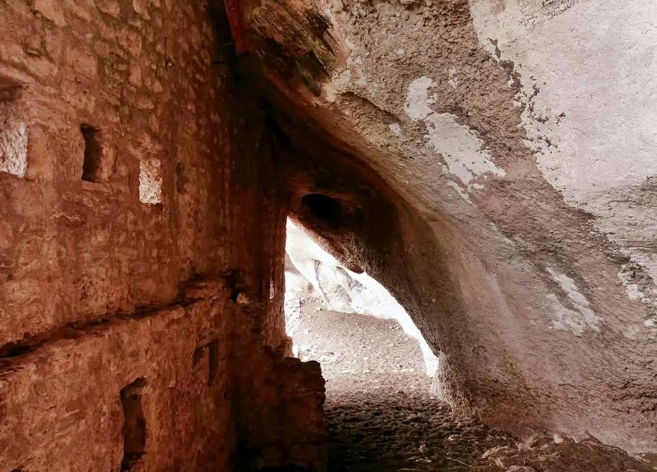
fortfied rock shelter at the SW rock
21 / 32
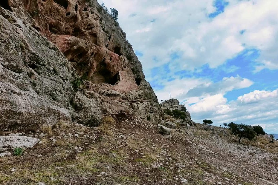
fortfied rock shelter at the SW rock, right the NE rock with the flag
22 / 32
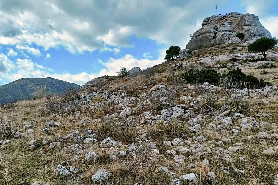
the NE rock with the flag and the remains of the settlement
23 / 32
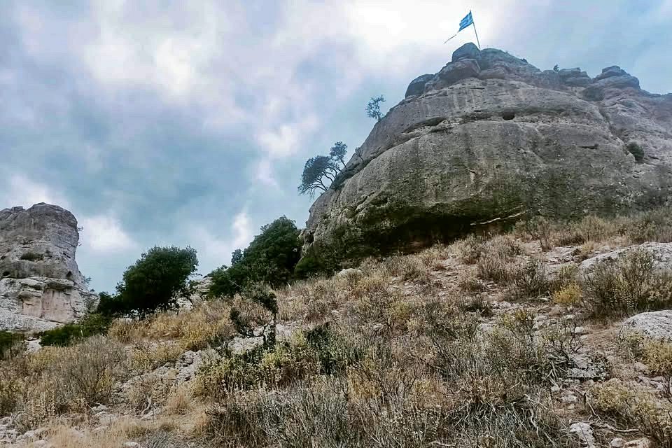
the NE rock
24 / 32
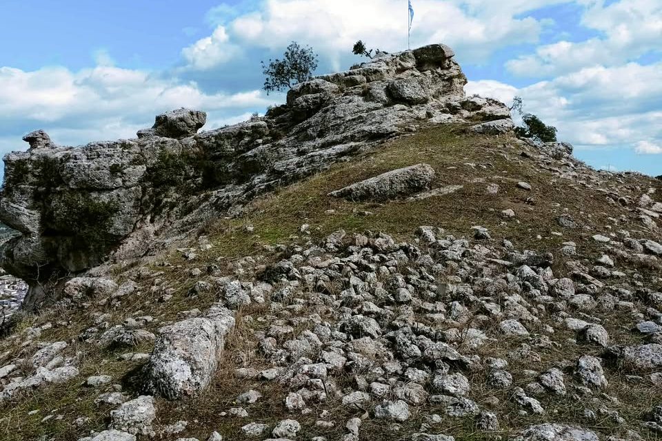
the NE rock
25 / 32
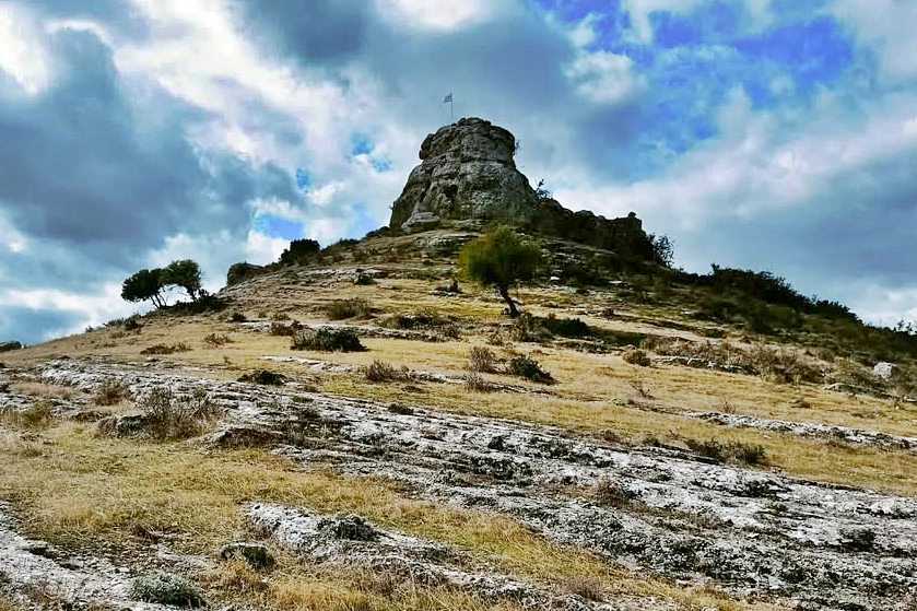
the NE rock
26 / 32
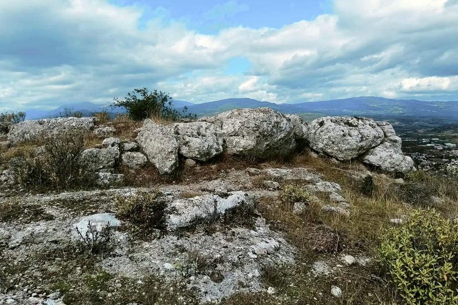
remains of the fortification
27 / 32
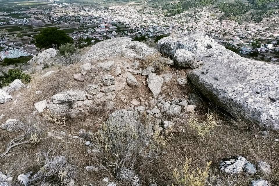
remains of the fortification
28 / 32
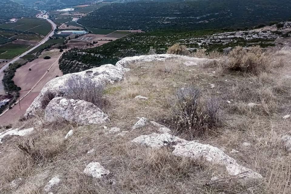
remains of the fortification
29 / 32
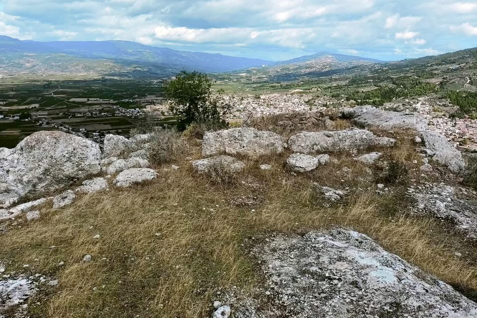
remains of the fortification
30 / 32
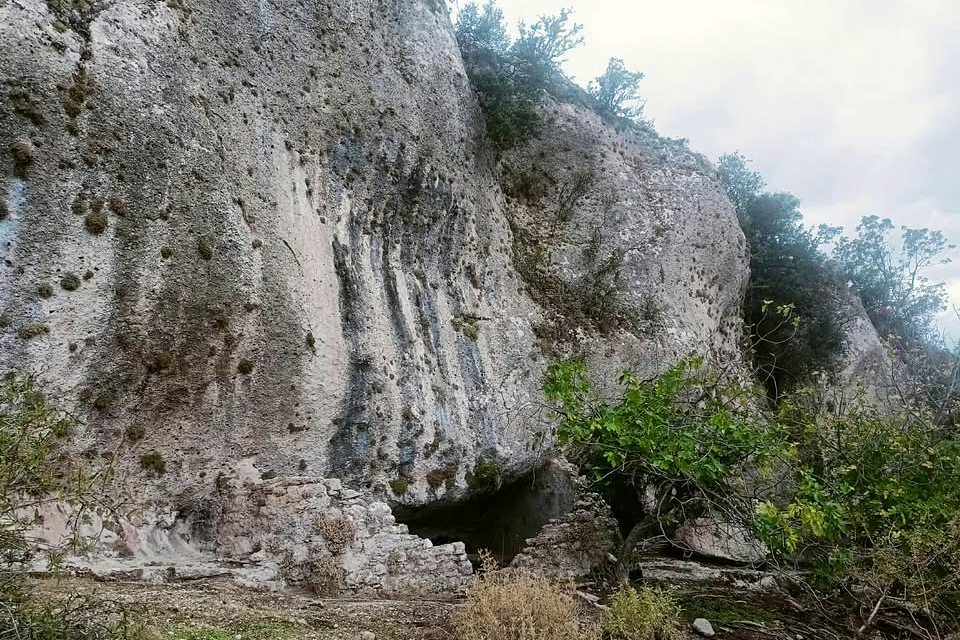
cistern
31 / 32
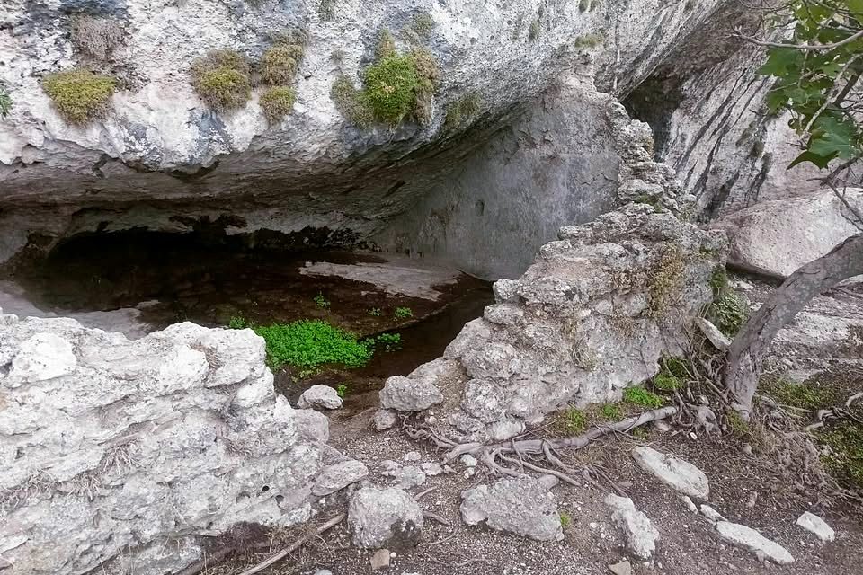
cistern
32 / 32
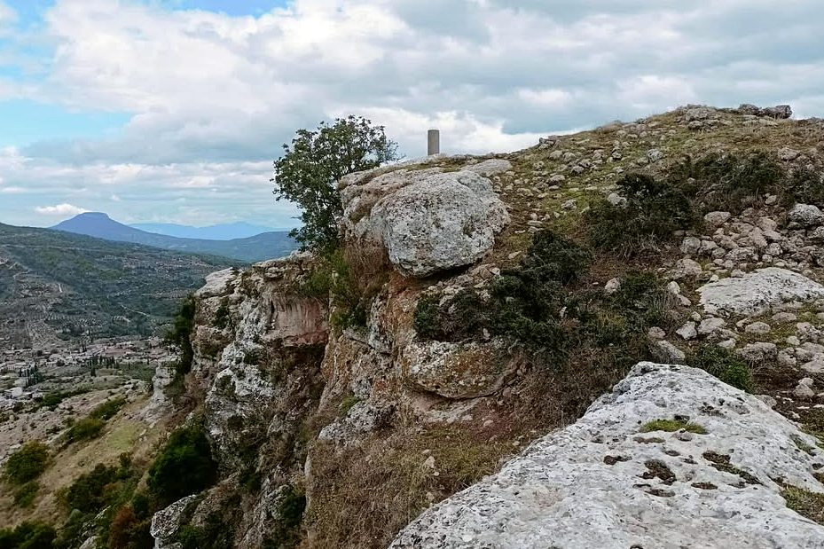
the top of the mountain with some fortification (SW rock)
THE END
| Location: |
| On a rocky hill south of Nemea town in the region of Corinth in northern Peloponnese |
| Region > Prefecture: | 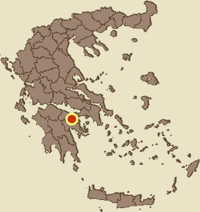 |
| Peloponnese Corinthia | |
| Municipality > Town: | |
| City of Nemea • Nemea | |
| Altitude: | |
|
Elevation ≈ 631 m (Relative Height≈270 m) |
| Time of Construction | Origin | |
| late 13th cent. | FRANKISH  |
|
| Castle Type | Condition | |
| Castle Ruins |
In Ruins
|
A Frankish castle on an insulated impressive rocky hill south of the modern town Nemea and close to ancient Nemea.
It was one of the castles guarding the pass of Kontoporeia odos, i.e the ancient road from Corinth to Argolid and to southern Peloponnese.
It was one of the castles of the Castellany of Corinth.
History
The earliest reference to the castle occurs in the French version of the Chronicle of the Morea, under the name Poliphant. Knowing that the French version tells stories until 1305, it is easy to conclude that the castle was built in the 13th century.
In several other historical sources, it is mentioned under a number of different names: Polifant, Agios Georgios, San Giorgio, Sancto Giorgio de Polisengo, S. Zorzi Tropico.
In 1320, it was captured by the Byzantine general Andronikos Asan. It was a period of serious advancement of the Despotate of Mystras against the Principality of Achaea.
The Byzantine occupation did not last long. In 1358, a certain Aloysius is mentioned as castellan, who had personally spent over 200 hyperpyra on the maintenance of the castle. In the same year, Aloysius conveyed to the then prince of Achaia, Roberto di Taranto, a letter from the inhabitants requesting protection against Turkish pirates (the main problem was the pirates from the Emirate of Aydin, based in Smyrna).
Robert of Taranto, who had other priorities and was unable to deal with the problems in the Principality decisively, decided in 1358 to donate the Castellania of Corinth to the Florentine banker Niccolò Acciaiuoli as a reward for his services in the Principality of Achaea and the Kingdom of Naples (where he was Senesshalo). The Castellania, which included 8 castles including Polyphengo, would develop into a semi-independent Frankish state.
Acciaiuoli immediately began repairs, at his own expense, to all the castles. Repairs must have been made to Polypheno at that time as well. After 1371, the Castellania of Corinth passed into the hands of Nerio Atzagioli, nephew of Niccolò. Nerio expanded and later became Duke of Athens.
Generally, the castle is mentioned in all the Hopf list: In the list of 1377 it is Lo castello de Sancto Georgio de Polifengno. In the list of 1463 is S. Zorzi Tropico, one of the castles that were – temporarily – under Venetian occupation. ("Tropico" is considered a corruption of "Tropaiforos" one of the Greek epithets of Saint George.) In 1467 it is recorded under the same name but it is no longer in the hands of the Venetians, it is in the hands of the Ottomans. In the list of 1471 it is recorded again as Venetian under the name San-Zorzi Tropico.
The Ottomans captured it – easily – in 1458, in the first campaign of Mohammed the Conqueror in the Morea. They did not bother much and the castle was occupied for a while by the Venetians during the First Venetian-Turkish War (1463-1470). At the end of that war, it was permanently occupied by the Turks, who apparently did not use it. It is not known exactly when the castle was abandoned, but it must have been in the early years of the Tourkokratia.
Structure, Fortification & Buildings
The castle is located on a low (631m) but massive and imposing mountain, a short distance south of the town of Nemea.
On the northeastern side of the mountain, its ridge is more or less straight, on the SW-NE axis.
Near the NE end of the narrow rocky ridge, a small dentation is formed: a neck (a space) between two elevated rocks, at a point where the straight ridge is interrupted (as clearly seen in photos 2,3,7,11). The neck is located at a depth of 10-15 meters in relation to the rocky outcrops on either side.
The medieval fortress was located around this dentation. There are few remains of it.
The center of the castle and of the settlement was the neck between the two rocks of the ridge.
The neck had natural protection due to the two rocks on either side: a single rocky outcrop to its northeast (the rock with the flag in photos 21-25) and on the other side a rocky hill to its southwest, which is the continuation of the ridge ending at the highest point of the mountain (with the GYS pillar).
The northeastern rock is small and very steep and had no fortification. On the contrary, on the southwestern hill there was a wall to the west and a building that looks like a tower (photos 12-15). This building on the southwestern rock is the best preserved part of the fortress.
Lower down, the neck was protected by a wall on its southern side (traces of which survive) that was parallel to the ridge. It was also protected by two smaller walls perpendicular to the previous one. The walled area around the neck did not exceed 7,000 sq.m..
Within this fortified enclosure there was a dense settlement of small houses built with dry stone, measuring approximately 4✖5m.
Beyond the walls, to the northeast and lower down, there was another settlement that lies on piles of stones. Traces of this settlement reach the edge of the rock to the northeast, that is, to the cliff above the road.
At the edge of this settlement, on the southeastern side of the ridge, above the monastery of Panagia tou Vrachou, there seem to be rudimentary fortifications (photos 9,10).
On the neck, between the two rocks, there are the ruins of a building that may have been the central tower, with dimensions of 10.4✖7.4m. Next to it there are two slab-shaped boulders 0.40m thick and 0.8-1.0m high, which are probably the remains of an ancient fort. These unusual boulders are also observed in some other parts of the mountain.
On the southern side of the southwestern rock there are caves of the open rock shelter type (photo 16). One of them, with an entrance opening of 30m and a maximum internal height of 6m (photo 17-21) is blocked with stonework (with lime mortar). The stonework has windows for ventilation at the top while at the bottom there is a series of rifle slots. The role of the cave is not clear. It may have been a hermitage or a later lair or perhaps a sheepfold for the settlement.
Outside the castle, on the western slope, at the root of the southwestern rock, there was a spring and a cistern (photo 30,31).
Sources
- Effie F. Athanassopoulos, “ Landscape Archaeology and the Medieval Countryside:Settlement and Abandonment in the Nemea Region”, published online.
- Video and photos 12, 13 Panayiotis Lambropoulos, Nov 2021
- Ιωάννης Θ. Σφηκόπουλος, «Τα Μεσαιωνικά κάστρα του Μορηά», Αθήνα, 1968. 161-163
- Photos 13-31: Aris Tax. September 2025
- Video by G Traveller Κάστρο Πολυφέγγους | Castle of Polyfengo (January 2024)
| Access |
|---|
| Entrance: |
| Free access |