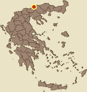
Makrynitsa, Sintiki, Serres,Central Macedonia
Castle of Makrynitsa
| Location: |
| On a wooded hill 1 km east of the village Makrynitsa at the north of Serres prefecture |
| Region > Prefecture: |  |
| Central Macedonia Serres | |
| Municipality > Town: | |
| City of Sintiki • Makrynitsa | |
| Altitude: | |
|
Elevation ≈ 500 m (Relative Height≈140 m) |
| Time of Construction | Origin | |
| 6th cent. or before | Early ΒΥΖΑΝΤΙΝΕ |
|
| Castle Type | Condition | |
| Castle Ruins |
Few Remains
|
Few visible ruins of a castle and settlement 1 km east of the village Makrynitsa in the northern part of the prefecture of Serres, on a wooded hill with the name “Monastery of Kalogria”. The hill belongs to the range of Mount Beles.
History
We do not know anything about the history of the castle which remains unidentified.
According to the Archaeological Bulletin of 1996 (issue 55-B2), small bronze objects and pottery sherds were found at the site, while “two bronze coins of Justinian were handed over”. According to the bulletin: “Based on the findings, the fort is placed in the late Roman-early Christian times (early Byzantine period)”.
So, the castle was certainly in use during the 6th century and probably already existed from the 3rd or 4th century AD. Like many neighboring castles the habitation and use of the castle ended with the descent of the Slavs and the barbarian raids of the 6th and 7th centuries.
The name of the hill (and the stream) “Monastery of Kalogria” implies the existence of a monastery. It is possible that the hill was originally a castle (or fortified settlement) and at an unknown period of time, later, was turned into a monastery. All of this is of course completely hypothetical, given that the dense vegetation has covered everything on the hill and does not allow a more detailed investigation of the area.
Structure, Fortification & Buildings
In the western foothills of the hill, the waters of a ravine named “Kalogria Stream” flow and in the eastern foothills there is another deep ravine called “Kestelenik”.
All sides of the hill are steep. There is very dense vegetation on the hill. The elongated top runs in a north-south axis. The northern end is the highest point of the castle (505m.) and there is a small neck that separates the hill from the mountainside.
Visible ruins exist only at the southern end, where the foundations of a damaged wall are visible within masses of stone piles (photos 3,4).
Within the enclosure there are ruins of four-sided buildings, possibly houses.
| First entry in Kastrologos: | December 2023 |
Sources
- Research, presentation and photos by Sakis Amfitreidis and his blog ΑΜΦΙΤΡΕΙΔΗΣ (December 2023)
- Σαμσάρης, Πέτρος «Βυζαντινοί τόποι και μνημεία της κάτω κοιλάδας του Στρυμόνα», 2004, Πανεπιστήμιο Ιωαννίνων – Διδακτορική Διατριβή, 2004, σελ. 680-681
- ΑΡΧΑΙΟΛΟΓΙΚΟΝ ΔΕΛΤΪΟΝ, αναφορά από Βάλλα Μαγδαληνή , τεύχος 51-Β2 (1996), σελίδα 576
|
|
| Access |
|---|
| Approach to the monument: |
| From Makrynitsa follow the sign to the camp “Axion Esti”. From there walk east and reach the river and from there north via an adjacent hill. After 30 min reach the neck that leads to the castle. |
| Entrance: |
| Free access. The hike is very difficult dew to vegetation |
| Other castles around |
|---|
| Castle of Mandraki at Kerkini |


