

Faia Petra, Sintiki, Serres,Central Macedonia
Fortification of Faia Petra


| Location: |
| On a rocky o hill southeast of the village Faia Petra in Serres prefecture. |
| Region > Prefecture: |  |
| Central Macedonia Serres | |
| Municipality > Town: | |
| City of Sintiki • Faia Petra | |
| Altitude: | |
|
Elevation ≈ 315 m (Relative Height≈25 m) |
| Time of Construction | Origin | |
| Unknown | BYZANTINE |
|
| Castle Type | Condition | |
| Natural Fort |
In Ruins
|
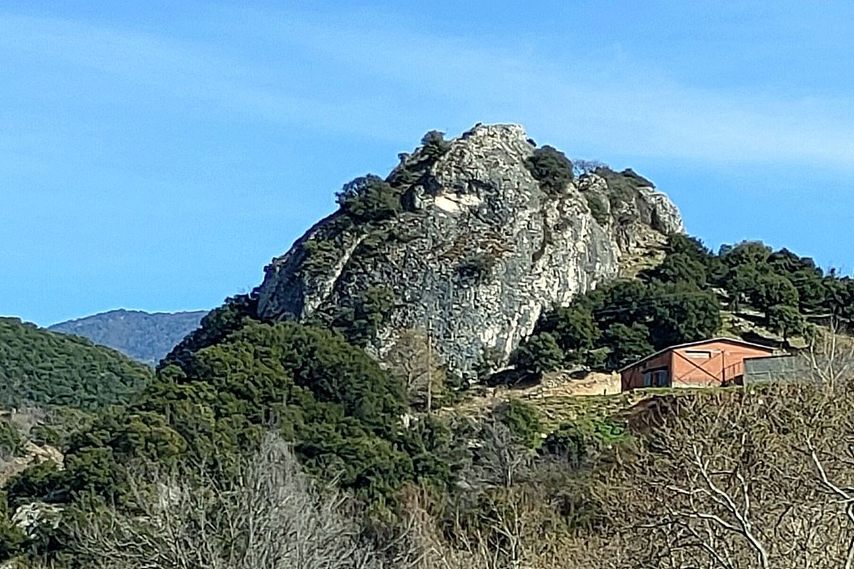
A few remains of a medieval wall on a rocky and steep hill located half a kilometer southeast of the village of Faia Petra (Gr. for Black Stone ) in the prefecture of Serres.
The fortification is very close (air-distance of 4 km) to the Black Rock castle which is in a similar position and has a similar name. It goes without saying that there is visual contact between the two fortifications, but also with the castle of Sidirokastro.
History
We know nothing of the history of this particular site which is not mentioned in historical sources.
The surface pottery dates from Roman to late Byzantine times. Which means that the site was in use from the Roman period until the Late-Byzantine period (13th-14th century). It should be noted that the area was conquered by the Ottomans in 1383.
The wall, from its construction, is considered medieval-Byzantine (use of lime mortar). Actually, it was just a rudimentary wall blocking the entrance to the rock. It does not appear that there was ever a strong fortification or fortress.
Structure, Fortification & Buildings
Faia Petra “castle” is built on a steep grayish rock with good natural protection.
North of the rock there is a deep stream, the waters of which after about one kilometer and a half flow into the Krousovitis River.
A wall is preserved mainly on the south-southwest side of the rock, which was also the most vulnerable. The other sides had the natural protection of the vertical rocks.
A few ruins of a total length of about 25 meters are preserved from the wall that blocked the entrance to the rugged rock. Its construction consists of stones of different sizes with binding mortar between them and a few ceramics. The surviving height today is one to one and a half meters.
A few remains of the wall are also on the west side. Here the wall simply fills the gaps between the rocks. On this west side is the best-preserved part of the wall, 6m long, 2.5m high. and 0.90m thick.
Inside there are no traces of buildings. Outside the wall on the south side, there is a plateau full of scattered stones, boulders and pottery. This is probably where the settlement was.
| First entry in Kastrologos: | April 2023 |
Sources
- Info, research and photos by Sakis Amfitreidis and his blog ΑΜΦΙΤΡΕΙΔΗΣ (March 2023)
- Σαμσάρης, Πέτρος «Βυζαντινοί τόποι και μνημεία της κάτω κοιλάδας του Στρυμόνα», 2004, Πανεπιστήμιο Ιωαννίνων – Διδακτορική Διατριβή, 2004, σελ. 716-717
|
|
| Access |
|---|
| Approach to the monument: |
| Before entering the village, there is a downhill dirt road on the right that leads to the stream. Continuing, at 400m we meet a sheepcote. Above the sheepcote is the rock. |
| Entrance: |
| Free access. |


