

Thespies, Aliartos - Thespies, Boeotia,Central Greece
Tower of Thespies


| Location: |
| 1km southeast of the village Thespies of Boeotia |
| Region > Prefecture: |  |
| Central Greece Boeotia | |
| Municipality > Town: | |
| City of Aliartos - Thespies • Thespies | |
| Altitude: | |
|
Elevation ≈ 300 m (Relative Height≈0 m) |
| Time of Construction | Origin | |
| 13th or 14th cent. | FRANKISH |
|
| Castle Type | Condition | |
| Ruined Tower |
In Ruins
|
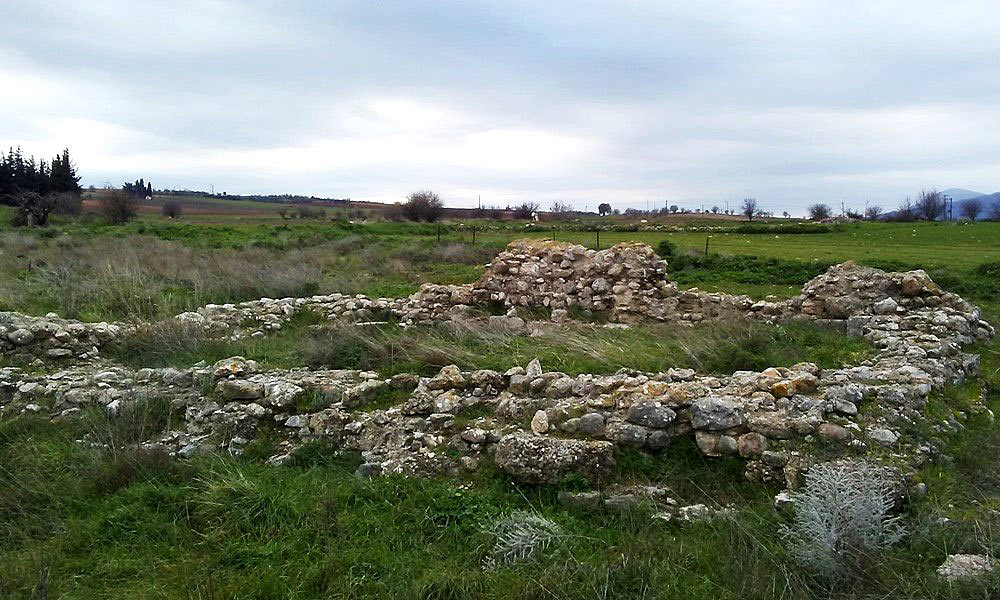
Remains of a Frankish (most probably) tower inside the archaeological site of the ancient city of Thespiai. The name of the place in the Middle Ages was Erimokastro (meaning “deserted castle”). It is located south of the modern villages of Thespies and Leontari in Boeotia.
Only the lower part of the building is still standing. The original tower measured 12.20✖7.70 meters at its basis. The thickness of the walls was around 1.65m and it is preserved at a maximum height of 1.72m, at its western side.
The tower is built on the narthex of an early-Christian church. Next to it lie the remains of a Frankish church which was built on top of the main part of the early-Christian temple. Material from the older church were used for the construction of both the tower and the Frankish church. This material was mostly spolia from the ancient city.
We do not have more information on this tower which was discovered recently during the research by the Boeotia Project which was set up in 1978, under the guidance of professors John Bintliff and Anthony Snodgrass. It is certainly a medieval tower and most probably a Frankish one built in the 13th or the 14th century.
| First entry in Kastrologos: | January 2019 |
Sources
- Research and photographs by Mr. Ioannis Dedes
- Athanassios Vionis, “Understanding Settlements in Byzantine Greece New Data and Approaches for Boeotia, Sixth to Thirteenth Century”, Dumbarton Oaks Papers, 2017
|
|
| Access |
|---|
| Entrance: |
| Free access |