

Chrysi, Almopia, Pella,Central Macedonia
Castle of Chrysi


| Location: |
| Chrysi, Exaplatanos area, Pella, central Macedonia |
| Region > Prefecture: |  |
| Central Macedonia Pella | |
| Municipality > Town: | |
| City of Almopia • Chrysi | |
| Altitude: | |
|
Elevation ≈ 170 m (Relative Height≈100 m) |
| Time of Construction | Origin | |
| 10th or 11th century | BYZANTINE |
|
| Castle Type | Condition | |
| Byzantine City |
Not Good
|
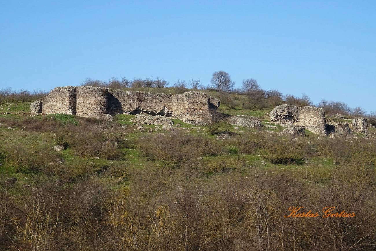
The ruins of an important castle of the middle Byzantine period on a hill overlooking the village Chrysi, 27km from Edessa in Western Macedonia.
History
Moglena is one of the settlements that were founded and fortified in west Macedonia in the early Byzantine period, probably before the 6th century. Gradually it developed to a city-fortress.
In the end of the 10th century, the city was captured by the Bulgarians. The Byzantines took it back in 1015, with the Byzantine emperor Basil II (the Bulgar-slayer) being personally in command of the siege.
In 1082 the city was captured by the Norman prince Bohemond (later, one of the leaders of the 1st Crusade and much later Bohemond I of Antioch). Bohemond repaired the fortifications, but Moglena was soon recaptured by the Byzantines who destroyed the walls.
The ruins of the walls we see today is from the late 10th to 12th century. Towards the end of the 12th century the city passed under Bulgarian control (of the so called “2nd Bulgarian empire”) and remained so until the Ottoman conquest around 1396. During this period, it declined and was gradually abandoned.
Structure, Fortification & Buildings
The castle is not in good condition. The total area is around 40,000 sq.m.
Excavation works in 1985-1987 have revealed the perimeter of the walls (500m), 3 towers (two square, one cylindrical) and the ruins of a church, probably the cathedral. The walls follow the route of the nearby river Moglenitsa. Their thickness is around 2.40m and the highest preserved part is 7m tall.
Most findings are dated back from 10th to 12th century.
| First entry in Kastrologos: | October 2012 | Last addition of photo/video: | October 2021 |
Sources
- Video by the user InPozar Κάστρο Χρυσής Η Μογλενών
- photos 1, 2, 3, 8 Kostas Gertzos, 2021
- ΑΡΧΑΙΟΛΟΓΙΚΟΝ ΔΕΛΤΙΟΝ issue 41 (1986) p.160


