

Goumero, Pyrgos, Elis,West Greece
Goumero Castle


| Location: |
| On a low hill between the villages Goumero and Agia Anna in Eleia, in Peloponnese |
| Region > Prefecture: |  |
| West Greece Elis | |
| Municipality > Town: | |
| City of Pyrgos • Goumero | |
| Altitude: | |
|
Elevation ≈ 615 m (Relative Height≈80 m) |
| Time of Construction | Origin | |
| probably 14th century | FRANKISH |
|
| Castle Type | Condition | |
| Castle Ruins |
In Ruins
|
Remains of a large castle which must have been Frankish (with a probable Byzantine past) on a low hill in the mountainous part of Eleia, north of the village Goumero.
History
The Goumero castle is identified with the Castello de Vunario which appears for the first time in the list of Frankish fiefs of 1377.
In 1463, Srefano Magno's list presents it as Venetian with the name Vumeri. In the list of 1467 it remains Venetian and is referred to as Vumero. It is generally accepted that all these names are identified with the castle at Goumero. The current name as well as the various Frankish names (Vunario, Vumeri etc.) are a corruption of the medieval name Vumeron which is probably of Slavic origin. Etymologies from “Vromi” (oat) and “Bromeron” (smelly) have also been proposed, which are probably not correct.
The castle remained Frankish until the end of the Principality of Achaia, around 1428, when it came under the rule of the Greeks of the Despotate of Mystras.
Goumero was conquered by the Ottomans in the second, probably, invasion of Mohammed II in the Peloponnese in 1460. In 1463, with the start of the Venetian-Turkish war, it was among the castles of the northwestern Peloponnese captured by the Venetians.
The historian Sathas, who studied the archives of Venice, found that the commanding officer of the castle in 1465 was (on behalf of the Venetians) the Maniote Mihalis Raptis, one of the protagonists - from the Greek side - of the First Venetian-Turkish war.
The Short Chronicle of Sfrantzis states that in 1470 Boumero is one of the Venetian castles that was surrendered to the Turks, along with those in Vostitza, Olena, Helidoni and Pontikokastro.
Although Sfrantzis mentions the destruction of only Pontikokastro, probably in this campaign the rest of the castles (Vostitza, Goumero, Olenas and Helidonio) were also destroyed because since then there was no mention of castles in these places.
Structure, Fortification & Buildings
The researcher G.Papandreou, (1924) characterizes the castle as Byzantine and describes it as follows:
Total area about 200,000 sq.m. It was oblong with a length of 600 meters and a width varying from 8-10m on the south-east side to 50 meters on the north-east.
There are traces of a tower on the east side. There were also traces of buildings with mortar and cisterns within the fortification.
Antoine Bon, who visited it in 1946, mentions the existence of a well-built outer wall without giving any further information, while he puts more emphasis on the uncertainty surrounding the origin of the name. He also mentions that the locals showed him coins they had found on the hill, which were Byzantine, Frankish and Venetian.
Sfikopoulos (1968), although he is usually thorough in his descriptions, repeats Papandreou’s description, with the excuse that the weather conditions were very bad during his visit. He disagrees only as to the historical origin and maintains that it is a Frankish castle.
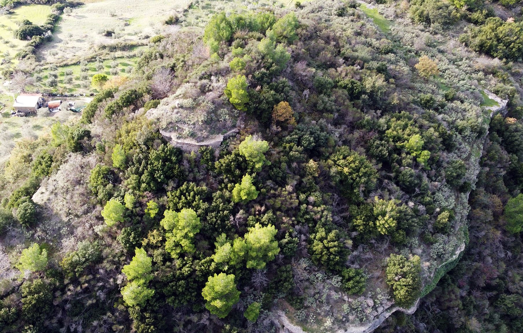
Newer researchers (including those of the Morea project in the 90s) did not find any significant ruins on the hill, which is rather strange.
One possible explanation is the fact that the area was covered by dense forest until recently. The layout of the castle became more visible after the wildfire of 2007 but, stiil, its contour is not shaped by walls but mostly by steep rocks.
As inferred from the satellite image, it covered a large area (over 100,000 sq.m. within the outer enclosure, but not the 200 mentioned by Papandreou).
On the southern side of the hill, at the highest point, there seems to be a plateau of almost 5,000 sq.m. protected by an inner enclosure and a large tower (perhaps the castle's donjon – photo 1, 6).
However this large castle has not been systematically researched and that is why we currently do not have a clear picture of its dimensions and its construction.
Collateral stories
About Michail Rallis who was the commander of the castle in 1465:
In 1464, 10,000 Greeks and Arvanites had taken refuge in Zakynthos to escape the Turks. Their leader was the warlord Michalis Rallis who was fighting on the side of the Venetians.
In 1466 Rallis was captured by the Turks after the failed operation against Patras and had a martyr's death by impalement on August 10, 1466 together with the Venetian Providetore Jacomo Barbarigo and the bishop of Patras Neophytos.
| First entry in Kastrologos: | March 2016 | Last update of info and text: | July 2023 | Last addition of photo/video: | July 2023 |
Sources
- Konstantinos Kourelis, “MONUMENTS OF RURAL ARCHAEOLOGY MEDIEVAL SETTLEMENTS ΙΝ ΤΗΕ NORTHWESTERN PELOPONNESE”, Presented to the Faculties of the University of Pennsylvania in Partial Fulfillment of the Requirements for the Degree of Doctor of Philosophy, 2003, pp.272
- Antoine Bon, 1969, La Morée franque. Recherches historiques, topographiques et archéologiques sur la principauté d'Achaïe (1205-1430), Editions de Boccard, pp.331,344
- Ιωάννης Θ. Σφηκόπουλος, «Τα Μεσαιωνικά κάστρα του Μορηά», Αθήνα,1968, pp. 274-276
- Γεώργιος Παπανδρέου (Γυμνασιάρχης), Η Ηλεία διαμέσου των αιώνων, Αθήνα 1924, pp. 178-179
- Antoine Bon, Ηλειακα [article], Bulletin de Correspondance Hellénique, Année 1946, pp. 29-30
- Photos 1, 2, 3, 6, 7 by Harry Lolas and his page in Facebook (December 2022)
|
|
| Access |
|---|
| Entrance: |
| Free access |
| Other castles around |
|---|
| Doxapatri Castle |
| Castle of Greveno |
| Castle of Olena |
| Castle of Ochia (Viper) |
| Castle of Portes |
| Castle of Santameri |
| Castle of Smerna |
| Cave-fort of Tourkopanagis |


