

Klokotos, Farkadona, Trikala,Thessaly
Castle of Klokotos


| Location: |
| On the west side of the hill “Mikro Vouno” above the village Klokotos of Trikala prefecture. |
| Region > Prefecture: |  |
| Thessaly Trikala | |
| Municipality > Town: | |
| City of Farkadona • Klokotos | |
| Altitude: | |
|
Elevation ≈ 205 m (Relative Height≈110 m) |
| Time of Construction | Origin | |
| Various periods | ANCIENT |
|
| Castle Type | Condition | |
| Castle Ruins |
In Ruins
|
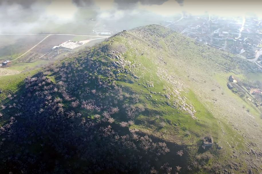
Ruins of a medieval fortification and of an ancient city named Farkadon, on the hill “Mikro Vouno” above the village of Klokotos in the prefecture of Trikala.
History
The ruins on Mikro Vounos hill were identified with the ancient city of Farkadon by the English colonel Leake in 1835. This identification is generally accepted until today.
According to Strabo, Farkadon was one of the cities of Estaiotis (which was one of the Thessalian states), which together with Trikki and Pelinna were positioned along the southern bank of the Pinios river.
The fortification of the ancient Farkadon was destroyed by Philip II of Macedonia who captured the city in 357 BC. As the historian Polyaenos reports (Strategemata IV, 2, 18) the Macedonian soldiers were able to capture the city when they climbed up the unprotected eastern side of the hill by stairs.
Regarding the later medieval (and apparently Byzantine) fortification, the remains of which exist on the hill, we have no information from historical sources.
Structure, Fortification & Buildings
Ancient Farkadon was spread over two main settlements on the two peaks and the southern slopes of the hill Mikro Vouno. The highest peak (252m) was to the east and was steep and unwalled. The citadel of the city was on the western lowest peak and was protected by a wall of which today parts are preserved at a low height.
At this point, on the western peak, there was a later Byzantine fortification, of undetermined date, which was reinforced by at least two rectangular towers that were made of half-finished stones and lime mortar.
One tower was at the western low end of the citadel and the other at the southeast. The dimensions of the western tower (which is the one shown in the photos) were 6.5✖7.5m. The southeastern tower was a little smaller.
The perimeter of the acropolis fortification was 530 meters and the area inside about 22,000 sq.m.. Between the two peaks of the hill there was a single (ancient) wall that protected the neck.
| First entry in Kastrologos: | February 2023 |
Sources
- Video and photos by G Traveller Κάστρο Κλοκοτού | Castle of Koklotos (February 2023)
|
|
| Access |
|---|
| Entrance: |
| Free access. |
| Other castles around |
|---|
| Castle of Agrelia |
| Damasio Castle |
| Fanari Castle |
| Fort of Grizano |
| Castle of Grizano |
| Tower of Agios Achilios |
| Pelinnaion |


