

Romvi, Nafplion, Argolis,Peloponnese
Fortification of Romvi


| Location: |
| At the summit of the hill at the southwestern part of Romvi island, offshore Tolo in Argolis |
| Region > Prefecture: |  |
| Peloponnese Argolis | |
| Municipality > Town: | |
| City of Nafplion • Romvi | |
| Altitude: | |
| Elevation ≈ 140 m |
| Time of Construction | Origin | |
| probably 7th cent. | BYZANTINE |
|
| Castle Type | Condition | |
| Medieval Settlement |
In Ruins
|
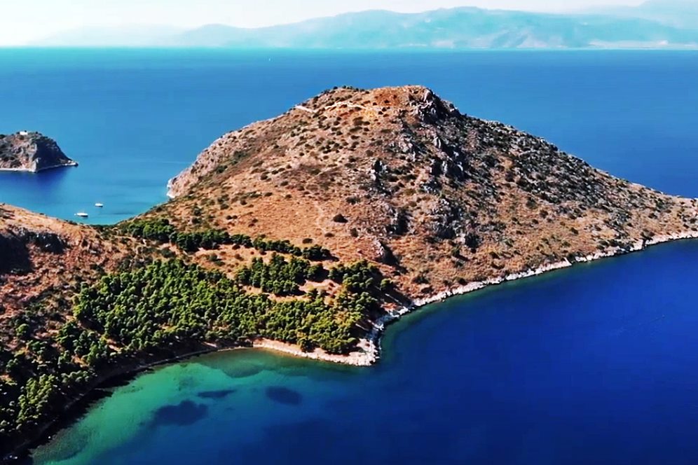
Remains of a fortifications and a Byzantine settlement on the hill of the southwestern side of Romvi island in the bay of Argolis.
History
Romvi is an uninhabited island with an area of 1600 acres. It is opposite to the town of Tolo in Argolis. Very close, to the south of Ronvi, there is another, smaller and also deserted island named Daskalio.
The island was inhabited in the Middle Ages as a result of the raids of the Slavs in Peloponnese around the end of the 6th century. The document Chronicle of Monemvasia reports that the people from Argos moved there seeking a refuge from invading Slavs.
So a first fortification must have been built then, at the beginning of the 7th century, the latest. Since the Slavs were not leaving from the mainland, the habitation continued. It seems that the peak of the settlement was during the 8th century. Later the settlement declined (perhaps because the raids were reduced) and was abandoned gradually.
Structure, Fortification & Buildings
The fortified settlement occupies a relatively large area. The perimeter of the walls is 550m enclosing a surface of 1.5 hectares.
The fortification consists of an external wall and an inner acropolis. Inside the walls are the remains of a cistern and of a church at the highest point.
| First entry in Kastrologos: | July 2018 |
Sources
- Website ARGOLIKOS ARCHIVAL LIBRARY OF HISTORY AND CULTURE - Ρόμβη (Νησίδα, Τολό Αργολίδας)
- Wikipedia article - Ρόμβη Αργολίδας
- Website
- Οχύρωση νήσου Ρόμβης - Website ecastles - Ρόμβη
- ΑΡΧΑΙΟΛΟΓΙΚΟΝ ΔΕΛΤΙΟΝ, τεύχος 26-Β1, 1971, σελ. 84
|
|
| Access |
|---|
| Approach to the monument: |
| The island is accessed only byboat from Tolo. |
| Entrance: |
| Free access |


