

Manganiako, Ithomo, Messenia,Peloponnese
Castle of Manganiako


| Location: |
| On a conical hill 800m NW of the village Manganiako in Messinia |
| Region > Prefecture: |  |
| Peloponnese Messenia | |
| Municipality > Town: | |
| City of Ithomo • Manganiako | |
| Altitude: | |
|
Elevation ≈ 600 m (Relative Height≈190 m) |
| Time of Construction | Origin | |
| 13th or 14th cent. | FRANKISH |
|
| Castle Type | Condition | |
| Castle Ruins |
In Ruins
|
Remains of a Frankish castle and an ancient fortification on a conical hill 800m northwest of the village of Manganiako in Messinia.
History
On the top of the hill a Frankish castle has been built where pre-existed, apparently, an ancient citadel, as the top is surrounded by ruins of an ancient fortified settlement, which has not been identified with any known polis.
The construction technique of the ancient fortifications was not of high standards and certainly does not follow the standards of the classical or Hellenistic period. On the other hand, it does not look like a Mycenaean fortification either. Most likely this prehistoric castle belongs to a time period after the decline of the Mycenaean Civilization and before the descent of the Dorians. In other words, this is a rare – for Messinia – case of a settlement of the Archaic Era, somewhere between the 10th and 8th centuries BC.
Furthermore, there was an earlier fortification on the site, traces of which are preserved low on the western side, outside the archaic acropolis. This oldest fortification must have belonged to the Late Mycenaean Period and the Bronze Age.
So before the Frankish castle was created, there had been at least two other periods of use on the hill (Mycenaean and Archaic), while we should not rule out the reasonable possibility that there was a fortress or settlement there during the Middle Byzantine Period as well (of which, however, there are no traces).
There is no much information about the history of the Frankish castle nor about the date of its construction. The first historical evidence we have is that it is included in the Venetian list of castles of the Morea of 1463 (i.e. after the Ottoman conquest) under the name Manconico or Mayayiado. It is included again in the list of 1467 as Manconico with the note that it is destroyed and in the hands of the Turks (it was the time of the First Venetian-Turkish war and the situation in Moreas was not settled).
Finally, the castle is also mentioned in the Venetian list of 1471 as Moncinuaco with the note that it is Venetian.
In other words, the castle of Manganiako definitely existed in the 15th century. Logically, it must have been built much earlier, most likely in the 14th or perhaps the 13th century. Maybe it originally had a different name and that is why we do not find it earlier in the sources.
According to local researchers, the castle of Manganiako could be identified with Mostenitsa which in the 13th and 14th centuries was a fiefdom of the Teutonic knights. The Teutonic Knights were a monastic order and after the congesta, in 1205, they had taken 4 fiefs in the Peloponnese, one of which was the eluding Mostenitsa. This hypothesis is not proven but is not unreasonable as this would explain the lack of historical references to the castle, as the Teutonic knights as a monastic order and as Germans were somewhat cut off from the activities of the rest of the Franks of the Morea.
Incidentally, we should point out that not only on the hill but also on the site of today’s village there are plenty of medieval remains, such as Byzantine churches, various buildings and a tower, the Melipyrgos which show that the place was important and probably populous in the Middle Ages and it is strange that nothing of its history has been recorded.
During the Second Venetian Empire (1685-1715), Magnaniako is mentioned in a census as >Magnaniaco belonging to the province of Androussa (Territorio d'Androussa). Obviously, this is the current village and not the settlement on the hill, which was probably abandoned at the beginning of the Tourkokratia.
Structure, Fortification & Buildings
The hill is naturally fortified on all sides with the western side being relatively easier accessible, where a neck joins it with the neighboring higher mountain. Access to the hill is by a dirt road that starts from the modern village of Manganiako and reaches the pass on the west side or from the village of Koromilea which is located to the west.
As mentioned, there was a fortified city of the archaic period on the hill. The total area is about 10,000 sq.m. At the top, on the location of the acropolis of the ancient acropolis, the Frankish castle was built.
Lower, on the plateau of the neck on the western side, there are wall remains and ceramic sherds that probably belong to the Mycenaean period. This part of the castle has suffered serious damage from the opening of the road and the use of the building material by the locals.
The traces of the Mycenaean period stop on the south side of the hill, where the fortifications and the pottery, from this point and on the rest of the hill, seem to be of a more recent era.
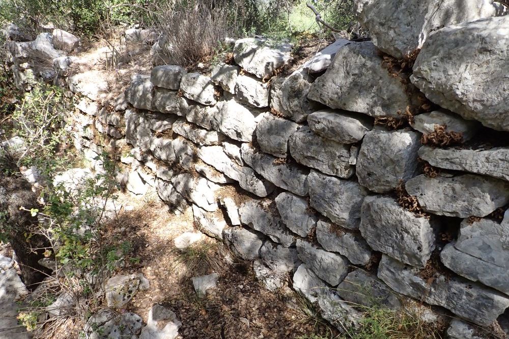
On the S, SE and E sides of the hill there are ruins from the ancient fortification (photos 9-12). The large volume of building material and the large size of the structures point to a fairly large and strongly fortified city (by the standards of the Archaic Era).
On the S-SE side, in addition to the walls, there appear to be at least two large ancient defensive towers. On the eastern side of the acropolis there are walls and parts of buildings that are preserved at a height of several rows. The fortifications continue on the NE side as well.
The walls of the ancient castle consist of large semi-processed stones of various sizes. In some places, especially on corner stones, large boulders have been used, which have been processed. The stonework is characterized by the parallel placement of semi-processed stones of unequal sizes and is not related to the isodomic constructions of the classical era and later periods.
The main gate of the castle appears to have been to the north-west and can be traced by the interruption of the stone piles at that point.
The Frankish castleThe Frankish castle is located on the top plateau of the hill. It is a square fortification with dimensions of about 30✖30m.
The walls of the fortress have been built with relatively small stones and with the use of binding mortar.
Externally, and nearby, on the S and E sides, there is an external wall that reinforces the Frankish fortification.
Inside the castle there is a large Γ-shaped building that runs along the eastern and northern interior sides. The outer side of the building uses the fortification wall while the inner wall of the building is also strong with quite a large thickness.
The large water tank (cistern) of the castle is impressive (photos 16, 17). It measures approximately 7✖4m. Its roof has collapsed in, but it still holds water. The walls of the cistern were covered with white plaster while the arched bases that supported the roof can be seen at both ends.
| First entry in Kastrologos: | January 2024 |
Sources
- Website Αριστομένης Ο Μεσσήνιος, post Κάστρο Μαγγανιακού (source of photos 2-5,9-14,20) – October 2023
- Info and photos (1,6,7,8,15-19,22) by Peter Barkevics – October 2023
- Γιάννης Μπίρης, άρθρο στην εφημερίδα ΕΛΕΥΘΕΡΙΑ (26 Νοεμβρίου 2018) - Το κάστρο στο Μαγγανιακό (Manconico)
|
|
| Access |
|---|
| Approach to the monument: |
| Rather easy approach via a dirt road starting from Manganiako. Also, the hill can be approached from the opposite side, from Koromilia. |
| Entrance: |
| Free access. |


