

Linistena, Andritsaina-Krestena, Elis,West Greece
Crepacore Castle
or Castle of Minthe or Castle of Oria or Palaiophanaro


| Location: |
| On the summit Zakouka of mount Minthe in Elis, between Linistena and Andritsena in W.Peloponnese |
| Region > Prefecture: |  |
| West Greece Elis | |
| Municipality > Town: | |
| City of Andritsaina-Krestena • Linistena | |
| Altitude: | |
| Elevation ≈ 1340 m |
| Time of Construction | Origin | |
| end of 13th century | FRANKISH |
|
| Castle Type | Condition | |
| Castle |
In Ruins
|
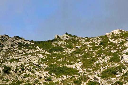
The castle of Krepakore is on the summit 'Zakouka' of mount Minthe at 1340m altitude, between Andritsena and Linistena and above the village Fanari.
It was built by the Franks around the end of the 13th century .
It is not just a stronghold but a medieval settlement. Because of the high altitude and its bad condition, it remains genarally unknown although it is one of the most interesting settlements in NW Peloponnese.
The Name of the Castle
The castle was known as Paliokastro Zakouka, Phanariotiko, Castle of Lynistaina, Palaiophanaro.
It was also known as "Castle of Oria", one of the many castles in Greece with this name. Lately, the locals try to pass the name "Castle of Filanthi". Filanthi was the "Oria", i.e. the beautiful lady. This is just an effort of beautification of the name, as Krepakore was never called “Filanthi” in the past.
Jean Alexandre Buchon, 1843, identified the castle with the Crèvecoeur referred to the Chronicle of the Morea (French and Aragonese version). In 1364, it appears in the list of feuds as Crepacore (lo castello de Crepacore) considered a corruption of the French Crève-Coeur. This Italian name apparently has to do with the fact that at that time the Principality of Achaia was under the dominion of the Kingdom of Naples and its ruler was Philip II of Taranto (house of d'Anjou).
The theory that the castle on Zakouka is the medieval Krepakore is generally accepted, but without absolute certainty. Some scholars identify it with the legendary Araklovo, but this has not been proven.
History
It has been suggested that the settlement was built on an ancient city, but this is not confirmed by archaeological findings.
It was a medieval settlement and castle, built by the Franks. If the theory that this was Krepakore is correct (which is most likely), then it had been created in the last decades of the 13th century.
In 1302, the Greeks of Skorta (the mountainous region south of Alphius river) rebelled against the Franks and with the help of the Byzantines of Mystras occupied the castle, together with the Agia Eleni castle (Theisoa) and destroyed it. The Franks however managed to take back these territories.
After that, it was probably inhabited again. After 1320, it must have been under the rule of the Despotate of Mystras.
Although it was near the border of the Frankish territory with the Despotate, is not mentioned in the history of confrontation between the Byzantines and the Franks in the region. Most likely, it has lost its value as a castle and remained a settlement without strong fortification. It is included in the lists of Frankish fiefs of 1364 and 1391 (perhaps only as property title without really belonging to Franks).
It must have been conquered by the Turks like the rest of the region in 1460 under unknown circumstances.
In the second Venetian occupation (1689-1715) Krepakore became a Venetian dominion as the entire Peloponnese. Perhaps then, the fortification was repaired by the Venetians. The Turks took it back in 1715 with a ruse. That was the time when the legend of Oria was born. “Oria” (=beautiful lady) was a girl named Filanthi, who in her effort to run away from the Turks, entered the underground secret tunnels leading to the waterfalls of Neda river, where she was drowned. In 1975, the bust of Filanthi was installed at the central square of Lynistaina.
After the dramatic capture of 1715, the castle was abandoned and the inhabitants settled by force in modern Lynistaina and surrounding villages.
The final destruction happened in 1774. After the Orlofika, the population fled again to Krepakore to escape the vengeful fury of the Turks. After a slaughterous battle, the Turks occupied the castle and this time destroyed it to prevent reuse.
Structure, Fortification & Buildings
The castle sits on a dramatic limestone outcropping aligned on a north-south axis; the slopes below are steep and impassable on all sides. Buildings are concentrated on the north of the ridge. Α plateau south of the site in front of the fortification makes up the only flat area between settlement and sharp fall.
Α defensive circuit wall surrounds the settlement. On the south side of the circuit, two towers stand at its entrance demarcating a gate. Although much of the line of fortification has collapsed over the slopes below, enough evidence survives to reconstruct the full circuit including seven towers.
Α roughly built line of fortifications south of the settlement may have guarded the natural protection for the plateau.
Α square structure (6m✖6 m) stands at the highest point of the settlement, now topped by a concrete geodetic column. This was the keep of the castle. The structure is completely ruined but enough survives to warrant its identification as a tower/cistern. The walls are 1.20m thick, built with stone and mortar and form a freestanding tower.
The settlement is organized into three zones. Zone one, at the peak is an open area of about 40m✖50 m with the aforementioned tower/cistern dominating at the northwest corner.
Zone two surrounds the open area to the west, south and east with a group of 40 houses. The houses are laid out contiguous to each other, arranged in an orthogonal scheme that accords with the cardinal directions. The contiguous houses of zone two form a dense neighborhood with discernible streets, shared courtyards and an urban character.
Zone three, outside this core, is comprised of 70 houses extending irregularly to the west and south. The houses are freestanding and follow the shifting configuration of the trrain. At the northwest edge, the houses are packed together more densely and integrally attached to the southwest corner of the fortification circuit. The houses in zone three are modular (5m✖5 m, 5m✖10m, etc.) and rectangular with the long axis descending the slope. The longest house consists of four modules (ca.5 m wide), extending to an impressive length of 32m!
The approach from the south gate to the keep can be traced through a series of zigzagging passages and courtyards.
With the exception of the circuit wall, the tower at the peak and the cisterns, all buildings are of drywall construction with larger stones at the quoins. The state of preservation of the houses varies. The densely built areas with contiguous walls survive in better condition. In general, Crepacore represents the best-preserved medieval village in the northwestern Peloponnese. Its 110 houses, constructed of stone without mortar and roofed with ceramic tiles, conform to two arrangements with shared party walls in zone two, and freestanding disposition in zone three.
| First entry in Kastrologos: | November 2013 |
Sources
- Konstantinos Kourelis, 2003, “MONUMENTS OF RURAL ARCHAEOLOGY MEDIEVAL SETTLEMENTS ΙΝ ΤΗΕ NORTHWESTERN PELOPONNESE”, Presented to the Faculties of the University of Pennsylvania in Partial Fulfillment of the Requirements for the Degree of Doctor of Philosophy, pag.312-322
- Antoine Bon, 1969, La Morée franque. Recherches historiques, topographiques et archéologiques sur la principauté d'Achaïe (1205-1430), Editions de Boccard, Paris, 1969, pag.381
- YpuTube video by the user ΧΡΗΣΤΟΣ ΑΔΑΜΟΠΟΥΛΟΣ - Κάστρο Κρεπακόρε - Castle Krepakore
|
|
| Access |
|---|
| Approach to the monument: |
| The approach is possible after several hours of trekking starting either from Linistena or from Fanari. |
| Entrance: |
| Free access |


