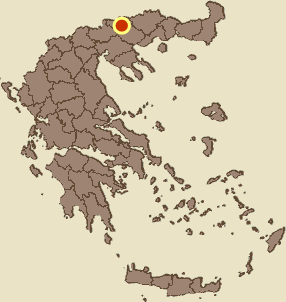
Kalokastro, Herakleia, Serres,Central Macedonia
Castle of Kalokastro
| Location: |
| Atop a low, flat hill at the southern side of the village Kalokastro in Macedonia. |
| Region > Prefecture: |  |
| Central Macedonia Serres | |
| Municipality > Town: | |
| City of Herakleia • Kalokastro | |
| Altitude: | |
|
Elevation ≈ 125 m (Relative Height≈25 m) |
| Time of Construction | Origin | |
| Unknown | Early ΒΥΖΑΝΤΙΝΕ |
|
| Castle Type | Condition | |
| Castle Ruins |
Few Remains
|
Few remains of Byzantine fortifications surrounding a flat hill on the south side of the village of Kalokastro Serres.
Location & Strategic Scope
The castle covered a large area on the extensive hilltop plateau which is easily accessible (by two dirt roads) and has arable land within. The slopes of the hill, although not very high, are rather steep and offer some physical defensive protection.
South of the hill there is a stream with an old (not medieval) three-arched stone bridge, over which the modern country road to Lachanas passes. The castle is about 4 km from the river Strymon.
History
The few ruins preserved in the area seem to come from the medieval period, i.e. they are Byzantine. We do not know which Byzantine polis was at this point, but judging by its large area, it must have been an important and populous settlement and not a simple fortress.
It is most likely that the fortified settlement existed from the Early-Byzantine period (or even earlier) and was destroyed with the descent of the Slavs at the end of the 7th century. We have to assume that it was not used in the following centuries, because otherwise a settlement and fortification of this size should have been mentioned somewhere in the historical sources.
The Archaeological Service has declared the hill “Asar” (=castle) of Kalokastro an archaeological site ...with surface finds from the classical to Byzantine times with remains of Byzantine fortifications. Graves have been discovered in the surrounding area.
The location has been identified with the ancient Macedonian city Euporia (Ευπόρια – built by the king Alxander I) based on the Tabula Peutingeriana which shows Euporia on a seconadry road to Via Egnatia at 35 miles from Amphipolis.
Structure, Fortification & Buildings
Encircling the flat top of the hill there was a wall with a total length of about 1,600 meters with a polygonal shape, which followed the relief of the ground. The area inside the fortification was large: about 170,000 sq.m.
All that is visible today from the fortification are few remnants of Byzantine walls on the south and west sides of the hill.
From a plan of the layout of the site made in 1918-1919 (see LAYOUT above) it is clear that much more was preserved in the past: in the north-east part there was a church and in the middle of the north side a gate which are not preserved. On the south side there was something like a triangular bastion with a gate. Only a trace of this complex survives today (photo 7).
The fact that few remains of the fortification have been preserved is due to the embankments and the covering by vegetation, but the most destructive was - obviously - the removal of material by the inhabitants of today’s Kalokastro. (This is the common fate of castles that are easily accessible and close to modern settlements. Especially in areas like this where it is plain and stones are not plentiful.)
The construction of the wall consists of stones of various sizes with binding mortar and ceramics in the gaps.
According to a resident of the area, there were deep wells within the walls which were covered in previous years for safety reasons. Also on the southern slope of the hill there was an underground gallery which was also blocked for the same reasons.
| First entry in Kastrologos: | February 2023 |
Sources
- Info and photos by Sakis Amfitreidis and his blog ΑΜΦΙΤΡΕΙΔΗΣ (January 2023)
- Σαμσάρης, Πέτρος «Βυζαντινοί τόποι και μνημεία της κάτω κοιλάδας του Στρυμόνα», 2004, Πανεπιστήμιο Ιωαννίνων – Διδακτορική Διατριβή, 2004, σελ. 677,678,803 (σχ.93)
- Σαμσάρης,Δημήτριος «Ιστορική γεωγραφία της Ανατολικής Μακεδονίας κατά την αρχαιότητα». Μακεδονικά, 16(1), 1976, σελ. 43-53, 113, 117-118
|
|
| Access |
|---|
| Approach to the monument: |
| Arriving at Kalokastro, the hill of the castle can be seen immediately to the south. From the western and eastern sides there are dirt roads that lead to the plateau of the hill. |
| Entrance: |
| Free and easy access to the hill where there are arable lands. |
| Similar |
|---|
| Castle of Agio Pneuma |
| Castle of Chionochori |
| Other castles around |
|---|
| Castle of Nikokleia |
| Paliokastro of Lachanas |
| Castle of Mavrouda |
| Castle of Nigrita |
| Acropolis of Serres |
| Tower of Skepasto |
| Castle of Strymonikon |
| Fortification of Vyssiani |


