

Stathmos Agkistas, Nea Zichni, Serres,Central Macedonia
Castle of Stathmos Agkistas


| Location: |
| On a low hill called “Paliokostra” 1 km NE from the village of Stathmos Agkistas in the prefecture of Serres |
| Region > Prefecture: |  |
| Central Macedonia Serres | |
| Municipality > Town: | |
| City of Nea Zichni • Stathmos Agkistas | |
| Altitude: | |
|
Elevation ≈ 65 m (Relative Height≈25 m) |
| Time of Construction | Origin | |
| Various periods | ANCIENT |
|
| Castle Type | Condition | |
| Castle Ruins |
Few Remains
|
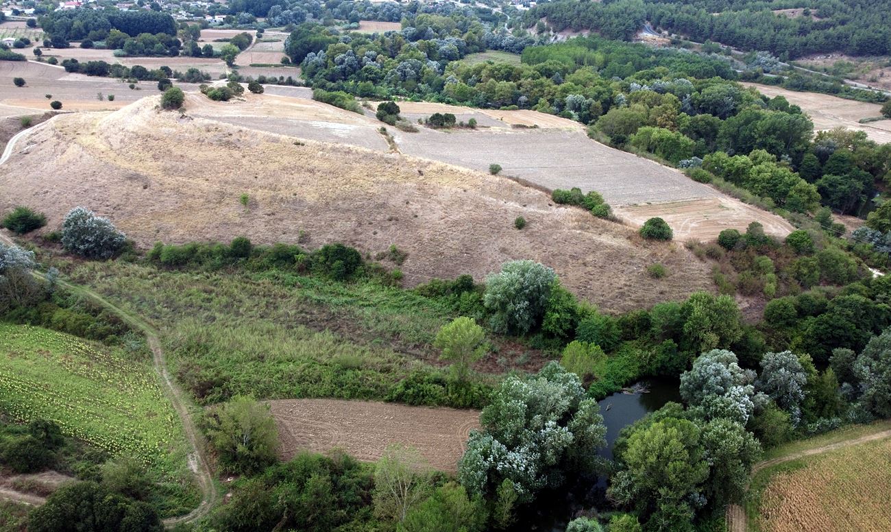
Few traces of settlement and fortifications on a low hill named Paliokostra, one kilometer from the village of Stathmos Agkistas(Agkistas’ Station).
History
The ruins is believed to have belonged to the Byzantine castle of Panakas referred to as kastellion and horion by historical sources. It should be noted that the Agkitis river – the largest tributary of Strymon – in the Byzantine Period was also referred to as “Panakas”.
However we are not sure that this particular settlement is indeed the Panakas mentioned in the sources, as there are 2-3 other places around Agkitis with remnants of Byzantine fortifications that have also possibilities of identification with the village of Panakas.
This location, next to Stathmos Agistas, had a long use with continuous habitation from the prehistoric period until the Byzantine years, with the only interval being the Bronze Age. In ancient times, it seems that there was an important city there that flourished from the Hellenistic to the Roman years. Several archaeological findings (classical, Hellenistic, Roman) have been found on the hill and in the surrounding area such as statues, coins etc, which have been transferred to the archaeological museum of Serres.
Today all that remains are a few indiscernible ruins of a fortification, probably from the Byzantine period, at the highest point.
The name of the hill "Palikostra" is obviously a corruption of the word Paleokastro (=old castle).
Structure, Fortification & Buildings
The hill is currently cultivated. It has some natural protection, as it is partly – the northern and northeastern slopes – protected by the Agkitis river, while its slopes are steep (but not too much).
It is divided into two plateaus: the southern highest part and the northern lower one. The perimeter is estimated at approximately 800 meters. Few traces of fortification exist only on the southern upper part of the hill, together with the ruins of a four-sided building (photo 2).
In the southwest corner there was probably a tower.
The walls are made of mudstone with a binding mortar between them and a few bricks. An abundance of scattered ceramics can be seen throughout the space.
Five hundred meters west of the Paliokostra hill and north of the village there is the well-known arched bridge of Agkitis that has existed since the Roman Period. The current form of the bridge dates back to the early Turkish era (16th century). All these elements show that the area was an important passage that connected the north with the Egnatia road and Amphipolis.

the arched bridge of Agkitis river
| First entry in Kastrologos: | October 2023 |
Sources
- Research, presentation and photos by Sakis Amfitreidis and his blog ΑΜΦΙΤΡΕΙΔΗΣ (September 2023)
- Σαμσάρης, Πέτρος «Βυζαντινοί τόποι και μνημεία της κάτω κοιλάδας του Στρυμόνα», 2004, Πανεπιστήμιο Ιωαννίνων – Διδακτορική Διατριβή, 2004, σελ. 214-216, 429-432, 728-729
- ΑΡΧΑΙΟΛΟΓΙΚΟ ΚΤΗΜΑΤΟΛΟΓΙΟ, link: https://www.arxaiologikoktimatologio.gov.gr/el/monuments_info?id=165396&type=Space
|
|
| Access |
|---|
| Approach to the monument: |
| The approach to Paliokostra hill is via a dirt road that leads to the western foot of the hill. |
| Entrance: |
| Free access |


