

Rodolivos, Amfipoli, Serres,Central Macedonia
Castle of Rodolivos
1
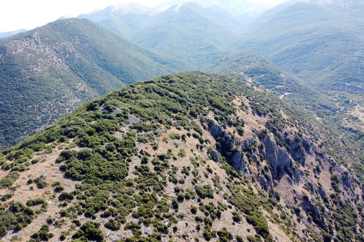
2 / 10

the hill of the castle from SW
3 / 10

part of the wall at the east corner
4 / 10

part of the wall of the south side
5 / 10

part of the wall of the north side
6 / 10

SW corner
7 / 10

SW corner (possibly remains of a tower)
8 / 10

ruins in the interior (from unknown building)
9 / 10

Π-shaped ruins outside the castle (perhaps from an old monastery)
10 / 10

from the SW corner

THE END
| Location: |
| On the hill Kales, 2km east of the village Rodolivow in Serres perdecture. |
| Region > Prefecture: |  |
| Central Macedonia Serres | |
| Municipality > Town: | |
| City of Amfipoli • Rodolivos | |
| Altitude: | |
|
Elevation ≈ 730 m (Relative Height≈350 m) |
| Time of Construction | Origin | |
| around 4th cent. | Early ΒΥΖΑΝΤΙΝΕ |
|
| Castle Type | Condition | |
| Castle Ruins |
In Ruins
|
Ruins of a castle and a fortified settlement on an elongated hilltop called "Kales" or "Kalias", 2 km east of the village of Rodolivos in the prefecture of Serres.
The hill with an altitude of 730 meters belongs to the Pangaion massif .
History
The castle is not mentioned in historical sources and its history is not known.
The wider area of Rodolivos seems to have been continuously inhabited from the prehistoric period until today.
The specific castle is placed in the early Byzantine period. It must be of the same period as other fortified settlements in Serres, such as Kastro Sfelinos, Hionohori Castle, Agios Pneumat Castle and Achladochori Castle.
Unknown how long the fortified settlement in Rodolivos survived. It was probably abandoned before the 7th century AD, due to the barbarian raids (by Huns, Goths, Slavs, etc.) of the previous centuries.
Building bricks and surface unpainted pottery from jar rims, handles and vessel bodies with grooved and combed decoration have been found at the site. Two bronze coins from the time of Constantius II (337-361 AD) were also found.
Outside the eastern part of the enclosure, on a small plateau, collected box-shaped tombs were found. Probably at this point was the necropolis of the castle.
The original name of the fortified settlement remains unknown. The name Rodolivos or Radolivos appears centuries later, from 1090 AD. with various variations, where it is referred to as a proasteion and not as a castle, in the place where the current village is located.
Structure, Fortification & Buildings
Rodolivοs Castle stretches along the narrow top of the hill. The long slopes on the north and south slopes are inaccessible and precipitous, and in addition are protected by ravines. The narrow sides of the east and west sides are quite sloping and only from them could an enemy approach. On the south-eastern slopes of the hill, there is the modern chapel of Agios Georgios, which was built in a position identified with the late-Byzantine monastery of “Saint George the so-called Voriskos mentioned in documents of the 14th-15th centuries. Voriskos was an agridion, that is, a rural settlement and is located somewhere near the chapel.
The wall followed a perimeter course formed on the rugged terrain of the long narrow peak. It surrounded the entire perimeter of the castle (that is, it covered even the steep sides). The size of the perimeter is impressively large and is estimated at approximately 1350 meters.
The castle is in a dilapidated state. The bushy vegetation that exists is very dense and has covered a large part of the buildings. The construction of the wall consists of stones with a binding mortar between them and ceramics. The wall today is partially preserved in some places. Within the walls is a large ruin of houses and buildings of the castle that have collapsed. The castle wall and buildings appear to have been altered by later installations and the passage of time.
The few wall sections found on all sides vary in height, 1-1.5m. The maximum height is a fortification section of the SW corner that reaches approximately 2 meters. Older researchers report a wall reaching a height of 3 meters, and another section 21 meters long, as well as a tower (Samsaris, 2004). These were not detected during our recent visit (Amfitreidis, 2023). The rampant vegetation did not help in locating them.
It is worth mentioning that at the western end, where the summit plateau is, there is a massive Π-shaped pile of stones that abuts the early Byzantine wall. It is clearly a building of a later installation that obviously altered a large part of the original buildings of the castle. There are reports on the internet that there was probably a monastery with an enclosure at this location.
| First entry in Kastrologos: | October 2023 |
Sources
- Research, presentation and photos by Sakis Amfitreidis and his blog ΑΜΦΙΤΡΕΙΔΗΣ (August 2023)
- Σαμσάρης, Πέτρος «Βυζαντινοί τόποι και μνημεία της κάτω κοιλάδας του Στρυμόνα», 2004, Πανεπιστήμιο Ιωαννίνων – Διδακτορική Διατριβή, 2004, σελ. 706-707
|
|
| Access |
|---|
| Entrance: |
| Free access |


