

Gazoros, Nea Zichni, Serres,Central Macedonia
Castle of Gazoros
1
2 / 12

3 / 12

remains of NW wall
4 / 12

remains of NW wall
5 / 12

remains of the eastern wall (12m long, 2-2.5m high)
6 / 12

remains of the eastern wall (12m long, 2-2.5m high)
7 / 12

stones from a wall (?) on the eastern slope
8 / 12

reamains of wall at the NE corner
9 / 12

excavated foundations of buildings next to the church
10 / 12

excavated foundations of buildings next to the church
11 / 12

the inscription with the resolution of 158 AD. in the museum of Serres
12 / 12

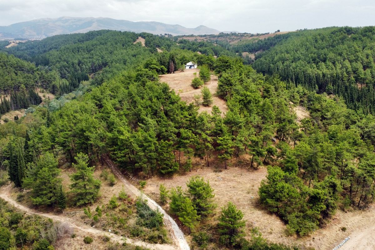
the hill of Agios Athanasios

THE END
| Location: |
| On the hill “Agios Athanassios” 2km NE of the village Gazoros in Serres prefecture of Central Macedonia |
| Region > Prefecture: |  |
| Central Macedonia Serres | |
| Municipality > Town: | |
| City of Nea Zichni • Gazoros | |
| Altitude: | |
|
Elevation ≈ 240 m (Relative Height≈50 m) |
| Time of Construction | Origin | |
| Various periods | ANCIENT |
|
| Castle Type | Condition | |
| Ancient City |
Few Remains
|
Few ruins of an ancient city (which has been identified with ancient Gazoros) that existed at least until the Early Byzantine Period on the hill of Agios Athanasios, northeast of the village of Gazoros in the prefecture of Serres.
History
The ancient city that existed on the hill has been identified with Gazoros mentioned by the geographer Ptolemy (who wrote the “Geographical Hyphigesis” in the 2nd century AD) and the writer Stefanos Byzantios (who wrote a multi-volume geographical dictionary, the “Ethnika” in the 6th AD century). The identification is considered certain and is based on two inscriptions found on the hill.
Ptolemy mentions the city when enumerating the Odomantic and Idonic cities (Odomantic and Idonic were provinces of Thrace - Odomantic having Serres as its capital) while Stefanos Byzantios mentions it as a Macedonian city without any further topographical information .
Stefanos Byzantios gives the information that the city was the seat of the cult of Gazoria Artemis, which seems to have had a wider spread as it is also mentioned in inscriptions from Skydra and Pella.
In the past, many different places were proposed by researchers for the location of ancient Gazoros. In 1958, however, an epigraphic discovery on the top of the hill of Agios Athanasios contained a reference to the city of Gazoros. This is a resolution of 158-9 AD. (photo 11 – archaeological museum of Serres).
Another Hellenistic inscription found in 1964 at the foot of the hill confirmed the identification of the site with Ancient Gazoros.
These inscriptions give important information about the organization of Gazoros in the Hellenistic and Roman periods. The city flourished significantly in Roman times and seems to have been part of a Koinon. It is probably the “League of the Pentapolitans” (five cities) according to an inscription found in Philippi.
Today, however, the few remains of the wall seem to belong to the Byzantine period, rather than the Roman or Hellenistic. Papakyriakou (2013) is the only one who mentions the foundations of a Byzantine-era fortress in Gazoros. Based on this scenario, we assume that the city after the Roman period was limited to the plateau of the acropolis of the hill and continued to be inhabited in the Early Byzantine period (4th-7th century) and was perhaps abandoned with the destructive raids that took place in the 5th-7th century AD by Goths, Huns, Slavs and others.
Much later, during the late Byzantine era, in the period 1338-1353, we have references to the village of Porina or Porina, which was an area with arable land located in the area of the current village of Gazoros (former name: Porna). From this name (Porina), probably, the current village of Gazoros received during the Turkish occupation the bad-sounding name Porna, which is a corruption of the word Porina. The name Porina probably comes from the word poros and means passage. In the year 1926, the village of Porna was renamed Gazoros.
Structure, Fortification & Buildings
What is preserved today from the archaeological site are few ruins of a wall and buildings along the hill, the construction of which is made of mudstone with lime mortar between the stones and few fragments of ceramics. The use of lime mortar leads to the hypothesis that the walls were created in the 3rd-4th century AD or shortly thereafter.
The perimeter of the hill is approximately 450-500 meters.
The wall is preserved fragmentarily in only a few places. The pine planting that took place on the hill seems to have significantly altered the archaeological site. The best part is preserved on the northwest side of the hill and it is a wall with a length of around 8m, a height that reaches up to 3m. and 1.10m thick. (photos 3,4).
In the middle of the eastern slope, a section of wall with a length of 12 meters and a height of 2-2.5m is preserved. (photos 5,6). Various other ruins can be seen scattered on the same slope (photo 7).
Next to the church of Agios Athanasios, an archaeological excavation has been carried out, which revealed the foundations of four-sided buildings (photos 9, 10).
| First entry in Kastrologos: | November 2023 |
Sources
- Research, presentation and photos by Sakis Amfitreidis and his blog ΑΜΦΙΤΡΕΙΔΗΣ (September 2023)
- Σαμσάρης, Πέτρος «Βυζαντινοί τόποι και μνημεία της κάτω κοιλάδας του Στρυμόνα», 2004, Πανεπιστήμιο Ιωαννίνων – Διδακτορική Διατριβή, 2004, σελ. 668-669
- Σαμσάρης,Δημήτριος «Ιστορική γεωγραφία της Ανατολικής Μακεδονίας κατά την αρχαιότητα». Μακεδονικά, 16(1), 1976, σελ. 129-131
- ΑΡΧΑΙΟΛΟΓΙΚΟ ΚΤΗΜΑΤΟΛΟΓΙΟ στον σύνδεσμο https://www.arxaiologikoktimatologio.gov.gr/el/monuments_info?id=165387&type=Space
- Παπακυριάκου Κυριάκος, «Ιστορία του Νομού Σερρών – Μέρος πρώτο: Ιστορία του Νομού Σερρών κατά την Αρχαιότητα», Θεσσαλονίκη 2013, σελ. 181-184
|
|
| Access |
|---|
| Approach to the monument: |
| There is a 1.5 km dirt road that starts next to the Serres-Drama highway. The dirt road is rough towards the end in some places. It ends at the top of the hill, right in front of the church of Agios Athanasios. |
| Entrance: |
| Free access |


