

Embonas, Rhodes, Dodecanese,South Aegean
Kastrelia


| Location: |
| On a low hill in the region Kastrelia, east of the village Embonas, 2.5km NE from the Artamitis monastery |
| Region > Prefecture: |  |
| South Aegean Dodecanese | |
| Municipality > Town: | |
| City of Rhodes • Embonas | |
| Altitude: | |
|
Elevation ≈ 380 m (Relative Height≈100 m) |
| Time of Construction | Origin | |
| Unknown | BYZANTINE |
|
| Castle Type | Condition | |
| Castle Ruins |
Few Remains
|
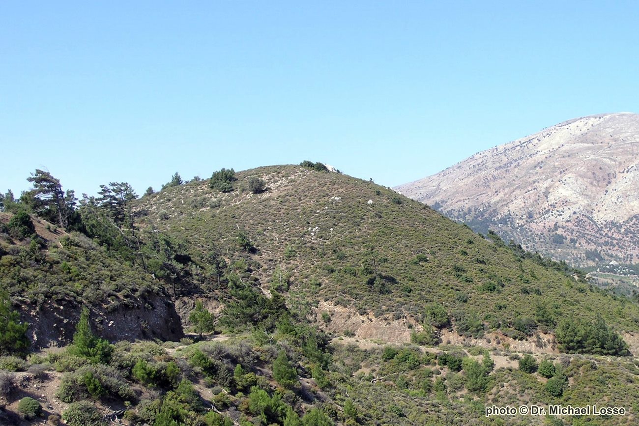
Sparse remains of a small Byzantine fortification on a hilltop, in the Kastrelia area, northeast of the Agios Ioannis Artamitis monastery, Rhodes.
Castle Description
Text: Dr. Michael Losse – Singen (Hohentwiel), GermanyGeneral Description
The place name Kastrelia refers to a Kastro(n) or to land once belonging to a castle. It refers to the southeastern foothills of a ridge that runs from northwest to southeast between the Atavyros and Profitis Ilias mountains or ridges.
The ruin is also called “Kastrelia” by locals. The name does not appear in all maps available on site.
On a limestone top overgrown with bushes, whose foot of the hill on the southeast side is disturbed by a road, there are small remains of a Byzantine castle or fortification. Visibly preserved are parts of the oval enceinte consisting of limestone quarry stone; on the summit runs a section of a two-shell wall about 0.55 m thick, which is several meters long.
Many of the limestones in the southeastern slope probably come from the masonry of the castle. This was probably pulled down soon after the castle‘s abandonment due to the extensive lack of building stones in the fertile valley above which the castle hill rises.
You can see the Kastro Kitala (see article in Kastrologos) and Erimokastro near Arnitha (ibid.) from Kastrelia castle. If there were higher buildings in this castle, the Byzantine fortifications on Mt. Vouni near Mesanagros and perhaps also the island of Symi would have been visible from here.
Access
Almost 2.5 km from the monastery of Moni Agiou Ioannou Artamiti, a road branches off to the right from the road leading to Embona. After crossing a ford after almost 1.5 km, it forks at the height of a farm. While the left path leads in many bends along the ridge with partly good views of the castle to it, the right branching path reaches it after about 1.5 km.
The castle hill is freely accessible. The visit is only worthwhile for very interested people.
History of the castle
The history of the castle is unknown, but the kind of masonry and the lines of sight to some Byzantine fortifications suggests that the castle was built in Byzantine times.
In places large quantities of ceramics in the valley below the fortification indicate a (in connection with that?) habitation, perhaps a loose scattered settlement.
Other Info
SourcesLosse, Michael: Die Burgen und Festungen des Johanniter-Ritterordens auf Rhódos und in der Ägäis (Griechenland) 1307-1522. (Publisher: Nünnerich-Asmus Verlag) Mainz 2017.
Losse, Michael: Erimókastra und „Ritterburgen in dem edlen Style des fünfzehnten Jahrhunderts“ – Neue Erkenntnisse zu Burgen und Wehrbauten auf Griechenlands „Ritterinsel“ Rhódos. In: Burgenforschung – Europäisches Correspondenzblatt für interdisziplinäre Castellologie (will be released in Spring 2022).
| First entry in Kastrologos: | February 2022 |
Sources
- Photos (2007) and article (Dec 2021) by Dr. Michael Losse
|
|
| Access |
|---|
| Approach to the monument: |
| 2.5 km from the monastery of Agiou Ioannou Artamiti, a road branches off to the right from the road leading to Embona. After crossing a ford after almost 1.5 km, it forks at the height of a farm. The right path leads to the hill after 1.5km |
| Entrance: |
| Free access |